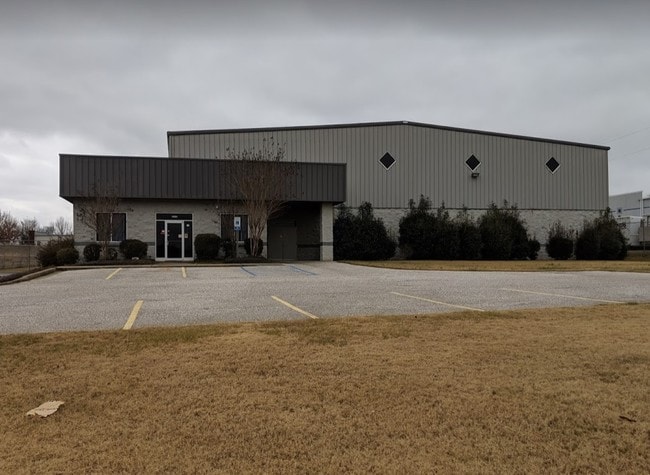
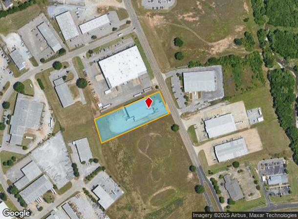
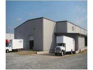
Property Record
1131 Emory Folmar Blvd, Montgomery, AL 36110
NEARBY LISTINGS FOR SALE OR LEASE
Property Detail
1131 Emory Folmar Blvd
Montgomery, AL
Montgomery Business Park 6A
04-08-33-1-000-011.000
0408331000011000
Publicstorage
Montgomery
X
Alabama
01101C0092J
a
2025
1.85 AC
2025
North Montgomery
002500
Montgomery
17,186 SF
DEMOGRAPHICS near 1131 Emory Folmar Blvd
1 Mile
3 Mile
5 Mile
2024 Total Population
2,776
36,174
85,913
2029 Population
2,700
35,516
84,343
Pop Growth 2024-2029
(2.74%)
(1.82%)
(1.83%)
Average Age
35
39
38
2024 Total Households
973
14,782
35,566
HH Growth 2024-2029
(2.98%)
(1.97%)
(1.78%)
Median Household Inc
$58,365
$41,807
$47,518
Avg Household Size
2.50
2.30
2.20
2024 Avg HH Vehicles
2.00
2.00
2.00
Median Home Value
$119,483
$104,946
$133,688
Median Year Built
1978
1966
1973
Nearby Places
Map Layers
Map Styles
 Street
 Aerial
- Restaurants
- Banks
- Shops
- Fitness
- Groceries
PUBLIC TRANSPORTATION
AIRPORT
Montgomery Regional (Dannelly Field)
DRIVE
WALK
Distance
Montgomery Regional (Dannelly Field)
21 min
14.8 mi
Freight Ports
Port of Panama City
DRIVE
WALK
Distance
Port of Panama City
243 min
191.6 mi
SALE & LEASE HISTORY
LISTING DATE
SALE/LEASE

Jan 09, 2019
For Sale
Nearby Properties
Address
Land Use
TOTAL SIZE
Lot Size
Zoning
Address
Land Use
TOTAL SIZE
Lot Size
Zoning
427,546 SF
37.68 AC
M-1
Address
Land Use
TOTAL SIZE
Lot Size
Zoning
216,654 SF
26.49 AC
B-2
Address
Land Use
TOTAL SIZE
Lot Size
Zoning
591,904 SF
26 AC
M-1
Address
Land Use
TOTAL SIZE
Lot Size
Zoning
122,119 SF
21 AC
R-75-S
Address
Land Use
TOTAL SIZE
Lot Size
Zoning
3,221 SF
14.41 AC
R-65-M
Address
Land Use
TOTAL SIZE
Lot Size
Zoning
96,168 SF
95.16 AC
INST
Address
Land Use
TOTAL SIZE
Lot Size
Zoning
187,340 SF
22.80 AC
M-1
Address
Land Use
TOTAL SIZE
Lot Size
Zoning
30,747 SF
21.58 AC
M-1
Address
Land Use
TOTAL SIZE
Lot Size
Zoning
67,643 SF
12.82 AC
M-1
Address
Land Use
TOTAL SIZE
Lot Size
Zoning
244,062 SF
12.94 AC
M-1
Address
Land Use
TOTAL SIZE
Lot Size
Zoning
18,557 SF
9.41 AC
R-75-S
Address
Land Use
TOTAL SIZE
Lot Size
Zoning
138,670 SF
3.89 AC
B-2
Address
Land Use
TOTAL SIZE
Lot Size
Zoning
1,910 SF
11.09 AC
R-65-M
Address
Land Use
TOTAL SIZE
Lot Size
Zoning
47,345 SF
8.44 AC
B-2
Address
Land Use
TOTAL SIZE
Lot Size
Zoning
187,113 SF
15 AC
M-1
Address
Land Use
TOTAL SIZE
Lot Size
Zoning
69,372 SF
11.79 AC
M-1
Address
Land Use
TOTAL SIZE
Lot Size
Zoning
1,665 SF
6.80 AC
R-65-M
Address
Land Use
TOTAL SIZE
Lot Size
Zoning
12,891 SF
35.50 AC
M-1
Address
Land Use
TOTAL SIZE
Lot Size
Zoning
127,232 SF
9.61 AC
M-1
Address
Land Use
TOTAL SIZE
Lot Size
Zoning
292,718 SF
31 AC
M-1
Address
Land Use
TOTAL SIZE
Lot Size
Zoning
64,837 SF
8.30 AC
INST
Address
Land Use
TOTAL SIZE
Lot Size
Zoning
74,046 SF
9.40 AC
INST
Address
Land Use
TOTAL SIZE
Lot Size
Zoning
175,504 SF
16 AC
M-1
Address
Land Use
TOTAL SIZE
Lot Size
Zoning
286 SF
38.40 AC
M-1
Address
Land Use
TOTAL SIZE
Lot Size
Zoning
10,847 SF
3.57 AC
B-3
Address
Land Use
TOTAL SIZE
Lot Size
Zoning
30,752 SF
1.13 AC
R-100
Address
Land Use
TOTAL SIZE
Lot Size
Zoning
45,643 SF
3.70 AC
R-60-S
Address
Land Use
TOTAL SIZE
Lot Size
Zoning
53,415 SF
5.50 AC
R-65-S
Address
Land Use
TOTAL SIZE
Lot Size
Zoning
38,998 SF
10.43 AC
AGR-2
Address
Land Use
TOTAL SIZE
Lot Size
Zoning
42,437 SF
4.90 AC
B-2
The World's #1 Commercial Real Estate Marketplace
Connect with us
© 2025 CoStar Group
The information above has been obtained from sources believed reliable. While we do not doubt its accuracy we have not verified it and make no guarantee, warranty or representation about it. It is your responsibility to independently confirm its accuracy and completeness. Any projections, opinions, assumptions, or estimates used are for example only and do not represent the current or future performance of the property. The value of this transaction to you depends on tax and other factors which should be evaluated by your tax, financial, and legal advisors. You and your advisors should conduct a careful, independent investigation of the property to determine to your satisfaction the suitability of the property for your needs.