Property Record
11330 Sw 64Th Ave, Portland, OR 97219
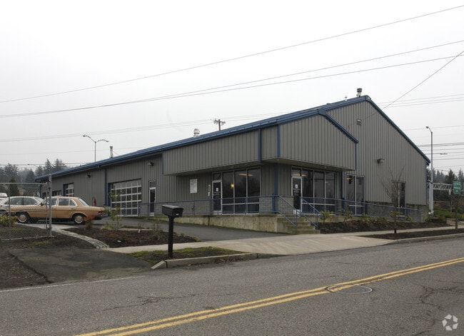
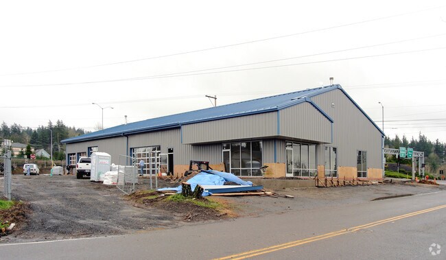
Property Detail
11330 Sw 64Th Ave
R240759
PASADENA, BLOCK 7, LOT 11&22, LOT 12 EXC PT IN HWY, LOT 20&21 EXC PT IN HWY & EXC PT IN ST
Commercialnec
Multnomah
CG
Oregon
B and X Area of moderate flood hazard, usually the area between the limits of the 100-year and 500-year floods.
11
2025
0.40 AC
2025
Barbur Blvd/Capitol Hwy
006501
Portland
6,448 SF
Portland-Vancouver-Hillsboro, OR-WA
NEARBY LISTINGS FOR SALE OR LEASE
DEMOGRAPHICS near 11330 Sw 64Th Ave
1 mile
3 mile
5 mile
2025 Total Population
12,586
115,033
322,996
2030 Population
12,551
115,245
324,391
Pop Growth 2025-2030
(0.28%)
+ 0.18%
+ 0.43%
Average Age
42
42
42
2025 Total Households
5,153
47,951
134,942
HH Growth 2025-2030
(0.29%)
+ 0.14%
+ 0.48%
Median Household Inc
$102,301
$107,243
$105,884
Avg Household Size
2.40
2.30
2.30
2025 Avg HH Vehicles
2.00
2.00
2.00
Median Home Value
$671,840
$702,559
$711,177
Median Year Built
1978
1978
1980
Nearby Places
Map Layers
Map Styles
 Street
 Aerial
Transit
 Traffic
 Biking
Places
Listings with unknown addresses are not visible on the map
- Restaurants
- Banks
- Shops
- Fitness
- Groceries
PUBLIC TRANSPORTATION
COMMUTER RAIL
Tigard Transit Center (Westside Express Service - Tri-County Metropolitan Transportation District of Oregon Rail (TriMet Rail))
Drive
Walk
Distance
Tigard Transit Center (Westside Express Service - Tri-County Metropolitan Transportation District of Oregon Rail (TriMet Rail))
6 min
2.3 mi
Hall/Nimbus (Westside Express Service - Tri-County Metropolitan Transportation District of Oregon Rail (TriMet Rail))
Drive
Walk
Distance
Hall/Nimbus (Westside Express Service - Tri-County Metropolitan Transportation District of Oregon Rail (TriMet Rail))
7 min
3.5 mi
AIRPORT
Portland International
Drive
Walk
Distance
Portland International
30 min
19.2 mi
Freight Ports
Port of Portland
Drive
Walk
Distance
Port of Portland
17 min
10.4 mi
Nearby Properties
Address
Land Use
TOTAL SIZE
Lot Size
Zoning
Address
Land Use
TOTAL SIZE
Lot Size
Zoning
828,566 SF
54.77 AC
CI2
Address
Land Use
TOTAL SIZE
Lot Size
Zoning
888,084 SF
31.12 AC
MUC
Address
Land Use
TOTAL SIZE
Lot Size
Zoning
1 SF
16 AC
R-5
Address
Land Use
TOTAL SIZE
Lot Size
Zoning
175,880 SF
36.43 AC
OS
Address
Land Use
TOTAL SIZE
Lot Size
Zoning
Address
Land Use
TOTAL SIZE
Lot Size
Zoning
14.77 AC
MUE
Address
Land Use
TOTAL SIZE
Lot Size
Zoning
79,646 SF
9.23 AC
R2R7
Address
Land Use
TOTAL SIZE
Lot Size
Zoning
88,000 SF
15.49 AC
R-4.5
Address
Land Use
TOTAL SIZE
Lot Size
Zoning
20.82 AC
R-5
Address
Land Use
TOTAL SIZE
Lot Size
Zoning
155,201 SF
4.04 AC
R7
Address
Land Use
TOTAL SIZE
Lot Size
Zoning
6 AC
MC
Address
Land Use
TOTAL SIZE
Lot Size
Zoning
43,537 SF
3.59 AC
MUC
Address
Land Use
TOTAL SIZE
Lot Size
Zoning
62,647 SF
9.65 AC
R7
Address
Land Use
TOTAL SIZE
Lot Size
Zoning
Address
Land Use
TOTAL SIZE
Lot Size
Zoning
11,736 SF
2.85 AC
MUE-1
Address
Land Use
TOTAL SIZE
Lot Size
Zoning
285,650 SF
26.94 AC
INST
Address
Land Use
TOTAL SIZE
Lot Size
Zoning
5,724 SF
13.95 AC
NC/R-0
Address
Land Use
TOTAL SIZE
Lot Size
Zoning
423,095 SF
21.51 AC
R1
Address
Land Use
TOTAL SIZE
Lot Size
Zoning
88,000 SF
12.62 AC
R-4.5
Address
Land Use
TOTAL SIZE
Lot Size
Zoning
128,176 SF
25.06 AC
R7
Address
Land Use
TOTAL SIZE
Lot Size
Zoning
4,046 SF
4.08 AC
MUE-1
Address
Land Use
TOTAL SIZE
Lot Size
Zoning
301,940 SF
15.04 AC
MU-CBD
Address
Land Use
TOTAL SIZE
Lot Size
Zoning
517,403 SF
3.21 AC
MUE-1
Address
Land Use
TOTAL SIZE
Lot Size
Zoning
140,938 SF
7.02 AC
C-WS
Address
Land Use
TOTAL SIZE
Lot Size
Zoning
262,880 SF
0.95 AC
CX
Address
Land Use
TOTAL SIZE
Lot Size
Zoning
Address
Land Use
TOTAL SIZE
Lot Size
Zoning
209,706 SF
4.89 AC
MUC
Address
Land Use
TOTAL SIZE
Lot Size
Zoning
121,664 SF
11.65 AC
C-G
Address
Land Use
TOTAL SIZE
Lot Size
Zoning
0.09 AC
OI-WS
Address
Land Use
TOTAL SIZE
Lot Size
Zoning
517,596 SF
13.49 AC
MUC
The World's #1 Commercial Real Estate Marketplace
Connect with us
© 2026 CoStar Group
The information above has been obtained from sources believed reliable. While we do not doubt its accuracy we have not verified it and make no guarantee, warranty or representation about it. It is your responsibility to independently confirm its accuracy and completeness. Any projections, opinions, assumptions, or estimates used are for example only and do not represent the current or future performance of the property. The value of this transaction to you depends on tax and other factors which should be evaluated by your tax, financial, and legal advisors. You and your advisors should conduct a careful, independent investigation of the property to determine to your satisfaction the suitability of the property for your needs.