Property Record
114 Rolling Hills Cir, Easley, SC 29640

Save to a Folder
{{folder.Name}}
{{folder.ListingIds.length}} Properties
{{folder.ListingIds.length}} Property
Create a New Folder
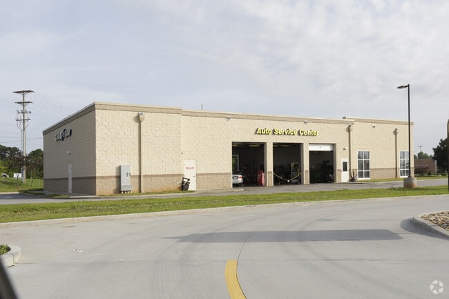
Property Detail
114 Rolling Hills Cir
5039-14-42-6537
S/SIDE ROLLING HILLS DR E/SIDE PRINCE PERRY (INTX) LOT 3-A PLAT 601/117 PLAT 594/24
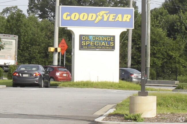
Autorepair
PICKENS
GC
South Carolina
B and X Area of moderate flood hazard, usually the area between the limits of the 100-year and 500-year floods.
3-a
2025
0.95 AC
2025
Pickens County
010604
Greenville/Spartanburg
6,087 SF
Greenville-Anderson-Greer, SC
NEARBY LISTINGS FOR SALE OR LEASE
DEMOGRAPHICS near 114 Rolling Hills Cir
1 mile
3 mile
5 mile
2025 Total Population
3,809
26,149
61,027
2030 Population
3,953
27,382
64,195
Pop Growth 2025-2030
+ 3.78%
+ 4.72%
+ 5.19%
Average Age
42
42
41
2025 Total Households
1,715
10,853
24,239
HH Growth 2025-2030
+ 4.02%
+ 4.96%
+ 5.48%
Median Household Inc
$57,899
$64,073
$64,943
Avg Household Size
2.20
2.40
2.50
2025 Avg HH Vehicles
2.00
2.00
2.00
Median Home Value
$279,257
$268,589
$259,393
Median Year Built
1991
1991
1991
Nearby Places
Map Layers
Map Styles
 Street
 Aerial
Layers
 Traffic
 Biking
Places
Listings with unknown addresses are not visible on the map
- Restaurants
- Banks
- Shops
- Fitness
- Groceries
PUBLIC TRANSPORTATION
COMMUTER RAIL
Drive
Walk
Distance
18 min
9.0 mi
AIRPORT
Greenville Spartanburg International
Drive
Walk
Distance
Greenville Spartanburg International
37 min
25.3 mi
Nearby Properties
Address
Land Use
TOTAL SIZE
Lot Size
Zoning
Address
Land Use
TOTAL SIZE
Lot Size
Zoning
81,245 SF
8.49 AC
GC
Address
Land Use
TOTAL SIZE
Lot Size
Zoning
21.71 AC
GR2
Address
Land Use
TOTAL SIZE
Lot Size
Zoning
19,164 SF
3.22 AC
GC
Address
Land Use
TOTAL SIZE
Lot Size
Zoning
24,362 SF
3.84 AC
GENERAL CO
Address
Land Use
TOTAL SIZE
Lot Size
Zoning
19,088 SF
3 AC
CC
Address
Land Use
TOTAL SIZE
Lot Size
Zoning
10,906 SF
2.59 AC
CORE COMME
Address
Land Use
TOTAL SIZE
Lot Size
Zoning
3.60 AC
CORE COMME
Address
Land Use
TOTAL SIZE
Lot Size
Zoning
3,344 SF
3.04 AC
GR2
Address
Land Use
TOTAL SIZE
Lot Size
Zoning
16.29 AC
GENERAL CO
Address
Land Use
TOTAL SIZE
Lot Size
Zoning
4,200 SF
0.98 AC
GC
Address
Land Use
TOTAL SIZE
Lot Size
Zoning
13.75 AC
GC
Address
Land Use
TOTAL SIZE
Lot Size
Zoning
6,670 SF
4 AC
GR2
Address
Land Use
TOTAL SIZE
Lot Size
Zoning
1,532 SF
9.03 AC
GR2
Address
Land Use
TOTAL SIZE
Lot Size
Zoning
3,044 SF
2 AC
GENERAL RE
Address
Land Use
TOTAL SIZE
Lot Size
Zoning
3,325 SF
16.01 AC
R10
Address
Land Use
TOTAL SIZE
Lot Size
Zoning
5,427 SF
1.34 AC
Address
Land Use
TOTAL SIZE
Lot Size
Zoning
49,803 SF
18.36 AC
GC
Address
Land Use
TOTAL SIZE
Lot Size
Zoning
5,000 SF
0.12 AC
CORE COMME
Address
Land Use
TOTAL SIZE
Lot Size
Zoning
5,321 SF
3.38 AC
Address
Land Use
TOTAL SIZE
Lot Size
Zoning
220,956 SF
16.80 AC
GENERAL CO
Address
Land Use
TOTAL SIZE
Lot Size
Zoning
36.37 AC
Address
Land Use
TOTAL SIZE
Lot Size
Zoning
20,406 SF
1.26 AC
CORE COMME
Address
Land Use
TOTAL SIZE
Lot Size
Zoning
4,800 SF
0.37 AC
GENERAL CO
Address
Land Use
TOTAL SIZE
Lot Size
Zoning
3.98 AC
NEIGHBORHO
Address
Land Use
TOTAL SIZE
Lot Size
Zoning
8.96 AC
R 10 ONE F
Address
Land Use
TOTAL SIZE
Lot Size
Zoning
187,150 SF
19.38 AC
GC
Address
Land Use
TOTAL SIZE
Lot Size
Zoning
21,258 SF
15 AC
GR2
Address
Land Use
TOTAL SIZE
Lot Size
Zoning
7.30 AC
R 10 ONE F
Address
Land Use
TOTAL SIZE
Lot Size
Zoning
7.09 AC
GC
Address
Land Use
TOTAL SIZE
Lot Size
Zoning
135,439 SF
13.80 AC
GC
The World's #1 Commercial Real Estate Marketplace
Connect with us
© 2026 CoStar Group
The information above has been obtained from sources believed reliable. While we do not doubt its accuracy we have not verified it and make no guarantee, warranty or representation about it. It is your responsibility to independently confirm its accuracy and completeness. Any projections, opinions, assumptions, or estimates used are for example only and do not represent the current or future performance of the property. The value of this transaction to you depends on tax and other factors which should be evaluated by your tax, financial, and legal advisors. You and your advisors should conduct a careful, independent investigation of the property to determine to your satisfaction the suitability of the property for your needs.