Property Record
55 Logistics Dr, Auburn, ME 04210
Current Lease Availabilities
NEARBY LISTINGS FOR SALE OR LEASE
Property Detail
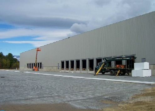
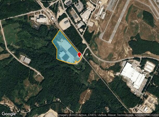
55 Logistics Dr
AUBN-000119-000000-000004
Androscoggin
Industrialgeneral
Maine
X
4
23005C0170F
22.69 AC
2024
Portland Surrounding
2024
Other Market Areas
010700
Lewiston-Auburn, ME
103,250 SF
DEMOGRAPHICS near 55 Logistics Dr
1 Mile
3 Mile
5 Mile
2024 Total Population
168
4,293
19,631
2029 Population
170
4,341
19,824
Pop Growth 2024-2029
+ 1.19%
+ 1.12%
+ 0.98%
Average Age
44
43
43
2024 Total Households
69
1,753
8,048
HH Growth 2024-2029
+ 1.45%
+ 1.25%
+ 1.04%
Median Household Inc
$116,071
$85,424
$67,787
Avg Household Size
2.40
2.40
2.30
2024 Avg HH Vehicles
2.00
2.00
2.00
Median Home Value
$297,221
$252,886
$241,169
Median Year Built
1991
1983
1965
Nearby Places
Map Layers
Map Styles
 Street
 Aerial
- Restaurants
- Banks
- Shops
- Fitness
- Groceries
PUBLIC TRANSPORTATION
AIRPORT
Portland International Jetport
DRIVE
WALK
Distance
Portland International Jetport
43 min
32.6 mi
Freight Ports
Portland, ME
DRIVE
WALK
Distance
Portland, ME
45 min
32.4 mi
Nearby Properties
Address
Land Use
TOTAL SIZE
Lot Size
Zoning
Address
Land Use
TOTAL SIZE
Lot Size
Zoning
601,694 SF
62.88 AC
Address
Land Use
TOTAL SIZE
Lot Size
Zoning
34,797 SF
10.98 AC
Address
Land Use
TOTAL SIZE
Lot Size
Zoning
511,690 SF
139.18 AC
Address
Land Use
TOTAL SIZE
Lot Size
Zoning
300,870 SF
18.55 AC
Address
Land Use
TOTAL SIZE
Lot Size
Zoning
278,946 SF
16.83 AC
Address
Land Use
TOTAL SIZE
Lot Size
Zoning
142,868 SF
39.52 AC
Address
Land Use
TOTAL SIZE
Lot Size
Zoning
37,835 SF
2,071.44 AC
Address
Land Use
TOTAL SIZE
Lot Size
Zoning
163,052 SF
32.10 AC
Address
Land Use
TOTAL SIZE
Lot Size
Zoning
68,094 SF
26.82 AC
Address
Land Use
TOTAL SIZE
Lot Size
Zoning
7.54 AC
Address
Land Use
TOTAL SIZE
Lot Size
Zoning
80,500 SF
7.66 AC
Address
Land Use
TOTAL SIZE
Lot Size
Zoning
103,250 SF
Address
Land Use
TOTAL SIZE
Lot Size
Zoning
31,582 SF
11.59 AC
Address
Land Use
TOTAL SIZE
Lot Size
Zoning
5,389 SF
100 AC
SHOREL
Address
Land Use
TOTAL SIZE
Lot Size
Zoning
54,800 SF
9.38 AC
Address
Land Use
TOTAL SIZE
Lot Size
Zoning
61,090 SF
10.19 AC
Address
Land Use
TOTAL SIZE
Lot Size
Zoning
104,472 SF
55.69 AC
Address
Land Use
TOTAL SIZE
Lot Size
Zoning
120,339 SF
72.67 AC
Address
Land Use
TOTAL SIZE
Lot Size
Zoning
25,170 SF
5.75 AC
Address
Land Use
TOTAL SIZE
Lot Size
Zoning
4,599 SF
85.81 AC
COMMER
Address
Land Use
TOTAL SIZE
Lot Size
Zoning
30,296 SF
10.52 AC
Address
Land Use
TOTAL SIZE
Lot Size
Zoning
71,599 SF
6.39 AC
Address
Land Use
TOTAL SIZE
Lot Size
Zoning
83,584 SF
49.55 AC
Address
Land Use
TOTAL SIZE
Lot Size
Zoning
50,715 SF
3.55 AC
Address
Land Use
TOTAL SIZE
Lot Size
Zoning
25,201 SF
3.40 AC
Address
Land Use
TOTAL SIZE
Lot Size
Zoning
57,090 SF
10 AC
Address
Land Use
TOTAL SIZE
Lot Size
Zoning
52,500 SF
12.27 AC
Address
Land Use
TOTAL SIZE
Lot Size
Zoning
34,352 SF
3.28 AC
Address
Land Use
TOTAL SIZE
Lot Size
Zoning
58,792 SF
7.35 AC
Address
Land Use
TOTAL SIZE
Lot Size
Zoning
67,688 SF
5.81 AC
The World's #1 Commercial Real Estate Marketplace
Connect with us
© 2026 CoStar Group
The information above has been obtained from sources believed reliable. While we do not doubt its accuracy we have not verified it and make no guarantee, warranty or representation about it. It is your responsibility to independently confirm its accuracy and completeness. Any projections, opinions, assumptions, or estimates used are for example only and do not represent the current or future performance of the property. The value of this transaction to you depends on tax and other factors which should be evaluated by your tax, financial, and legal advisors. You and your advisors should conduct a careful, independent investigation of the property to determine to your satisfaction the suitability of the property for your needs.