Property Record
115 N 13Th St, Philomath, OR 97370
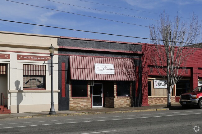
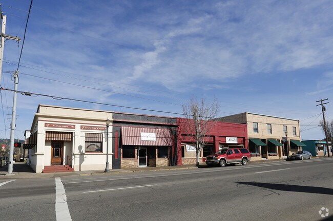

Property Detail
115 N 13Th St
170690
PHILOMATH
Commercialacreage
BENTON
CC
Oregon
B and X Area of moderate flood hazard, usually the area between the limits of the 100-year and 500-year floods.
0.14 AC
2024
Oregon West Area
2025
Other Market Areas
010800
Corvallis, OR
NEARBY LISTINGS FOR SALE OR LEASE
DEMOGRAPHICS near 115 N 13Th St
1 mile
3 mile
5 mile
2025 Total Population
4,190
10,873
40,951
2030 Population
4,274
11,115
42,570
Pop Growth 2025-2030
+ 2.00%
+ 2.23%
+ 3.95%
Average Age
41
43
37
2025 Total Households
1,620
4,385
15,209
HH Growth 2025-2030
+ 1.98%
+ 2.23%
+ 4.33%
Median Household Inc
$80,710
$90,602
$69,811
Avg Household Size
2.50
2.40
2.30
2025 Avg HH Vehicles
2.00
2.00
2.00
Median Home Value
$414,916
$529,047
$593,253
Median Year Built
1977
1990
1988
Nearby Places
Map Layers
Map Styles
 Street
 Aerial
Transit
 Traffic
 Biking
Places
Listings with unknown addresses are not visible on the map
- Restaurants
- Banks
- Shops
- Fitness
- Groceries
PUBLIC TRANSPORTATION
AIRPORT
Mahlon Sweet Field
Drive
Walk
Distance
Mahlon Sweet Field
62 min
38.8 mi
Freight Ports
Port of Portland
Drive
Walk
Distance
Port of Portland
119 min
92.2 mi
SALE & LEASE HISTORY
LISTING DATE
SALE/LEASE

Sep 25, 2016
For Lease
Sep 23, 2016
For Sale
Nearby Properties
Address
Land Use
TOTAL SIZE
Lot Size
Zoning
Address
Land Use
TOTAL SIZE
Lot Size
Zoning
241,599 SF
14.33 AC
R-3
Address
Land Use
TOTAL SIZE
Lot Size
Zoning
235,104 SF
9.96 AC
PD(RS-20)
Address
Land Use
TOTAL SIZE
Lot Size
Zoning
124,682 SF
10.62 AC
PD(RS-12)
Address
Land Use
TOTAL SIZE
Lot Size
Zoning
15.04 AC
RI
Address
Land Use
TOTAL SIZE
Lot Size
Zoning
94,542 SF
10.96 AC
PD(NC-MAJO
Address
Land Use
TOTAL SIZE
Lot Size
Zoning
112,048 SF
4.72 AC
RS-20
Address
Land Use
TOTAL SIZE
Lot Size
Zoning
40,969 SF
4.59 AC
UR-5
Address
Land Use
TOTAL SIZE
Lot Size
Zoning
38,420 SF
5.43 AC
LDR
Address
Land Use
TOTAL SIZE
Lot Size
Zoning
Address
Land Use
TOTAL SIZE
Lot Size
Zoning
44,125 SF
2.36 AC
PD(RS-12)
Address
Land Use
TOTAL SIZE
Lot Size
Zoning
64,359 SF
5.85 AC
PF
Address
Land Use
TOTAL SIZE
Lot Size
Zoning
Address
Land Use
TOTAL SIZE
Lot Size
Zoning
151,683 SF
17.22 AC
IO
Address
Land Use
TOTAL SIZE
Lot Size
Zoning
Address
Land Use
TOTAL SIZE
Lot Size
Zoning
33,465 SF
1.22 AC
RS-12
Address
Land Use
TOTAL SIZE
Lot Size
Zoning
15,549 SF
3.93 AC
PF
Address
Land Use
TOTAL SIZE
Lot Size
Zoning
75,776 SF
3.18 AC
MURM
Address
Land Use
TOTAL SIZE
Lot Size
Zoning
14,688 SF
1.57 AC
PF
Address
Land Use
TOTAL SIZE
Lot Size
Zoning
40,239 SF
2.51 AC
RS-20
Address
Land Use
TOTAL SIZE
Lot Size
Zoning
Address
Land Use
TOTAL SIZE
Lot Size
Zoning
Address
Land Use
TOTAL SIZE
Lot Size
Zoning
9,640 SF
33.12 AC
P
Address
Land Use
TOTAL SIZE
Lot Size
Zoning
18,536 SF
2.65 AC
MURM
Address
Land Use
TOTAL SIZE
Lot Size
Zoning
16,496 SF
2.80 AC
LDR
Address
Land Use
TOTAL SIZE
Lot Size
Zoning
Address
Land Use
TOTAL SIZE
Lot Size
Zoning
1 SF
27.73 AC
IH
Address
Land Use
TOTAL SIZE
Lot Size
Zoning
15,484 SF
2.75 AC
PF
Address
Land Use
TOTAL SIZE
Lot Size
Zoning
Address
Land Use
TOTAL SIZE
Lot Size
Zoning
15,964 SF
0.85 AC
RS-12
Address
Land Use
TOTAL SIZE
Lot Size
Zoning
21,480 SF
36.19 AC
IO
The World's #1 Commercial Real Estate Marketplace
Connect with us
© 2026 CoStar Group
The information above has been obtained from sources believed reliable. While we do not doubt its accuracy we have not verified it and make no guarantee, warranty or representation about it. It is your responsibility to independently confirm its accuracy and completeness. Any projections, opinions, assumptions, or estimates used are for example only and do not represent the current or future performance of the property. The value of this transaction to you depends on tax and other factors which should be evaluated by your tax, financial, and legal advisors. You and your advisors should conduct a careful, independent investigation of the property to determine to your satisfaction the suitability of the property for your needs.