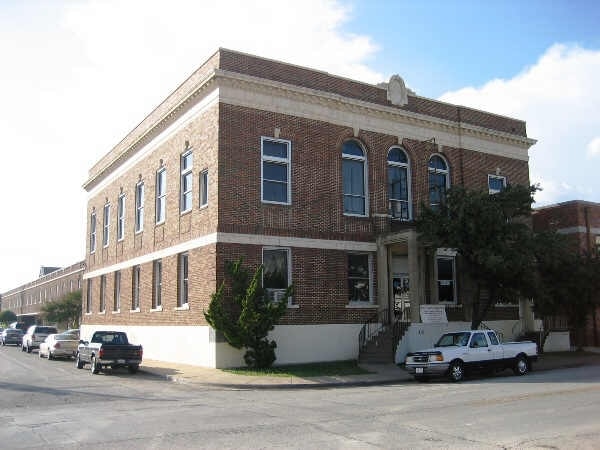
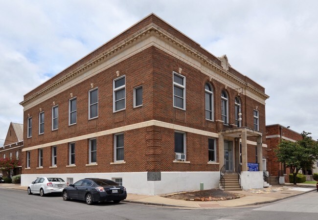
Property Record
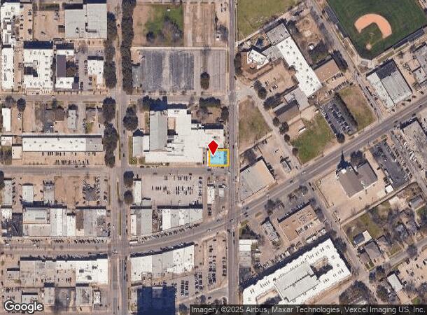
115 S Beckley Ave, Dallas, TX 75203

NEARBY LISTINGS FOR SALE OR LEASE
Property Detail
115 S Beckley Ave
Dallas-Fort Worth-Arlington, TX
Dallas Land And Loan 2
00000255641000000
DALLAS LAND AND LOAN 2 BLK 40/3160 LTS 9,10& 11 INT201700288245 DD10052017 CO-DC 3160 040 00900 2003160 040
Officebuilding
Dallas
X
Texas
48113C0480K
9
2024
0.15 AC
2025
Southwest Dallas
004700
Dallas/Ft Worth
19,968 SF
DEMOGRAPHICS near 115 S Beckley Ave
1 Mile
3 Mile
5 Mile
2024 Total Population
19,519
141,228
368,487
2029 Population
19,791
141,839
370,362
Pop Growth 2024-2029
+ 1.39%
+ 0.43%
+ 0.51%
Average Age
36
36
36
2024 Total Households
7,039
50,930
150,267
HH Growth 2024-2029
+ 1.15%
+ 0.79%
+ 0.74%
Median Household Inc
$47,107
$54,146
$56,916
Avg Household Size
2.70
2.60
2.30
2024 Avg HH Vehicles
2.00
2.00
2.00
Median Home Value
$329,294
$236,270
$215,682
Median Year Built
1959
1959
1982
Nearby Places
Map Layers
Map Styles
 Street
 Aerial
- Restaurants
- Banks
- Shops
- Fitness
- Groceries
PUBLIC TRANSPORTATION
TRANSIT/SUBWAY
Bishop Arts Station (DALLAS STREETCAR - Dallas Area Rapid Transit (DART))
DRIVE
WALK
Distance
Bishop Arts Station (DALLAS STREETCAR - Dallas Area Rapid Transit (DART))
1 min
8 min
0.4 mi
6Th Streetcar Station (DALLAS STREETCAR - Dallas Area Rapid Transit (DART))
DRIVE
WALK
Distance
6Th Streetcar Station (DALLAS STREETCAR - Dallas Area Rapid Transit (DART))
1 min
14 min
0.7 mi
Beckley Streetcar Station (DALLAS STREETCAR - Dallas Area Rapid Transit (DART))
DRIVE
WALK
Distance
Beckley Streetcar Station (DALLAS STREETCAR - Dallas Area Rapid Transit (DART))
2 min
20 min
1.0 mi
Dallas Zoo (Red Line - Dallas Area Rapid Transit (DART))
DRIVE
WALK
Distance
Dallas Zoo (Red Line - Dallas Area Rapid Transit (DART))
3 min
20 min
1.1 mi
COMMUTER RAIL
Victory Station (DART LIGHT RAIL - GREEN LINE - Dallas Area Rapid Transit (DART), DART LIGHT RAIL - ORANGE LINE - Dallas Area Rapid Transit (DART), TRINITY RAILWAY - Dallas Area Rapid Transit (DART))
DRIVE
WALK
Distance
Victory Station (DART LIGHT RAIL - GREEN LINE - Dallas Area Rapid Transit (DART), DART LIGHT RAIL - ORANGE LINE - Dallas Area Rapid Transit (DART), TRINITY RAILWAY - Dallas Area Rapid Transit (DART))
7 min
4.4 mi
Medical/Market Ctr Station (TRINITY RAILWAY - Dallas Area Rapid Transit (DART))
DRIVE
WALK
Distance
Medical/Market Ctr Station (TRINITY RAILWAY - Dallas Area Rapid Transit (DART))
11 min
6.9 mi
AIRPORT
Dallas Love Field
DRIVE
WALK
Distance
Dallas Love Field
17 min
9.3 mi
Dallas-Fort Worth International
DRIVE
WALK
Distance
Dallas-Fort Worth International
30 min
23.5 mi
Freight Ports
Port of Shreveport
DRIVE
WALK
Distance
Port of Shreveport
215 min
199.4 mi
SALE & LEASE HISTORY
LISTING DATE
SALE/LEASE

Jun 29, 2017
For Sale
Nearby Properties
Address
Land Use
TOTAL SIZE
Lot Size
Zoning
Address
Land Use
TOTAL SIZE
Lot Size
Zoning
1,298,826 SF
33.16 AC
Z163
Address
Land Use
TOTAL SIZE
Lot Size
Zoning
1,308,710 SF
8.42 AC
Z21
Address
Land Use
TOTAL SIZE
Lot Size
Zoning
1,480,246 SF
1.86 AC
Z21
Address
Land Use
TOTAL SIZE
Lot Size
Zoning
784,725 SF
2.33 AC
Z239
Address
Land Use
TOTAL SIZE
Lot Size
Zoning
858,120 SF
2.21 AC
Z21
Address
Land Use
TOTAL SIZE
Lot Size
Zoning
1,912,762 SF
1.54 AC
Z21
Address
Land Use
TOTAL SIZE
Lot Size
Zoning
307,597 SF
15.21 AC
Z116
Address
Land Use
TOTAL SIZE
Lot Size
Zoning
1,018,066 SF
1.20 AC
Z21
Address
Land Use
TOTAL SIZE
Lot Size
Zoning
741,673 SF
1.30 AC
Z21
Address
Land Use
TOTAL SIZE
Lot Size
Zoning
732,117 SF
5 AC
Z239
Address
Land Use
TOTAL SIZE
Lot Size
Zoning
724,888 SF
2.59 AC
Address
Land Use
TOTAL SIZE
Lot Size
Zoning
26,896 SF
3.56 AC
Z239
Address
Land Use
TOTAL SIZE
Lot Size
Zoning
316,447 SF
12.61 AC
Z164
Address
Land Use
TOTAL SIZE
Lot Size
Zoning
1,974,033 SF
1.67 AC
Z21
Address
Land Use
TOTAL SIZE
Lot Size
Zoning
510,277 SF
1.67 AC
Z239
Address
Land Use
TOTAL SIZE
Lot Size
Zoning
1,083,196 SF
6.13 AC
Z21
Address
Land Use
TOTAL SIZE
Lot Size
Zoning
179,370 SF
13.18 AC
Z248
Address
Land Use
TOTAL SIZE
Lot Size
Zoning
419,729 SF
3.62 AC
Z115
Address
Land Use
TOTAL SIZE
Lot Size
Zoning
452,834 SF
2.76 AC
Z21
Address
Land Use
TOTAL SIZE
Lot Size
Zoning
1,137,345 SF
0.83 AC
Z21
Address
Land Use
TOTAL SIZE
Lot Size
Zoning
506,299 SF
4.24 AC
Z116
Address
Land Use
TOTAL SIZE
Lot Size
Zoning
859,038 SF
0.92 AC
Z21
Address
Land Use
TOTAL SIZE
Lot Size
Zoning
381,448 SF
19.99 AC
Z151
Address
Land Use
TOTAL SIZE
Lot Size
Zoning
512,824 SF
0.47 AC
Z21
Address
Land Use
TOTAL SIZE
Lot Size
Zoning
646,211 SF
5.79 AC
Z239
Address
Land Use
TOTAL SIZE
Lot Size
Zoning
513,833 SF
0.17 AC
Z59
Address
Land Use
TOTAL SIZE
Lot Size
Zoning
100 SF
37.84 AC
Z115
Address
Land Use
TOTAL SIZE
Lot Size
Zoning
498,588 SF
4.33 AC
Z115
Address
Land Use
TOTAL SIZE
Lot Size
Zoning
466,681 SF
3.55 AC
Z239
Address
Land Use
TOTAL SIZE
Lot Size
Zoning
316,640 SF
5.02 AC
Z115
The World's #1 Commercial Real Estate Marketplace
Connect with us
© 2025 CoStar Group
The information above has been obtained from sources believed reliable. While we do not doubt its accuracy we have not verified it and make no guarantee, warranty or representation about it. It is your responsibility to independently confirm its accuracy and completeness. Any projections, opinions, assumptions, or estimates used are for example only and do not represent the current or future performance of the property. The value of this transaction to you depends on tax and other factors which should be evaluated by your tax, financial, and legal advisors. You and your advisors should conduct a careful, independent investigation of the property to determine to your satisfaction the suitability of the property for your needs.