Property Record
1160 E Sunset Rd, Henderson, NV 89011
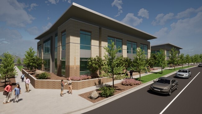

Property Detail
1160 E Sunset Rd
Las Vegas
CADENCE NEIGHBORHOOD 1 PARCEL 1-G1 PLAT BOOK 156 PAGE 41 PT LOT 1-G1
Las Vegas-Henderson-North Las Vegas, NV
CLARK
179-05-422-011
Nevada
Commercialnec
1
2026
0.90 AC
2026
SE Las Vegas/Henderson
005440
NEARBY LISTINGS FOR SALE OR LEASE
DEMOGRAPHICS near 1160 E Sunset Rd
1 mile
3 mile
5 mile
2024 Total Population
18,638
68,199
181,749
2029 Population
20,877
74,231
196,278
Pop Growth 2024-2029
+ 12.01%
+ 8.84%
+ 7.99%
Average Age
40
41
40
2024 Total Households
6,964
26,035
69,540
HH Growth 2024-2029
+ 12.21%
+ 8.93%
+ 8.04%
Median Household Inc
$66,841
$69,824
$73,553
Avg Household Size
2.60
2.50
2.50
2024 Avg HH Vehicles
2.00
2.00
2.00
Median Home Value
$386,227
$376,780
$377,063
Median Year Built
2010
1997
2000
Nearby Places
Map Layers
Map Styles
 Street
 Aerial
Transit
 Traffic
 Biking
Places
Listings with unknown addresses are not visible on the map
- Restaurants
- Banks
- Shops
- Fitness
- Groceries
PUBLIC TRANSPORTATION
AIRPORT
Boulder City Municipal
Drive
Walk
Distance
Boulder City Municipal
21 min
12.6 mi
Harry Reid International
Drive
Walk
Distance
Harry Reid International
21 min
14.8 mi
Freight Ports
Port of Long Beach
Drive
Walk
Distance
Port of Long Beach
319 min
283.4 mi
SALE & LEASE HISTORY
LISTING DATE
SALE/LEASE

May 17, 2022
For Lease
Nearby Properties
Address
Land Use
TOTAL SIZE
Lot Size
Zoning
Address
Land Use
TOTAL SIZE
Lot Size
Zoning
62,258 SF
59.95 AC
Address
Land Use
TOTAL SIZE
Lot Size
Zoning
Address
Land Use
TOTAL SIZE
Lot Size
Zoning
31,463 SF
191.46 AC
PS
Address
Land Use
TOTAL SIZE
Lot Size
Zoning
502,625 SF
45.92 AC
Address
Land Use
TOTAL SIZE
Lot Size
Zoning
9,493 SF
15.37 AC
Address
Land Use
TOTAL SIZE
Lot Size
Zoning
350.47 AC
PS
Address
Land Use
TOTAL SIZE
Lot Size
Zoning
10.50 AC
Address
Land Use
TOTAL SIZE
Lot Size
Zoning
81,485 SF
160.06 AC
PS
Address
Land Use
TOTAL SIZE
Lot Size
Zoning
387,990 SF
22.04 AC
Address
Land Use
TOTAL SIZE
Lot Size
Zoning
9,000 SF
96.81 AC
RE
Address
Land Use
TOTAL SIZE
Lot Size
Zoning
40,031 SF
21.25 AC
Address
Land Use
TOTAL SIZE
Lot Size
Zoning
78,760 SF
1.23 AC
Address
Land Use
TOTAL SIZE
Lot Size
Zoning
239,288 SF
14.10 AC
Address
Land Use
TOTAL SIZE
Lot Size
Zoning
250,076 SF
24.61 AC
Address
Land Use
TOTAL SIZE
Lot Size
Zoning
71,133 SF
7.56 AC
DP
Address
Land Use
TOTAL SIZE
Lot Size
Zoning
19,753 SF
10.21 AC
DP
Address
Land Use
TOTAL SIZE
Lot Size
Zoning
213,472 SF
7.46 AC
Address
Land Use
TOTAL SIZE
Lot Size
Zoning
3,664 SF
16.09 AC
RH20
Address
Land Use
TOTAL SIZE
Lot Size
Zoning
14,463 SF
19.48 AC
Address
Land Use
TOTAL SIZE
Lot Size
Zoning
3,293 SF
17.37 AC
H:RM-16-MP
Address
Land Use
TOTAL SIZE
Lot Size
Zoning
136,465 SF
34.67 AC
Address
Land Use
TOTAL SIZE
Lot Size
Zoning
168,361 SF
10.84 AC
Address
Land Use
TOTAL SIZE
Lot Size
Zoning
358,284 SF
17.44 AC
IG
Address
Land Use
TOTAL SIZE
Lot Size
Zoning
236,015 SF
17.43 AC
IG
Address
Land Use
TOTAL SIZE
Lot Size
Zoning
206,945 SF
12.43 AC
CA
Address
Land Use
TOTAL SIZE
Lot Size
Zoning
298,360 SF
15.73 AC
IG
Address
Land Use
TOTAL SIZE
Lot Size
Zoning
320 AC
PS
Address
Land Use
TOTAL SIZE
Lot Size
Zoning
292,375 SF
39.22 AC
M2
The World's #1 Commercial Real Estate Marketplace
Connect with us
© 2026 CoStar Group
The information above has been obtained from sources believed reliable. While we do not doubt its accuracy we have not verified it and make no guarantee, warranty or representation about it. It is your responsibility to independently confirm its accuracy and completeness. Any projections, opinions, assumptions, or estimates used are for example only and do not represent the current or future performance of the property. The value of this transaction to you depends on tax and other factors which should be evaluated by your tax, financial, and legal advisors. You and your advisors should conduct a careful, independent investigation of the property to determine to your satisfaction the suitability of the property for your needs.