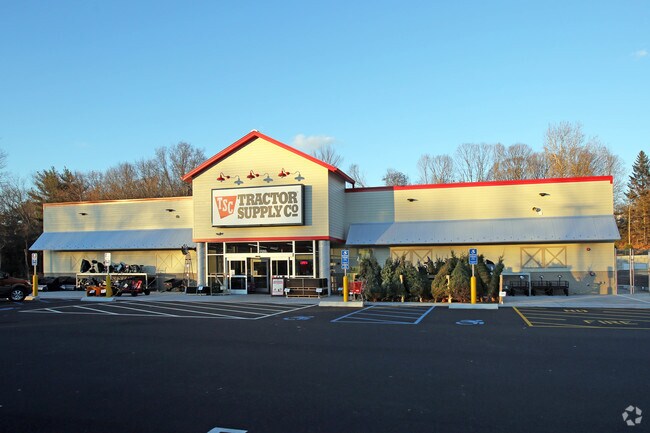
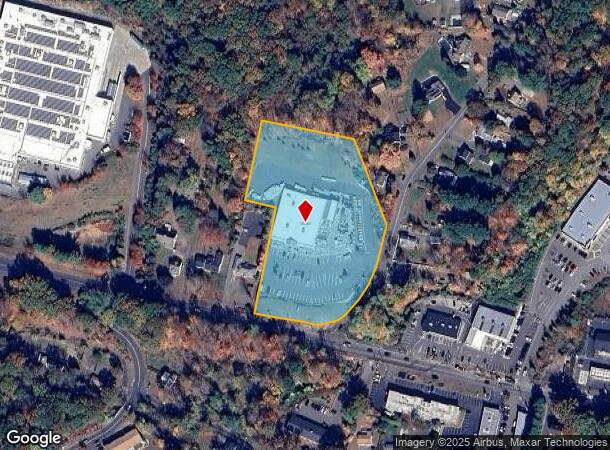
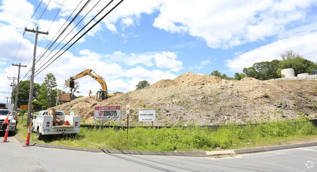
Property Record
1160 New Haven Rd, Naugatuck, CT 06770
NEARBY LISTINGS FOR SALE OR LEASE
Property Detail
1160 New Haven Rd
NAUG-000000S-E002520
New Haven
Storebuilding
Connecticut
X
7500
09009C0257H
4.16 AC
2025
Naugatuck
2025
Westchester/So Connecticut
345202
New Haven, CT
18,750 SF
DEMOGRAPHICS near 1160 New Haven Rd
1 mile
3 mile
5 mile
2024 Total Population
5,266
32,364
76,236
2029 Population
5,284
32,227
76,011
Pop Growth 2024-2029
+ 0.34%
(0.42%)
(0.30%)
Average Age
42
41
42
2024 Total Households
2,015
12,666
29,834
HH Growth 2024-2029
+ 0.20%
(0.51%)
(0.38%)
Median Household Inc
$87,053
$96,478
$88,580
Avg Household Size
2.40
2.50
2.50
2024 Avg HH Vehicles
2.00
2.00
2.00
Median Home Value
$178,845
$234,400
$239,841
Median Year Built
1980
1969
1969
Nearby Places
Map Layers
Map Styles
 Street
 Aerial
Transit
 Traffic
 Biking
Places
Listings with unknown addresses are not visible on the map
- Restaurants
- Banks
- Shops
- Fitness
- Groceries
PUBLIC TRANSPORTATION
COMMUTER RAIL
Naugatuck Station (New Haven Line - Metro-North Commuter Railroad Company (Metro-North))
Drive
Walk
Distance
Naugatuck Station (New Haven Line - Metro-North Commuter Railroad Company (Metro-North))
6 min
2.6 mi
Beacon Falls Station (New Haven Line - Metro-North Commuter Railroad Company (Metro-North))
Drive
Walk
Distance
Beacon Falls Station (New Haven Line - Metro-North Commuter Railroad Company (Metro-North))
9 min
4.4 mi
AIRPORT
Tweed/New Haven
Drive
Walk
Distance
Tweed/New Haven
36 min
19.9 mi
Bradley International
Drive
Walk
Distance
Bradley International
80 min
49.6 mi
Freight Ports
Port of New Haven
Drive
Walk
Distance
Port of New Haven
31 min
17.1 mi
Nearby Properties
Address
Land Use
TOTAL SIZE
Lot Size
Zoning
Address
Land Use
TOTAL SIZE
Lot Size
Zoning
17,181 SF
18.82 AC
R30
Address
Land Use
TOTAL SIZE
Lot Size
Zoning
268,279 SF
52.80 AC
RA1
Address
Land Use
TOTAL SIZE
Lot Size
Zoning
14,607 SF
9.24 AC
R8
Address
Land Use
TOTAL SIZE
Lot Size
Zoning
145,226 SF
28.56 AC
R8
Address
Land Use
TOTAL SIZE
Lot Size
Zoning
Address
Land Use
TOTAL SIZE
Lot Size
Zoning
8.24 AC
Address
Land Use
TOTAL SIZE
Lot Size
Zoning
21.65 AC
Address
Land Use
TOTAL SIZE
Lot Size
Zoning
112,055 SF
14.19 AC
RA1
Address
Land Use
TOTAL SIZE
Lot Size
Zoning
13,114 SF
7.70 AC
Address
Land Use
TOTAL SIZE
Lot Size
Zoning
46,302 SF
5 AC
R15
Address
Land Use
TOTAL SIZE
Lot Size
Zoning
188.50 AC
R-65
Address
Land Use
TOTAL SIZE
Lot Size
Zoning
52,250 SF
14.32 AC
RA1
Address
Land Use
TOTAL SIZE
Lot Size
Zoning
5.32 AC
RA1
Address
Land Use
TOTAL SIZE
Lot Size
Zoning
81,710 SF
10.86 AC
NHRDD
Address
Land Use
TOTAL SIZE
Lot Size
Zoning
41,056 SF
6.17 AC
RA1
Address
Land Use
TOTAL SIZE
Lot Size
Zoning
29.04 AC
R-3
Address
Land Use
TOTAL SIZE
Lot Size
Zoning
64,968 SF
1.60 AC
B-2
Address
Land Use
TOTAL SIZE
Lot Size
Zoning
106,949 SF
16.50 AC
R15
Address
Land Use
TOTAL SIZE
Lot Size
Zoning
717.07 AC
RA1
Address
Land Use
TOTAL SIZE
Lot Size
Zoning
37,842 SF
9.07 AC
I1
Address
Land Use
TOTAL SIZE
Lot Size
Zoning
6.47 AC
R15
Address
Land Use
TOTAL SIZE
Lot Size
Zoning
1.69 AC
RA1
Address
Land Use
TOTAL SIZE
Lot Size
Zoning
77,274 SF
5.99 AC
R8
Address
Land Use
TOTAL SIZE
Lot Size
Zoning
4 AC
RA1
Address
Land Use
TOTAL SIZE
Lot Size
Zoning
6.77 AC
RA1
Address
Land Use
TOTAL SIZE
Lot Size
Zoning
13,523 SF
1.34 AC
R30
Address
Land Use
TOTAL SIZE
Lot Size
Zoning
25,211 SF
7.38 AC
R15
Address
Land Use
TOTAL SIZE
Lot Size
Zoning
26 AC
R15
Address
Land Use
TOTAL SIZE
Lot Size
Zoning
3.60 AC
RA1
The World's #1 Commercial Real Estate Marketplace
Connect with us
© 2026 CoStar Group
The information above has been obtained from sources believed reliable. While we do not doubt its accuracy we have not verified it and make no guarantee, warranty or representation about it. It is your responsibility to independently confirm its accuracy and completeness. Any projections, opinions, assumptions, or estimates used are for example only and do not represent the current or future performance of the property. The value of this transaction to you depends on tax and other factors which should be evaluated by your tax, financial, and legal advisors. You and your advisors should conduct a careful, independent investigation of the property to determine to your satisfaction the suitability of the property for your needs.