Property Record
11675 Glenoaks Blvd, Pacoima, CA 91331


Save to a Folder
{{folder.Name}}
{{folder.ListingIds.length}} Properties
{{folder.ListingIds.length}} Property
Create a New Folder
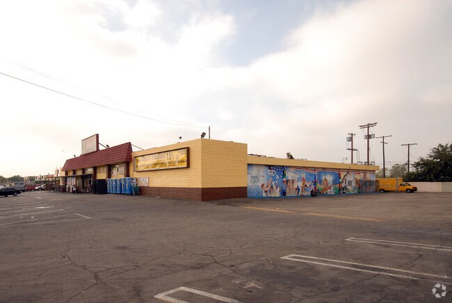
Property Detail
11675 Glenoaks Blvd
2524-022-003
TRACT # 24214 LOT COM AT MOST W COR OF LOT 1 TH S 41 2618 E 225.27 FT TH N 48 3652 E 20 FT TH S 41 2618 E 75 FT TH N 48 3652 E TO SW LINE OF GLENOAKS BLVD TH NW THEREON AND SW ON SE LINE OF VAUGHN ST TO BEG PART OF LOT 1
Religious
Los Angeles
LAC2
California
B and X Area of moderate flood hazard, usually the area between the limits of the 100-year and 500-year floods.
1
2025
2 AC
2025
Eastern SFV
104310
Los Angeles
22,386 SF
Los Angeles-Long Beach-Glendale, CA
NEARBY LISTINGS FOR SALE OR LEASE
DEMOGRAPHICS near 11675 Glenoaks Blvd
1 mile
3 mile
5 mile
2025 Total Population
28,563
193,931
424,860
2030 Population
27,764
190,041
420,710
Pop Growth 2025-2030
(2.80%)
(2.01%)
(0.98%)
Average Age
38
38
39
2025 Total Households
6,595
48,042
112,882
HH Growth 2025-2030
(3.32%)
(2.25%)
(1.14%)
Median Household Inc
$71,359
$84,625
$81,437
Avg Household Size
3.90
3.80
3.60
2025 Avg HH Vehicles
2.00
2.00
2.00
Median Home Value
$678,344
$694,541
$724,765
Median Year Built
1958
1963
1966
Nearby Places
Map Layers
Map Styles
 Street
 Aerial
Layers
 Traffic
 Biking
Places
Listings with unknown addresses are not visible on the map
- Restaurants
- Banks
- Shops
- Fitness
- Groceries
PUBLIC TRANSPORTATION
COMMUTER RAIL
Sylmar/San Fernando (Antelope Valley Line - Southern California Regional Rail Authority (Metrolink))
Drive
Walk
Distance
Sylmar/San Fernando (Antelope Valley Line - Southern California Regional Rail Authority (Metrolink))
6 min
2.7 mi
Van Nuys (Ventura County Line - Southern California Regional Rail Authority (Metrolink))
Drive
Walk
Distance
Van Nuys (Ventura County Line - Southern California Regional Rail Authority (Metrolink))
14 min
6.2 mi
AIRPORT
Bob Hope
Drive
Walk
Distance
Bob Hope
16 min
9.3 mi
Los Angeles International
Drive
Walk
Distance
Los Angeles International
38 min
28.6 mi
Long Beach (Daugherty Field)
Drive
Walk
Distance
Long Beach (Daugherty Field)
57 min
46.0 mi
Freight Ports
Port of Long Beach
Drive
Walk
Distance
Port of Long Beach
60 min
48.0 mi
Nearby Properties
Address
Land Use
TOTAL SIZE
Lot Size
Zoning
Address
Land Use
TOTAL SIZE
Lot Size
Zoning
237,451 SF
13.93 AC
LAA2
Address
Land Use
TOTAL SIZE
Lot Size
Zoning
124,418 SF
6.80 AC
LAC1
Address
Land Use
TOTAL SIZE
Lot Size
Zoning
281,288 SF
34.03 AC
LAM2
Address
Land Use
TOTAL SIZE
Lot Size
Zoning
196,404 SF
10.06 AC
LARD1.5
Address
Land Use
TOTAL SIZE
Lot Size
Zoning
185,568 SF
9.06 AC
LARD1.5
Address
Land Use
TOTAL SIZE
Lot Size
Zoning
169,259 SF
2.56 AC
LAC1
Address
Land Use
TOTAL SIZE
Lot Size
Zoning
61,315 SF
0.84 AC
LARAS4
Address
Land Use
TOTAL SIZE
Lot Size
Zoning
176,704 SF
4.10 AC
LAR3
Address
Land Use
TOTAL SIZE
Lot Size
Zoning
776,594 SF
16.18 AC
LAC2
Address
Land Use
TOTAL SIZE
Lot Size
Zoning
176,160 SF
3.19 AC
LAR3
Address
Land Use
TOTAL SIZE
Lot Size
Zoning
96,792 SF
5.52 AC
LARD2
Address
Land Use
TOTAL SIZE
Lot Size
Zoning
100,967 SF
11.78 AC
LAP
Address
Land Use
TOTAL SIZE
Lot Size
Zoning
150,041 SF
10.46 AC
LAA2
Address
Land Use
TOTAL SIZE
Lot Size
Zoning
56,396 SF
0.74 AC
LARAS4
Address
Land Use
TOTAL SIZE
Lot Size
Zoning
146,718 SF
7.36 AC
Address
Land Use
TOTAL SIZE
Lot Size
Zoning
146,718 SF
7.11 AC
SFM
Address
Land Use
TOTAL SIZE
Lot Size
Zoning
11,067 SF
3.21 AC
LAM2
Address
Land Use
TOTAL SIZE
Lot Size
Zoning
154,575 SF
12.20 AC
LAM3
Address
Land Use
TOTAL SIZE
Lot Size
Zoning
120,590 SF
9.52 AC
SFM2-C1P*
Address
Land Use
TOTAL SIZE
Lot Size
Zoning
179,394 SF
6.44 AC
LAC1
Address
Land Use
TOTAL SIZE
Lot Size
Zoning
108,012 SF
6.40 AC
LAR3
Address
Land Use
TOTAL SIZE
Lot Size
Zoning
140,411 SF
10.79 AC
LAM3
Address
Land Use
TOTAL SIZE
Lot Size
Zoning
93,635 SF
4.97 AC
LAM2
Address
Land Use
TOTAL SIZE
Lot Size
Zoning
44,480 SF
2.72 AC
LAM2
Address
Land Use
TOTAL SIZE
Lot Size
Zoning
79,778 SF
3.90 AC
LARD1.5
Address
Land Use
TOTAL SIZE
Lot Size
Zoning
99,966 SF
4.53 AC
LAM1
Address
Land Use
TOTAL SIZE
Lot Size
Zoning
110,096 SF
6.14 AC
LAM2
Address
Land Use
TOTAL SIZE
Lot Size
Zoning
122,868 SF
4.96 AC
LAM2
The World's #1 Commercial Real Estate Marketplace
Connect with us
© 2026 CoStar Group
The information above has been obtained from sources believed reliable. While we do not doubt its accuracy we have not verified it and make no guarantee, warranty or representation about it. It is your responsibility to independently confirm its accuracy and completeness. Any projections, opinions, assumptions, or estimates used are for example only and do not represent the current or future performance of the property. The value of this transaction to you depends on tax and other factors which should be evaluated by your tax, financial, and legal advisors. You and your advisors should conduct a careful, independent investigation of the property to determine to your satisfaction the suitability of the property for your needs.