Property Record
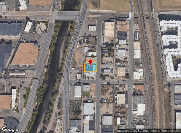
1175 S Cherokee St, Denver, CO 80223


NEARBY LISTINGS FOR SALE OR LEASE
Property Detail
1175 S Cherokee St
Denver-Aurora-Centennial, CO
West Broadway Add
5223-03-016
L 4 TO 7 INC BLK 2 WEST BROADWAY ADD
Warehouse
Denver
X
Colorado
0800460203K
4-7
2024
0.29 AC
2025
Upper South Central
001403
Denver
5,336 SF
DEMOGRAPHICS near 1175 S Cherokee St
1 mile
3 mile
5 mile
2024 Total Population
15,842
191,701
517,152
2029 Population
15,846
193,521
522,973
Pop Growth 2024-2029
+ 0.03%
+ 0.95%
+ 1.13%
Average Age
37
38
38
2024 Total Households
7,325
88,748
244,316
HH Growth 2024-2029
(0.33%)
+ 1.07%
+ 1.27%
Median Household Inc
$96,125
$79,498
$80,215
Avg Household Size
2.10
2.10
2.00
2024 Avg HH Vehicles
2.00
2.00
2.00
Median Home Value
$730,758
$636,706
$610,518
Median Year Built
1953
1962
1969
Nearby Places
Map Layers
Map Styles
 Street
 Aerial
Transit
 Traffic
 Biking
Places
Listings with unknown addresses are not visible on the map
- Restaurants
- Banks
- Shops
- Fitness
- Groceries
PUBLIC TRANSPORTATION
TRANSIT/SUBWAY
I-25-Broadway (C Line - Denver Regional Transportation District Light Rail (TheRide), D Line - Denver Regional Transportation District Light Rail (TheRide), E Line - Denver Regional Transportation District Light Rail (TheRide), F Line - Denver Regional Transportation District Light Rail (TheRide), H Line - Denver Regional Transportation District Light Rail (TheRide))
Drive
Walk
Distance
I-25-Broadway (C Line - Denver Regional Transportation District Light Rail (TheRide), D Line - Denver Regional Transportation District Light Rail (TheRide), E Line - Denver Regional Transportation District Light Rail (TheRide), F Line - Denver Regional Transportation District Light Rail (TheRide), H Line - Denver Regional Transportation District Light Rail (TheRide))
2 min
14 min
0.7 mi
Louisiana-Pearl (E Line - Denver Regional Transportation District Light Rail (TheRide), F Line - Denver Regional Transportation District Light Rail (TheRide), H Line - Denver Regional Transportation District Light Rail (TheRide))
Drive
Walk
Distance
Louisiana-Pearl (E Line - Denver Regional Transportation District Light Rail (TheRide), F Line - Denver Regional Transportation District Light Rail (TheRide), H Line - Denver Regional Transportation District Light Rail (TheRide))
2 min
18 min
0.9 mi
COMMUTER RAIL
Union Station: LoDo-Coors Field-16th Street Mall (C Line - Denver Regional Transportation District Light Rail (TheRide), E Line - Denver Regional Transportation District Light Rail (TheRide), W Line - Denver Regional Transportation District Light Rail (TheRide))
Drive
Walk
Distance
Union Station: LoDo-Coors Field-16th Street Mall (C Line - Denver Regional Transportation District Light Rail (TheRide), E Line - Denver Regional Transportation District Light Rail (TheRide), W Line - Denver Regional Transportation District Light Rail (TheRide))
9 min
5.0 mi
Drive
Walk
Distance
10 min
5.1 mi
AIRPORT
Denver International
Drive
Walk
Distance
Denver International
39 min
29.1 mi
SALE & LEASE HISTORY
LISTING DATE
SALE/LEASE

Nov 08, 2024
For Lease
Mar 30, 2021
For Lease
Nearby Properties
Address
Land Use
TOTAL SIZE
Lot Size
Zoning
Address
Land Use
TOTAL SIZE
Lot Size
Zoning
598,652 SF
1.38 AC
G-TR
Address
Land Use
TOTAL SIZE
Lot Size
Zoning
856,519 SF
10.04 AC
B-3
Address
Land Use
TOTAL SIZE
Lot Size
Zoning
472,235 SF
1.98 AC
C-RX
Address
Land Use
TOTAL SIZE
Lot Size
Zoning
1,096,923 SF
16.14 AC
CMP-H
Address
Land Use
TOTAL SIZE
Lot Size
Zoning
451,860 SF
1 AC
C-MX
Address
Land Use
TOTAL SIZE
Lot Size
Zoning
377,735 SF
1.72 AC
G-RX
Address
Land Use
TOTAL SIZE
Lot Size
Zoning
297,776 SF
2.88 AC
C-MX
Address
Land Use
TOTAL SIZE
Lot Size
Zoning
422,426 SF
1.05 AC
C-RX
Address
Land Use
TOTAL SIZE
Lot Size
Zoning
296,778 SF
2.28 AC
U-MS
Address
Land Use
TOTAL SIZE
Lot Size
Zoning
341,972 SF
1.21 AC
G-TR
Address
Land Use
TOTAL SIZE
Lot Size
Zoning
254,661 SF
1.12 AC
G-TR
Address
Land Use
TOTAL SIZE
Lot Size
Zoning
656,257 SF
3.05 AC
D-CV
Address
Land Use
TOTAL SIZE
Lot Size
Zoning
200,014 SF
5.14 AC
I-MX-3
Address
Land Use
TOTAL SIZE
Lot Size
Zoning
1,137,044 SF
35.49 AC
CMP-EI
Address
Land Use
TOTAL SIZE
Lot Size
Zoning
206,526 SF
0.43 AC
G-TR
Address
Land Use
TOTAL SIZE
Lot Size
Zoning
310,408 SF
0.79 AC
C-MX
Address
Land Use
TOTAL SIZE
Lot Size
Zoning
124,658 SF
2.13 AC
CMP-EI
Address
Land Use
TOTAL SIZE
Lot Size
Zoning
252,992 SF
11.76 AC
B-3
Address
Land Use
TOTAL SIZE
Lot Size
Zoning
150,106 SF
2.40 AC
C-RX
Address
Land Use
TOTAL SIZE
Lot Size
Zoning
169,731 SF
0.69 AC
C-RX
Address
Land Use
TOTAL SIZE
Lot Size
Zoning
293,795 SF
5.16 AC
CMP-H
Address
Land Use
TOTAL SIZE
Lot Size
Zoning
441,643 SF
9.79 AC
H-1-B
Address
Land Use
TOTAL SIZE
Lot Size
Zoning
163,951 SF
1.04 AC
G-TR
Address
Land Use
TOTAL SIZE
Lot Size
Zoning
488,638 SF
2.44 AC
D-CV
Address
Land Use
TOTAL SIZE
Lot Size
Zoning
550,760 SF
13.25 AC
CMP-EI
Address
Land Use
TOTAL SIZE
Lot Size
Zoning
113,932 SF
9.60 AC
I-B
Address
Land Use
TOTAL SIZE
Lot Size
Zoning
533,298 SF
3.23 AC
C-MX
Address
Land Use
TOTAL SIZE
Lot Size
Zoning
134,360 SF
1.45 AC
C-MX
Address
Land Use
TOTAL SIZE
Lot Size
Zoning
152,415 SF
1.09 AC
C-CCN-12
Address
Land Use
TOTAL SIZE
Lot Size
Zoning
543,122 SF
13.43 AC
CMP-EI
The World's #1 Commercial Real Estate Marketplace
Connect with us
© 2026 CoStar Group
The information above has been obtained from sources believed reliable. While we do not doubt its accuracy we have not verified it and make no guarantee, warranty or representation about it. It is your responsibility to independently confirm its accuracy and completeness. Any projections, opinions, assumptions, or estimates used are for example only and do not represent the current or future performance of the property. The value of this transaction to you depends on tax and other factors which should be evaluated by your tax, financial, and legal advisors. You and your advisors should conduct a careful, independent investigation of the property to determine to your satisfaction the suitability of the property for your needs.