Property Record
1175 W 675 N, Orem, UT 84057
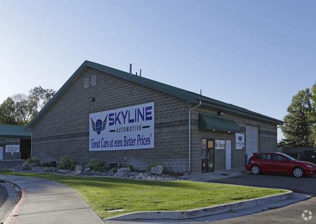
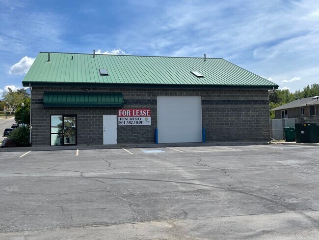
Property Detail
1175 W 675 N
Provo-Orem-Lehi, UT
UNIT 2, PLAT B, CREST BUSINESS PARK CONDOS. AREA 0.047 AC.
65-375-0001
Utah
Industrialgeneral
Utah
2024
0.05 AC
2025
Utah County
000801
Salt Lake City
2,040 SF
NEARBY LISTINGS FOR SALE OR LEASE
DEMOGRAPHICS near 1175 W 675 N
1 mile
3 mile
5 mile
2025 Total Population
16,454
116,622
207,311
2030 Population
17,891
127,627
227,170
Pop Growth 2025-2030
+ 8.73%
+ 9.44%
+ 9.58%
Average Age
32
32
33
2025 Total Households
5,428
35,366
63,518
HH Growth 2025-2030
+ 9.67%
+ 10.20%
+ 10.40%
Median Household Inc
$80,808
$92,872
$92,106
Avg Household Size
3.00
3.20
3.20
2025 Avg HH Vehicles
2.00
2.00
2.00
Median Home Value
$448,003
$569,328
$563,060
Median Year Built
1996
1994
1994
Nearby Places
Map Layers
Map Styles
 Street
 Aerial
Transit
 Traffic
 Biking
Places
Listings with unknown addresses are not visible on the map
- Restaurants
- Banks
- Shops
- Fitness
- Groceries
PUBLIC TRANSPORTATION
COMMUTER RAIL
Drive
Walk
Distance
3 min
1.6 mi
Drive
Walk
Distance
6 min
3.0 mi
AIRPORT
Provo Municipal
Drive
Walk
Distance
Provo Municipal
14 min
9.3 mi
Salt Lake City International
Drive
Walk
Distance
Salt Lake City International
48 min
41.7 mi
SALE & LEASE HISTORY
LISTING DATE
SALE/LEASE

May 25, 2022
For Lease
Nearby Properties
Address
Land Use
TOTAL SIZE
Lot Size
Zoning
Address
Land Use
TOTAL SIZE
Lot Size
Zoning
206,178 SF
16.64 AC
Address
Land Use
TOTAL SIZE
Lot Size
Zoning
1,003,185 SF
9.57 AC
Address
Land Use
TOTAL SIZE
Lot Size
Zoning
472,365 SF
15.90 AC
Address
Land Use
TOTAL SIZE
Lot Size
Zoning
736,672 SF
7.04 AC
Address
Land Use
TOTAL SIZE
Lot Size
Zoning
349,971 SF
11.43 AC
Address
Land Use
TOTAL SIZE
Lot Size
Zoning
326,355 SF
15.12 AC
Address
Land Use
TOTAL SIZE
Lot Size
Zoning
233,302 SF
15.03 AC
Address
Land Use
TOTAL SIZE
Lot Size
Zoning
333,719 SF
11.99 AC
Address
Land Use
TOTAL SIZE
Lot Size
Zoning
430,273 SF
15.74 AC
Address
Land Use
TOTAL SIZE
Lot Size
Zoning
222,803 SF
18.48 AC
Address
Land Use
TOTAL SIZE
Lot Size
Zoning
268,060 SF
11.73 AC
Address
Land Use
TOTAL SIZE
Lot Size
Zoning
364,248 SF
22.77 AC
Address
Land Use
TOTAL SIZE
Lot Size
Zoning
212,466 SF
25.89 AC
Address
Land Use
TOTAL SIZE
Lot Size
Zoning
139,462 SF
3.93 AC
Address
Land Use
TOTAL SIZE
Lot Size
Zoning
124,242 SF
9.33 AC
Address
Land Use
TOTAL SIZE
Lot Size
Zoning
266,887 SF
8.12 AC
Address
Land Use
TOTAL SIZE
Lot Size
Zoning
194,483 SF
10.66 AC
Address
Land Use
TOTAL SIZE
Lot Size
Zoning
179,347 SF
13.55 AC
Address
Land Use
TOTAL SIZE
Lot Size
Zoning
72,761 SF
5.92 AC
Address
Land Use
TOTAL SIZE
Lot Size
Zoning
128,992 SF
12.39 AC
Address
Land Use
TOTAL SIZE
Lot Size
Zoning
204,655 SF
8.10 AC
Address
Land Use
TOTAL SIZE
Lot Size
Zoning
59,218 SF
6.88 AC
Address
Land Use
TOTAL SIZE
Lot Size
Zoning
17,165 SF
5.29 AC
Address
Land Use
TOTAL SIZE
Lot Size
Zoning
154,973 SF
5.18 AC
Address
Land Use
TOTAL SIZE
Lot Size
Zoning
135,893 SF
9.93 AC
Address
Land Use
TOTAL SIZE
Lot Size
Zoning
111,474 SF
8.98 AC
Address
Land Use
TOTAL SIZE
Lot Size
Zoning
2.76 AC
Address
Land Use
TOTAL SIZE
Lot Size
Zoning
83,568 SF
2 AC
Address
Land Use
TOTAL SIZE
Lot Size
Zoning
87,031 SF
5.69 AC
Address
Land Use
TOTAL SIZE
Lot Size
Zoning
123,663 SF
5.31 AC
The World's #1 Commercial Real Estate Marketplace
Connect with us
© 2026 CoStar Group
The information above has been obtained from sources believed reliable. While we do not doubt its accuracy we have not verified it and make no guarantee, warranty or representation about it. It is your responsibility to independently confirm its accuracy and completeness. Any projections, opinions, assumptions, or estimates used are for example only and do not represent the current or future performance of the property. The value of this transaction to you depends on tax and other factors which should be evaluated by your tax, financial, and legal advisors. You and your advisors should conduct a careful, independent investigation of the property to determine to your satisfaction the suitability of the property for your needs.