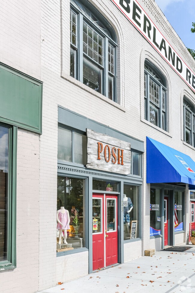
Property Record
118 Public Sq, Lebanon, TN 37087

NEARBY LISTINGS FOR SALE OR LEASE
Property Detail
118 Public Sq
068E-N-002.00
FORMERLY 68EA-A-2 65.9 X 46.5 M IRR
Commercialnec
Wilson
AE
Tennessee
47189C0183E
93 AC
2024
Mt Juliet-Lebanon
2024
Nashville
030700
Nashville-Davidson--Murfreesboro--Franklin, TN
7,890 SF
DEMOGRAPHICS near 118 Public Sq
1 Mile
3 Mile
5 Mile
2024 Total Population
9,027
31,433
47,524
2029 Population
10,684
37,274
56,334
Pop Growth 2024-2029
+ 18.36%
+ 18.58%
+ 18.54%
Average Age
39
39
40
2024 Total Households
3,255
12,032
18,121
HH Growth 2024-2029
+ 18.62%
+ 18.58%
+ 18.50%
Median Household Inc
$41,729
$51,089
$58,596
Avg Household Size
2.40
2.40
2.50
2024 Avg HH Vehicles
2.00
2.00
2.00
Median Home Value
$230,675
$252,772
$295,899
Median Year Built
1976
1990
1994
Nearby Places
Map Layers
Map Styles
 Street
 Aerial
- Restaurants
- Banks
- Shops
- Fitness
- Groceries
PUBLIC TRANSPORTATION
COMMUTER RAIL
Lebanon (East Corridor Line - Tennessee Regional Transportation Authority Music City Star (Music City Star))
DRIVE
WALK
Distance
Lebanon (East Corridor Line - Tennessee Regional Transportation Authority Music City Star (Music City Star))
2 min
12 min
0.5 mi
AIRPORT
Nashville International
DRIVE
WALK
Distance
Nashville International
28 min
25.5 mi
SALE & LEASE HISTORY
LISTING DATE
SALE/LEASE

Feb 24, 2025
For Lease
Nearby Properties
Address
Land Use
TOTAL SIZE
Lot Size
Zoning
Address
Land Use
TOTAL SIZE
Lot Size
Zoning
265,283 SF
25 AC
Address
Land Use
TOTAL SIZE
Lot Size
Zoning
465,181 SF
29.13 AC
Address
Land Use
TOTAL SIZE
Lot Size
Zoning
438,956 SF
35.78 AC
Address
Land Use
TOTAL SIZE
Lot Size
Zoning
405,286 SF
70.72 AC
Address
Land Use
TOTAL SIZE
Lot Size
Zoning
412,125 SF
36.44 AC
Address
Land Use
TOTAL SIZE
Lot Size
Zoning
309,940 SF
34 AC
Address
Land Use
TOTAL SIZE
Lot Size
Zoning
29,168 SF
304.39 AC
Address
Land Use
TOTAL SIZE
Lot Size
Zoning
530,720 SF
36.46 AC
Address
Land Use
TOTAL SIZE
Lot Size
Zoning
194,597 SF
20.20 AC
Address
Land Use
TOTAL SIZE
Lot Size
Zoning
186,969 SF
11.03 AC
Address
Land Use
TOTAL SIZE
Lot Size
Zoning
197,178 SF
73.06 AC
Address
Land Use
TOTAL SIZE
Lot Size
Zoning
213,333 SF
18.92 AC
Address
Land Use
TOTAL SIZE
Lot Size
Zoning
74,767 SF
5.89 AC
B4
Address
Land Use
TOTAL SIZE
Lot Size
Zoning
349,458 SF
15.45 AC
Address
Land Use
TOTAL SIZE
Lot Size
Zoning
108,903 SF
5.20 AC
Address
Land Use
TOTAL SIZE
Lot Size
Zoning
383,150 SF
35.03 AC
Address
Land Use
TOTAL SIZE
Lot Size
Zoning
199,465 SF
23.89 AC
Address
Land Use
TOTAL SIZE
Lot Size
Zoning
103,045 SF
9.56 AC
CS
Address
Land Use
TOTAL SIZE
Lot Size
Zoning
159,256 SF
11.40 AC
Address
Land Use
TOTAL SIZE
Lot Size
Zoning
222,400 SF
12.68 AC
Address
Land Use
TOTAL SIZE
Lot Size
Zoning
118,152 SF
5.72 AC
Address
Land Use
TOTAL SIZE
Lot Size
Zoning
41,168 SF
10.10 AC
Address
Land Use
TOTAL SIZE
Lot Size
Zoning
143,151 SF
15.31 AC
Address
Land Use
TOTAL SIZE
Lot Size
Zoning
501,391 SF
97.50 AC
Address
Land Use
TOTAL SIZE
Lot Size
Zoning
342,800 SF
20.51 AC
M3
Address
Land Use
TOTAL SIZE
Lot Size
Zoning
104,219 SF
14.52 AC
Address
Land Use
TOTAL SIZE
Lot Size
Zoning
37,400 SF
3.42 AC
Address
Land Use
TOTAL SIZE
Lot Size
Zoning
231,867 SF
17.03 AC
M3
Address
Land Use
TOTAL SIZE
Lot Size
Zoning
46,742 SF
10.25 AC
Address
Land Use
TOTAL SIZE
Lot Size
Zoning
68,037 SF
2.89 AC
The World's #1 Commercial Real Estate Marketplace
Connect with us
© 2025 CoStar Group
The information above has been obtained from sources believed reliable. While we do not doubt its accuracy we have not verified it and make no guarantee, warranty or representation about it. It is your responsibility to independently confirm its accuracy and completeness. Any projections, opinions, assumptions, or estimates used are for example only and do not represent the current or future performance of the property. The value of this transaction to you depends on tax and other factors which should be evaluated by your tax, financial, and legal advisors. You and your advisors should conduct a careful, independent investigation of the property to determine to your satisfaction the suitability of the property for your needs.