Property Record
11965 Main St, Broomfield, CO 80020


Property Detail
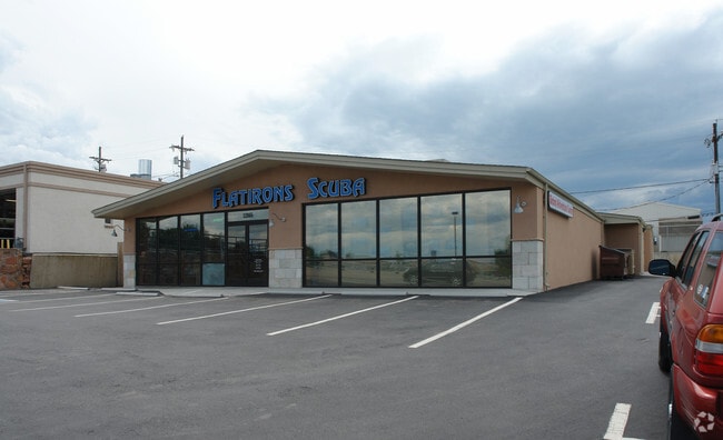
11965 Main St
1717-02-1-01-003
SUBD: OLSON SUBDIVISION LOT: 4 RCP:27220472
Storebuilding
Broomfield
RC (J)
Colorado
B and X Area of moderate flood hazard, usually the area between the limits of the 100-year and 500-year floods.
4
2024
0.24 AC
2025
Northwest
030200
Denver
3,531 SF
Denver-Aurora-Centennial, CO
NEARBY LISTINGS FOR SALE OR LEASE
DEMOGRAPHICS near 11965 Main St
1 mile
3 mile
5 mile
2024 Total Population
11,542
81,515
234,493
2029 Population
11,839
83,638
239,658
Pop Growth 2024-2029
+ 2.57%
+ 2.60%
+ 2.20%
Average Age
40
40
39
2024 Total Households
4,629
32,609
92,428
HH Growth 2024-2029
+ 2.94%
+ 2.92%
+ 2.47%
Median Household Inc
$96,528
$116,676
$103,422
Avg Household Size
2.40
2.50
2.50
2024 Avg HH Vehicles
2.00
2.00
2.00
Median Home Value
$584,832
$678,237
$606,297
Median Year Built
1984
1993
1991
Nearby Places
Map Layers
Map Styles
 Street
 Aerial
Transit
 Traffic
 Biking
Places
Listings with unknown addresses are not visible on the map
- Restaurants
- Banks
- Shops
- Fitness
- Groceries
PUBLIC TRANSPORTATION
COMMUTER RAIL
Drive
Walk
Distance
13 min
6.8 mi
Drive
Walk
Distance
14 min
7.3 mi
AIRPORT
Denver International
Drive
Walk
Distance
Denver International
41 min
33.3 mi
Nearby Properties
Address
Land Use
TOTAL SIZE
Lot Size
Zoning
Address
Land Use
TOTAL SIZE
Lot Size
Zoning
431,902 SF
17.63 AC
Address
Land Use
TOTAL SIZE
Lot Size
Zoning
305,331 SF
14.41 AC
PUD
Address
Land Use
TOTAL SIZE
Lot Size
Zoning
117,775 SF
34.58 AC
GA; PUD
Address
Land Use
TOTAL SIZE
Lot Size
Zoning
211,191 SF
30.46 AC
Address
Land Use
TOTAL SIZE
Lot Size
Zoning
254,500 SF
13.42 AC
PUD
Address
Land Use
TOTAL SIZE
Lot Size
Zoning
279.72 AC
A
Address
Land Use
TOTAL SIZE
Lot Size
Zoning
233.17 AC
A
Address
Land Use
TOTAL SIZE
Lot Size
Zoning
209,009 SF
22.30 AC
Address
Land Use
TOTAL SIZE
Lot Size
Zoning
320,771 SF
18.60 AC
PUD
Address
Land Use
TOTAL SIZE
Lot Size
Zoning
254,500 SF
13 AC
PUD
Address
Land Use
TOTAL SIZE
Lot Size
Zoning
174,398 SF
33.34 AC
PF; PROL;
Address
Land Use
TOTAL SIZE
Lot Size
Zoning
212,852 SF
12.82 AC
Address
Land Use
TOTAL SIZE
Lot Size
Zoning
187,920 SF
10.57 AC
PUD
Address
Land Use
TOTAL SIZE
Lot Size
Zoning
159,724 SF
8.11 AC
Address
Land Use
TOTAL SIZE
Lot Size
Zoning
577,088 SF
18.94 AC
PUD
Address
Land Use
TOTAL SIZE
Lot Size
Zoning
250,701 SF
14.14 AC
Address
Land Use
TOTAL SIZE
Lot Size
Zoning
154,700 SF
9.03 AC
PUD
Address
Land Use
TOTAL SIZE
Lot Size
Zoning
528,256 SF
3.87 AC
PUD
Address
Land Use
TOTAL SIZE
Lot Size
Zoning
166,982 SF
10.06 AC
Address
Land Use
TOTAL SIZE
Lot Size
Zoning
121,639 SF
25.99 AC
Address
Land Use
TOTAL SIZE
Lot Size
Zoning
34,584 SF
13.70 AC
PUD
Address
Land Use
TOTAL SIZE
Lot Size
Zoning
78,008 SF
5.01 AC
PUD
Address
Land Use
TOTAL SIZE
Lot Size
Zoning
203,755 SF
39.65 AC
R-1
Address
Land Use
TOTAL SIZE
Lot Size
Zoning
127,434 SF
7.53 AC
Address
Land Use
TOTAL SIZE
Lot Size
Zoning
308,832 SF
11.91 AC
PUD
Address
Land Use
TOTAL SIZE
Lot Size
Zoning
280,447 SF
5.98 AC
PUD
Address
Land Use
TOTAL SIZE
Lot Size
Zoning
133,573 SF
7.93 AC
PD
Address
Land Use
TOTAL SIZE
Lot Size
Zoning
133,573 SF
8.74 AC
PD
Address
Land Use
TOTAL SIZE
Lot Size
Zoning
201,000 SF
9.42 AC
PUD
Address
Land Use
TOTAL SIZE
Lot Size
Zoning
141,741 SF
5.58 AC
The World's #1 Commercial Real Estate Marketplace
Connect with us
© 2026 CoStar Group
The information above has been obtained from sources believed reliable. While we do not doubt its accuracy we have not verified it and make no guarantee, warranty or representation about it. It is your responsibility to independently confirm its accuracy and completeness. Any projections, opinions, assumptions, or estimates used are for example only and do not represent the current or future performance of the property. The value of this transaction to you depends on tax and other factors which should be evaluated by your tax, financial, and legal advisors. You and your advisors should conduct a careful, independent investigation of the property to determine to your satisfaction the suitability of the property for your needs.