Property Record
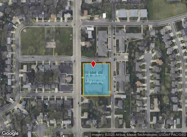
120 N Sycamore Ave, Sioux Falls, SD 57110

NEARBY LISTINGS FOR SALE OR LEASE
Property Detail
120 N Sycamore Ave
63880
Ladenes Addn
Apartment
BLOCK 1 LADENES ADDN TO CITY OF SIOUX FALLS
X
Minnehaha
46099C0466D
South Dakota
2024
1.70 AC
2024
Sioux Falls
000405
Other Market Areas
17,972 SF
Sioux Falls, SD-MN
DEMOGRAPHICS near 120 N Sycamore Ave
1 Mile
3 Mile
5 Mile
2024 Total Population
12,932
67,329
133,601
2029 Population
14,066
73,371
147,513
Pop Growth 2024-2029
+ 8.77%
+ 8.97%
+ 10.41%
Average Age
37
38
39
2024 Total Households
4,810
26,977
54,426
HH Growth 2024-2029
+ 9.11%
+ 9.36%
+ 10.96%
Median Household Inc
$64,290
$71,965
$72,300
Avg Household Size
2.60
2.40
2.30
2024 Avg HH Vehicles
2.00
2.00
2.00
Median Home Value
$259,488
$253,672
$255,535
Median Year Built
1992
1989
1984
Nearby Places
Map Layers
Map Styles
 Street
 Aerial
- Restaurants
- Banks
- Shops
- Fitness
- Groceries
PUBLIC TRANSPORTATION
AIRPORT
Joe Foss Field
DRIVE
WALK
Distance
Joe Foss Field
27 min
7.6 mi
Freight Ports
Port Milwaukee
DRIVE
WALK
Distance
Port Milwaukee
546 min
501.8 mi
Nearby Properties
Address
Land Use
TOTAL SIZE
Lot Size
Zoning
Address
Land Use
TOTAL SIZE
Lot Size
Zoning
Address
Land Use
TOTAL SIZE
Lot Size
Zoning
184,821 SF
1.83 AC
NO;SPECIAL
Address
Land Use
TOTAL SIZE
Lot Size
Zoning
15.39 AC
Address
Land Use
TOTAL SIZE
Lot Size
Zoning
4,136 SF
18.95 AC
Address
Land Use
TOTAL SIZE
Lot Size
Zoning
3,306 SF
17.41 AC
Address
Land Use
TOTAL SIZE
Lot Size
Zoning
14,820 SF
80.57 AC
FP;FP
Address
Land Use
TOTAL SIZE
Lot Size
Zoning
3.07 AC
FP;FP
Address
Land Use
TOTAL SIZE
Lot Size
Zoning
94,624 SF
12.31 AC
Address
Land Use
TOTAL SIZE
Lot Size
Zoning
11,800 SF
11.78 AC
Address
Land Use
TOTAL SIZE
Lot Size
Zoning
1.32 AC
FP;FP
Address
Land Use
TOTAL SIZE
Lot Size
Zoning
1.57 AC
C2;GENERAL
Address
Land Use
TOTAL SIZE
Lot Size
Zoning
41.01 AC
FP;FP
Address
Land Use
TOTAL SIZE
Lot Size
Zoning
2,406 SF
13.76 AC
Address
Land Use
TOTAL SIZE
Lot Size
Zoning
17,117 SF
6.51 AC
PD;PLANNED
Address
Land Use
TOTAL SIZE
Lot Size
Zoning
92,195 SF
8 AC
Address
Land Use
TOTAL SIZE
Lot Size
Zoning
1.20 AC
FP;FP
Address
Land Use
TOTAL SIZE
Lot Size
Zoning
87,328 SF
6.92 AC
Address
Land Use
TOTAL SIZE
Lot Size
Zoning
5.85 AC
Address
Land Use
TOTAL SIZE
Lot Size
Zoning
86,019 SF
3.60 AC
NO;SPECIAL
Address
Land Use
TOTAL SIZE
Lot Size
Zoning
2.26 AC
FP;FP
Address
Land Use
TOTAL SIZE
Lot Size
Zoning
89,935 SF
4.81 AC
Address
Land Use
TOTAL SIZE
Lot Size
Zoning
62,856 SF
11.26 AC
Address
Land Use
TOTAL SIZE
Lot Size
Zoning
0.94 AC
FP;FP
Address
Land Use
TOTAL SIZE
Lot Size
Zoning
92,461 SF
1.28 AC
Address
Land Use
TOTAL SIZE
Lot Size
Zoning
168,854 SF
2.13 AC
Address
Land Use
TOTAL SIZE
Lot Size
Zoning
132,353 SF
3.66 AC
FP;FP
Address
Land Use
TOTAL SIZE
Lot Size
Zoning
212,260 SF
20.37 AC
Address
Land Use
TOTAL SIZE
Lot Size
Zoning
219,120 SF
18.65 AC
Address
Land Use
TOTAL SIZE
Lot Size
Zoning
103,670 SF
2.29 AC
Address
Land Use
TOTAL SIZE
Lot Size
Zoning
79,504 SF
0.98 AC
The World's #1 Commercial Real Estate Marketplace
Connect with us
© 2026 CoStar Group
The information above has been obtained from sources believed reliable. While we do not doubt its accuracy we have not verified it and make no guarantee, warranty or representation about it. It is your responsibility to independently confirm its accuracy and completeness. Any projections, opinions, assumptions, or estimates used are for example only and do not represent the current or future performance of the property. The value of this transaction to you depends on tax and other factors which should be evaluated by your tax, financial, and legal advisors. You and your advisors should conduct a careful, independent investigation of the property to determine to your satisfaction the suitability of the property for your needs.