Property Record
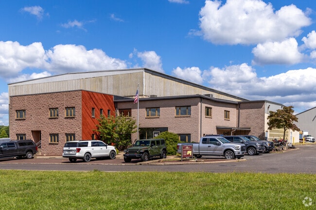
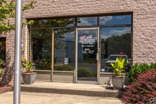
1200 N Ridge Rd, Perkasie, PA 18944
NEARBY LISTINGS FOR SALE OR LEASE
Property Detail
1200 N Ridge Rd
Philadelphia-Camden-Wilmington, PA-NJ-DE-MD
LOT 1A 146 FT N S RIDGE R D & 1100 FT SW T358
12-009-149-001
Bucks
Commercialnec
Pennsylvania
X
1a
42017C0143J
6 AC
2024
Bucks
2025
Philadelphia
102102
DEMOGRAPHICS near 1200 N Ridge Rd
1 Mile
3 Mile
5 Mile
2024 Total Population
4,375
27,345
62,340
2029 Population
4,441
27,256
62,243
Pop Growth 2024-2029
+ 1.51%
(0.33%)
(0.16%)
Average Age
42
42
42
2024 Total Households
1,725
10,512
24,003
HH Growth 2024-2029
+ 1.74%
(0.31%)
(0.19%)
Median Household Inc
$105,156
$100,773
$96,585
Avg Household Size
2.50
2.60
2.50
2024 Avg HH Vehicles
2.00
2.00
2.00
Median Home Value
$334,507
$341,882
$349,407
Median Year Built
1975
1976
1977
Nearby Places
Map Layers
Map Styles
 Street
 Aerial
- Restaurants
- Banks
- Shops
- Fitness
- Groceries
PUBLIC TRANSPORTATION
COMMUTER RAIL
Chalfont (R5 - Southeastern Pennsylvania Transportation Authority Regional Rail (SEPTA Regional Rail))
DRIVE
WALK
Distance
Chalfont (R5 - Southeastern Pennsylvania Transportation Authority Regional Rail (SEPTA Regional Rail))
22 min
9.9 mi
AIRPORT
Lehigh Valley International
DRIVE
WALK
Distance
Lehigh Valley International
44 min
24.8 mi
Trenton Mercer
DRIVE
WALK
Distance
Trenton Mercer
58 min
32.7 mi
Freight Ports
Port of Philadelphia
DRIVE
WALK
Distance
Port of Philadelphia
62 min
36.4 mi
Nearby Properties
Address
Land Use
TOTAL SIZE
Lot Size
Zoning
Address
Land Use
TOTAL SIZE
Lot Size
Zoning
256,512 SF
21.31 AC
CR
Address
Land Use
TOTAL SIZE
Lot Size
Zoning
1,261,187 SF
13.86 AC
CR
Address
Land Use
TOTAL SIZE
Lot Size
Zoning
92,018 SF
22.18 AC
I2
Address
Land Use
TOTAL SIZE
Lot Size
Zoning
131,218 SF
14.23 AC
PRD
Address
Land Use
TOTAL SIZE
Lot Size
Zoning
63,433 SF
8.20 AC
CO
Address
Land Use
TOTAL SIZE
Lot Size
Zoning
68,463 SF
10.86 AC
IS
Address
Land Use
TOTAL SIZE
Lot Size
Zoning
7.61 AC
CR
Address
Land Use
TOTAL SIZE
Lot Size
Zoning
105,840 SF
2.42 AC
R1B
Address
Land Use
TOTAL SIZE
Lot Size
Zoning
101,920 SF
21.05 AC
R1B
Address
Land Use
TOTAL SIZE
Lot Size
Zoning
39,966 SF
2.78 AC
I2
Address
Land Use
TOTAL SIZE
Lot Size
Zoning
40,000 SF
8.55 AC
I
Address
Land Use
TOTAL SIZE
Lot Size
Zoning
52,819 SF
15.35 AC
CR
Address
Land Use
TOTAL SIZE
Lot Size
Zoning
2,538 SF
4.96 AC
CR
Address
Land Use
TOTAL SIZE
Lot Size
Zoning
20,106 SF
6.49 AC
A
Address
Land Use
TOTAL SIZE
Lot Size
Zoning
5,546 SF
11.63 AC
PC1
Address
Land Use
TOTAL SIZE
Lot Size
Zoning
14,822 SF
2.95 AC
IS
Address
Land Use
TOTAL SIZE
Lot Size
Zoning
12,788 SF
1.88 AC
C1
Address
Land Use
TOTAL SIZE
Lot Size
Zoning
6,810 SF
0.35 AC
R2
Address
Land Use
TOTAL SIZE
Lot Size
Zoning
82,313 SF
4.41 AC
R3
Address
Land Use
TOTAL SIZE
Lot Size
Zoning
7,263 SF
0.11 AC
IS
Address
Land Use
TOTAL SIZE
Lot Size
Zoning
33,362 SF
14.97 AC
PI
Address
Land Use
TOTAL SIZE
Lot Size
Zoning
0.17 AC
I2
Address
Land Use
TOTAL SIZE
Lot Size
Zoning
2,638,407 SF
1 AC
IS
Address
Land Use
TOTAL SIZE
Lot Size
Zoning
6 AC
I1
Address
Land Use
TOTAL SIZE
Lot Size
Zoning
5,492 SF
0.07 AC
IS
Address
Land Use
TOTAL SIZE
Lot Size
Zoning
10,368 SF
2.02 AC
PC2
Address
Land Use
TOTAL SIZE
Lot Size
Zoning
42,460 SF
5.61 AC
PC2
Address
Land Use
TOTAL SIZE
Lot Size
Zoning
17,766 SF
0.24 AC
C2
Address
Land Use
TOTAL SIZE
Lot Size
Zoning
6,522 SF
0.17 AC
IS
The World's #1 Commercial Real Estate Marketplace
Connect with us
© 2026 CoStar Group
The information above has been obtained from sources believed reliable. While we do not doubt its accuracy we have not verified it and make no guarantee, warranty or representation about it. It is your responsibility to independently confirm its accuracy and completeness. Any projections, opinions, assumptions, or estimates used are for example only and do not represent the current or future performance of the property. The value of this transaction to you depends on tax and other factors which should be evaluated by your tax, financial, and legal advisors. You and your advisors should conduct a careful, independent investigation of the property to determine to your satisfaction the suitability of the property for your needs.