Property Record
1201 Jay Ln, Graham, NC 27253
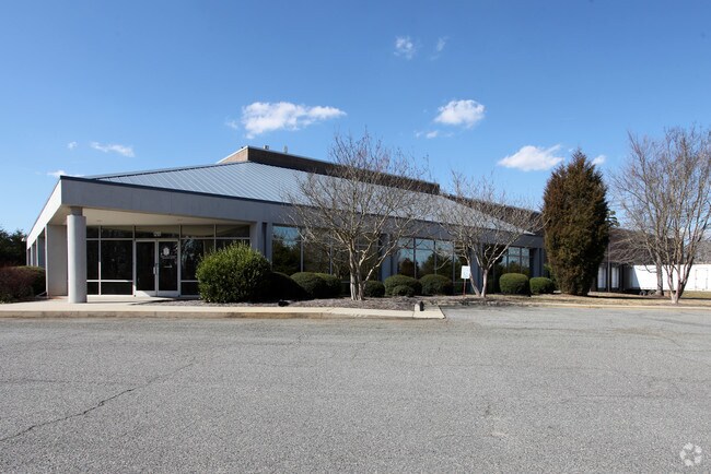

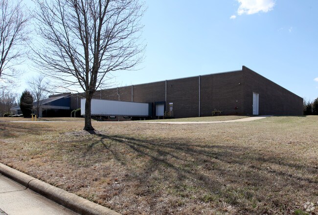
Property Detail
1201 Jay Ln
152729
BA 1201 JAY LANE LT 23 6-40-35
Multipleuses
Alamance
I 1
North Carolina
B and X Area of moderate flood hazard, usually the area between the limits of the 100-year and 500-year floods.
23
2025
5.50 AC
2025
S Central Alamance County
021101
Greensboro/Winston-Salem
51,738 SF
Burlington, NC
NEARBY LISTINGS FOR SALE OR LEASE
DEMOGRAPHICS near 1201 Jay Ln
1 mile
3 mile
5 mile
2025 Total Population
2,782
30,096
79,775
2030 Population
2,956
31,819
84,386
Pop Growth 2025-2030
+ 6.25%
+ 5.73%
+ 5.78%
Average Age
38
40
40
2025 Total Households
1,279
12,203
32,081
HH Growth 2025-2030
+ 6.41%
+ 5.91%
+ 5.95%
Median Household Inc
$74,955
$55,465
$57,960
Avg Household Size
2.20
2.40
2.40
2025 Avg HH Vehicles
2.00
2.00
2.00
Median Home Value
$264,473
$209,886
$232,070
Median Year Built
1996
1978
1981
Nearby Places
Map Layers
Map Styles
 Street
 Aerial
Layers
 Traffic
 Biking
Places
Listings with unknown addresses are not visible on the map
- Restaurants
- Banks
- Shops
- Fitness
- Groceries
PUBLIC TRANSPORTATION
COMMUTER RAIL
Burlington Station (Piedmont - North Carolina by Train (NC Train))
Drive
Walk
Distance
Burlington Station (Piedmont - North Carolina by Train (NC Train))
10 min
5.0 mi
AIRPORT
Piedmont Triad International
Drive
Walk
Distance
Piedmont Triad International
53 min
39.3 mi
Raleigh-Durham International
Drive
Walk
Distance
Raleigh-Durham International
57 min
43.7 mi
Nearby Properties
Address
Land Use
TOTAL SIZE
Lot Size
Zoning
Address
Land Use
TOTAL SIZE
Lot Size
Zoning
18,778 SF
167.10 AC
R20
Address
Land Use
TOTAL SIZE
Lot Size
Zoning
919,840 SF
85.58 AC
Address
Land Use
TOTAL SIZE
Lot Size
Zoning
9,728 SF
184.66 AC
M 2
Address
Land Use
TOTAL SIZE
Lot Size
Zoning
159,629 SF
82.81 AC
Address
Land Use
TOTAL SIZE
Lot Size
Zoning
27,803 SF
13.10 AC
B 2
Address
Land Use
TOTAL SIZE
Lot Size
Zoning
578,100 SF
55.30 AC
Address
Land Use
TOTAL SIZE
Lot Size
Zoning
48,136 SF
14.57 AC
B 2
Address
Land Use
TOTAL SIZE
Lot Size
Zoning
333,775 SF
46.14 AC
Address
Land Use
TOTAL SIZE
Lot Size
Zoning
37,502 SF
17.48 AC
CR
Address
Land Use
TOTAL SIZE
Lot Size
Zoning
27,803 SF
11.53 AC
Address
Land Use
TOTAL SIZE
Lot Size
Zoning
33,280 SF
9.07 AC
I2
Address
Land Use
TOTAL SIZE
Lot Size
Zoning
296,940 SF
33.78 AC
Address
Land Use
TOTAL SIZE
Lot Size
Zoning
72,164 SF
73.50 AC
Address
Land Use
TOTAL SIZE
Lot Size
Zoning
750 SF
65.26 AC
M 2
Address
Land Use
TOTAL SIZE
Lot Size
Zoning
10,368 SF
11.35 AC
R MF
Address
Land Use
TOTAL SIZE
Lot Size
Zoning
51,994 SF
42.20 AC
OI
Address
Land Use
TOTAL SIZE
Lot Size
Zoning
134,000 SF
23.33 AC
Address
Land Use
TOTAL SIZE
Lot Size
Zoning
71,962 SF
5.98 AC
O I
Address
Land Use
TOTAL SIZE
Lot Size
Zoning
216,968 SF
25.50 AC
CB
Address
Land Use
TOTAL SIZE
Lot Size
Zoning
296,940 SF
36 AC
Address
Land Use
TOTAL SIZE
Lot Size
Zoning
31,920 SF
4.59 AC
R MF
Address
Land Use
TOTAL SIZE
Lot Size
Zoning
7,192 SF
14.08 AC
RMF
Address
Land Use
TOTAL SIZE
Lot Size
Zoning
36,000 SF
4.43 AC
Address
Land Use
TOTAL SIZE
Lot Size
Zoning
9,008 SF
6.23 AC
R MF
Address
Land Use
TOTAL SIZE
Lot Size
Zoning
2,923 SF
10.13 AC
Address
Land Use
TOTAL SIZE
Lot Size
Zoning
158,339 SF
16.34 AC
Address
Land Use
TOTAL SIZE
Lot Size
Zoning
45,321 SF
31 AC
R 12
Address
Land Use
TOTAL SIZE
Lot Size
Zoning
8,312 SF
10.41 AC
Address
Land Use
TOTAL SIZE
Lot Size
Zoning
7,800 SF
5.51 AC
Address
Land Use
TOTAL SIZE
Lot Size
Zoning
43,170 SF
6.80 AC
O I
The World's #1 Commercial Real Estate Marketplace
Connect with us
© 2026 CoStar Group
The information above has been obtained from sources believed reliable. While we do not doubt its accuracy we have not verified it and make no guarantee, warranty or representation about it. It is your responsibility to independently confirm its accuracy and completeness. Any projections, opinions, assumptions, or estimates used are for example only and do not represent the current or future performance of the property. The value of this transaction to you depends on tax and other factors which should be evaluated by your tax, financial, and legal advisors. You and your advisors should conduct a careful, independent investigation of the property to determine to your satisfaction the suitability of the property for your needs.