Property Record
1205 E 22Nd St, Marysville, CA 95901
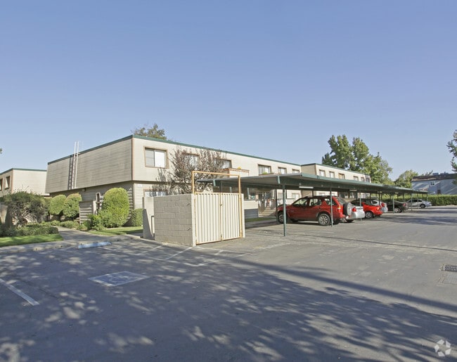


Property Detail
1205 E 22Nd St
Yuba City, CA
PT P-2 PM-2.66
008-280-029-000
Yuba
Apartment
California
PD
2
2024
4.90 AC
2025
Yuba County
040202
Sacramento
105,352 SF
NEARBY LISTINGS FOR SALE OR LEASE
DEMOGRAPHICS near 1205 E 22Nd St
1 mile
3 mile
5 mile
2025 Total Population
7,378
32,175
97,305
2030 Population
7,797
34,005
100,219
Pop Growth 2025-2030
+ 5.68%
+ 5.69%
+ 2.99%
Average Age
37
36
38
2025 Total Households
2,736
11,320
33,011
HH Growth 2025-2030
+ 6.03%
+ 5.95%
+ 3.08%
Median Household Inc
$70,649
$63,406
$68,026
Avg Household Size
2.70
2.70
2.80
2025 Avg HH Vehicles
2.00
2.00
2.00
Median Home Value
$322,577
$327,243
$381,647
Median Year Built
1973
1976
1978
Nearby Places
Map Layers
Map Styles
 Street
 Aerial
Layers
 Traffic
 Biking
Places
Listings with unknown addresses are not visible on the map
- Restaurants
- Banks
- Shops
- Fitness
- Groceries
Nearby Properties
Address
Land Use
TOTAL SIZE
Lot Size
Zoning
Address
Land Use
TOTAL SIZE
Lot Size
Zoning
18,410 SF
0.77 AC
C-3
Address
Land Use
TOTAL SIZE
Lot Size
Zoning
30,734 SF
1.38 AC
C-3
Address
Land Use
TOTAL SIZE
Lot Size
Zoning
154,480 SF
13.44 AC
C
Address
Land Use
TOTAL SIZE
Lot Size
Zoning
98,830 SF
0.40 AC
C-3
Address
Land Use
TOTAL SIZE
Lot Size
Zoning
51,371 SF
10.13 AC
Address
Land Use
TOTAL SIZE
Lot Size
Zoning
2,052 SF
1,157.17 AC
AE-40
Address
Land Use
TOTAL SIZE
Lot Size
Zoning
107,749 SF
9.33 AC
C
Address
Land Use
TOTAL SIZE
Lot Size
Zoning
203,353 SF
11.49 AC
C
Address
Land Use
TOTAL SIZE
Lot Size
Zoning
18,675 SF
2.98 AC
C3
Address
Land Use
TOTAL SIZE
Lot Size
Zoning
50,270 SF
4.16 AC
CO
Address
Land Use
TOTAL SIZE
Lot Size
Zoning
66,913 SF
18.23 AC
AE-40
Address
Land Use
TOTAL SIZE
Lot Size
Zoning
Address
Land Use
TOTAL SIZE
Lot Size
Zoning
1,827 SF
590 AC
AE-40
Address
Land Use
TOTAL SIZE
Lot Size
Zoning
79,817 SF
1.64 AC
M-1
Address
Land Use
TOTAL SIZE
Lot Size
Zoning
40,045 SF
1.38 AC
C
Address
Land Use
TOTAL SIZE
Lot Size
Zoning
47,686 SF
2 AC
R2
Address
Land Use
TOTAL SIZE
Lot Size
Zoning
41,920 SF
2.41 AC
R-4
Address
Land Use
TOTAL SIZE
Lot Size
Zoning
2.57 AC
R-4
Address
Land Use
TOTAL SIZE
Lot Size
Zoning
36,760 SF
3.06 AC
Address
Land Use
TOTAL SIZE
Lot Size
Zoning
119,880 SF
6.53 AC
PD
Address
Land Use
TOTAL SIZE
Lot Size
Zoning
53,952 SF
4.14 AC
R-02
Address
Land Use
TOTAL SIZE
Lot Size
Zoning
417,732 SF
5.45 AC
Address
Land Use
TOTAL SIZE
Lot Size
Zoning
28,943 SF
2.45 AC
C-3
Address
Land Use
TOTAL SIZE
Lot Size
Zoning
0.54 AC
PD
Address
Land Use
TOTAL SIZE
Lot Size
Zoning
30,812 SF
0.74 AC
C-3
Address
Land Use
TOTAL SIZE
Lot Size
Zoning
87,248 SF
8.06 AC
R-4
Address
Land Use
TOTAL SIZE
Lot Size
Zoning
0.41 AC
R-4
Address
Land Use
TOTAL SIZE
Lot Size
Zoning
32,776 SF
2 AC
R3
Address
Land Use
TOTAL SIZE
Lot Size
Zoning
26,986 SF
1.67 AC
C
The World's #1 Commercial Real Estate Marketplace
Connect with us
© 2026 CoStar Group
The information above has been obtained from sources believed reliable. While we do not doubt its accuracy we have not verified it and make no guarantee, warranty or representation about it. It is your responsibility to independently confirm its accuracy and completeness. Any projections, opinions, assumptions, or estimates used are for example only and do not represent the current or future performance of the property. The value of this transaction to you depends on tax and other factors which should be evaluated by your tax, financial, and legal advisors. You and your advisors should conduct a careful, independent investigation of the property to determine to your satisfaction the suitability of the property for your needs.