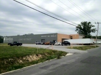
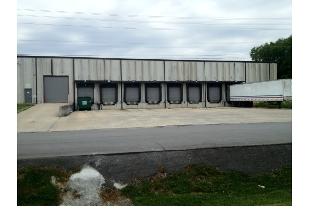
Property Record
1205 Royal Dr, Dalton, GA 30721

Property Detail
1205 Royal Dr
12-163-11-000
10 95A LEGION DR
Industrialgeneral
Whitfield
M-2
Georgia
AE The base floodplain where base flood elevations are provided. AE Zones are now used on new format FIRMs instead of A1-A30 Zones.
163
2025
10.95 AC
2025
Georgia Northwest
000401
Other Market Areas
193,500 SF
Dalton, GA
NEARBY LISTINGS FOR SALE OR LEASE
DEMOGRAPHICS near 1205 Royal Dr
1 mile
3 mile
5 mile
2025 Total Population
4,995
42,203
67,451
2030 Population
5,083
43,214
69,090
Pop Growth 2025-2030
+ 1.76%
+ 2.40%
+ 2.43%
Average Age
35
37
38
2025 Total Households
1,567
14,629
23,318
HH Growth 2025-2030
+ 1.85%
+ 2.48%
+ 2.49%
Median Household Inc
$72,023
$60,399
$60,425
Avg Household Size
3.10
2.80
2.80
2025 Avg HH Vehicles
2.00
2.00
2.00
Median Home Value
$183,102
$229,317
$238,501
Median Year Built
1988
1985
1984
Nearby Places
Map Layers
Map Styles
 Street
 Aerial
Layers
 Traffic
 Biking
Places
Listings with unknown addresses are not visible on the map
- Restaurants
- Banks
- Shops
- Fitness
- Groceries
PUBLIC TRANSPORTATION
AIRPORT
Lovell Field
Drive
Walk
Distance
Lovell Field
39 min
28.4 mi
Freight Ports
Georgia Ports - Savannah
Drive
Walk
Distance
Georgia Ports - Savannah
382 min
338.2 mi
Nearby Properties
Address
Land Use
TOTAL SIZE
Lot Size
Zoning
Address
Land Use
TOTAL SIZE
Lot Size
Zoning
34,320 SF
13.50 AC
Address
Land Use
TOTAL SIZE
Lot Size
Zoning
199,398 SF
37.16 AC
Address
Land Use
TOTAL SIZE
Lot Size
Zoning
54,546 SF
128.30 AC
Address
Land Use
TOTAL SIZE
Lot Size
Zoning
500,075 SF
11.48 AC
M2
Address
Land Use
TOTAL SIZE
Lot Size
Zoning
39,664 SF
27.50 AC
C-2
Address
Land Use
TOTAL SIZE
Lot Size
Zoning
784,920 SF
56.60 AC
M-2
Address
Land Use
TOTAL SIZE
Lot Size
Zoning
123,430 SF
51.17 AC
Address
Land Use
TOTAL SIZE
Lot Size
Zoning
346,476 SF
31.41 AC
Address
Land Use
TOTAL SIZE
Lot Size
Zoning
133,712 SF
14.93 AC
R7
Address
Land Use
TOTAL SIZE
Lot Size
Zoning
195,990 SF
60.25 AC
Address
Land Use
TOTAL SIZE
Lot Size
Zoning
664,020 SF
28.75 AC
M-2
Address
Land Use
TOTAL SIZE
Lot Size
Zoning
68,465 SF
0.71 AC
Address
Land Use
TOTAL SIZE
Lot Size
Zoning
100,084 SF
1.47 AC
Address
Land Use
TOTAL SIZE
Lot Size
Zoning
1,188,135 SF
106.61 AC
M2
Address
Land Use
TOTAL SIZE
Lot Size
Zoning
115,979 SF
10.60 AC
C2
Address
Land Use
TOTAL SIZE
Lot Size
Zoning
125,756 SF
7 AC
Address
Land Use
TOTAL SIZE
Lot Size
Zoning
160,386 SF
14.21 AC
Address
Land Use
TOTAL SIZE
Lot Size
Zoning
150,772 SF
12.66 AC
C2
Address
Land Use
TOTAL SIZE
Lot Size
Zoning
84,200 SF
22.70 AC
Address
Land Use
TOTAL SIZE
Lot Size
Zoning
158,128 SF
13.71 AC
R7
Address
Land Use
TOTAL SIZE
Lot Size
Zoning
391,865 SF
17.51 AC
Address
Land Use
TOTAL SIZE
Lot Size
Zoning
219,744 SF
12.74 AC
M-2
Address
Land Use
TOTAL SIZE
Lot Size
Zoning
147,860 SF
11.86 AC
R-7
Address
Land Use
TOTAL SIZE
Lot Size
Zoning
18,016 SF
27.65 AC
M-2
Address
Land Use
TOTAL SIZE
Lot Size
Zoning
38,016 SF
18 AC
Address
Land Use
TOTAL SIZE
Lot Size
Zoning
55,020 SF
7.02 AC
Address
Land Use
TOTAL SIZE
Lot Size
Zoning
127,376 SF
5.64 AC
Address
Land Use
TOTAL SIZE
Lot Size
Zoning
211,512 SF
3.60 AC
M2
Address
Land Use
TOTAL SIZE
Lot Size
Zoning
39,191 SF
1.93 AC
Address
Land Use
TOTAL SIZE
Lot Size
Zoning
31,376 SF
9.64 AC
The World's #1 Commercial Real Estate Marketplace
Connect with us
© 2026 CoStar Group
The information above has been obtained from sources believed reliable. While we do not doubt its accuracy we have not verified it and make no guarantee, warranty or representation about it. It is your responsibility to independently confirm its accuracy and completeness. Any projections, opinions, assumptions, or estimates used are for example only and do not represent the current or future performance of the property. The value of this transaction to you depends on tax and other factors which should be evaluated by your tax, financial, and legal advisors. You and your advisors should conduct a careful, independent investigation of the property to determine to your satisfaction the suitability of the property for your needs.