Property Record
12091 Highway 105 E, Conroe, TX 77306


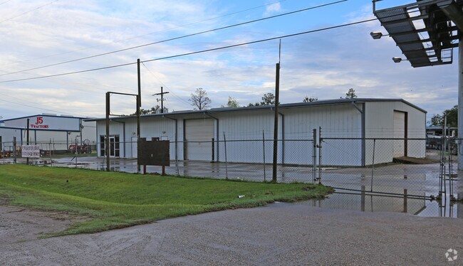
Property Detail
12091 Highway 105 E
3413-00-00600
S341300 - CIRCLE SIX BUSINESS PK, LOT 6 & ROAD, ACRES 0.4979
Commercialnec
Montgomery
1
Texas
A Areas with a 1% annual chance of flooding and a 26% chance of flooding over the life of a 30-year mortgage.
6
2024
0.50 AC
2025
The Woodlands/Conroe
693901
Houston
3,000 SF
Houston-Pasadena-The Woodlands, TX
NEARBY LISTINGS FOR SALE OR LEASE
DEMOGRAPHICS near 12091 Highway 105 E
1 mile
3 mile
5 mile
2025 Total Population
1,497
24,808
75,786
2030 Population
1,776
29,688
89,494
Pop Growth 2025-2030
+ 18.64%
+ 19.67%
+ 18.09%
Average Age
35
36
36
2025 Total Households
438
7,935
24,214
HH Growth 2025-2030
+ 19.18%
+ 20.30%
+ 19.08%
Median Household Inc
$64,575
$84,774
$70,451
Avg Household Size
3.20
3.00
3.00
2025 Avg HH Vehicles
2.00
2.00
2.00
Median Home Value
$279,438
$265,757
$239,602
Median Year Built
2001
2010
2004
Nearby Places
Map Layers
Map Styles
 Street
 Aerial
Transit
 Traffic
 Biking
Places
Listings with unknown addresses are not visible on the map
- Restaurants
- Banks
- Shops
- Fitness
- Groceries
PUBLIC TRANSPORTATION
AIRPORT
George Bush Intcntl/Houston
Drive
Walk
Distance
George Bush Intcntl/Houston
44 min
35.3 mi
Freight Ports
Port of Houston
Drive
Walk
Distance
Port of Houston
67 min
51.0 mi
SALE & LEASE HISTORY
LISTING DATE
SALE/LEASE

Sep 08, 2023
For Lease
Oct 05, 2016
For Lease
Jan 19, 2024
For Sale
Jan 18, 2018
For Sale
Feb 21, 2020
For Sale
Nearby Properties
Address
Land Use
TOTAL SIZE
Lot Size
Zoning
Address
Land Use
TOTAL SIZE
Lot Size
Zoning
619,770 SF
81.76 AC
Address
Land Use
TOTAL SIZE
Lot Size
Zoning
206,008 SF
107.61 AC
Address
Land Use
TOTAL SIZE
Lot Size
Zoning
242,944 SF
179.58 AC
Address
Land Use
TOTAL SIZE
Lot Size
Zoning
186,100 SF
29.68 AC
1
Address
Land Use
TOTAL SIZE
Lot Size
Zoning
262,564 SF
51.89 AC
1
Address
Land Use
TOTAL SIZE
Lot Size
Zoning
38,742 SF
249.26 AC
1
Address
Land Use
TOTAL SIZE
Lot Size
Zoning
159,185 SF
18.45 AC
1
Address
Land Use
TOTAL SIZE
Lot Size
Zoning
124,209 SF
9.18 AC
1
Address
Land Use
TOTAL SIZE
Lot Size
Zoning
143,641 SF
14.80 AC
1
Address
Land Use
TOTAL SIZE
Lot Size
Zoning
161,142 SF
493.71 AC
Address
Land Use
TOTAL SIZE
Lot Size
Zoning
187,426 SF
61.77 AC
1
Address
Land Use
TOTAL SIZE
Lot Size
Zoning
70,912 SF
5.07 AC
1
Address
Land Use
TOTAL SIZE
Lot Size
Zoning
82,560 SF
1
Address
Land Use
TOTAL SIZE
Lot Size
Zoning
63,366 SF
17.93 AC
1
Address
Land Use
TOTAL SIZE
Lot Size
Zoning
255 SF
254.02 AC
Address
Land Use
TOTAL SIZE
Lot Size
Zoning
25,011 SF
8.57 AC
Address
Land Use
TOTAL SIZE
Lot Size
Zoning
132,252 SF
21.40 AC
1
Address
Land Use
TOTAL SIZE
Lot Size
Zoning
14,750 SF
1.66 AC
Address
Land Use
TOTAL SIZE
Lot Size
Zoning
44,182 SF
6.25 AC
1
Address
Land Use
TOTAL SIZE
Lot Size
Zoning
64,150 SF
6.41 AC
1
Address
Land Use
TOTAL SIZE
Lot Size
Zoning
Address
Land Use
TOTAL SIZE
Lot Size
Zoning
84,177 SF
4.74 AC
1
Address
Land Use
TOTAL SIZE
Lot Size
Zoning
163,880 SF
11 AC
Address
Land Use
TOTAL SIZE
Lot Size
Zoning
50,160 SF
3.47 AC
1
Address
Land Use
TOTAL SIZE
Lot Size
Zoning
49,000 SF
5.53 AC
1
Address
Land Use
TOTAL SIZE
Lot Size
Zoning
57,700 SF
5 AC
Address
Land Use
TOTAL SIZE
Lot Size
Zoning
13,143 SF
24 AC
Address
Land Use
TOTAL SIZE
Lot Size
Zoning
49,200 SF
3.31 AC
Address
Land Use
TOTAL SIZE
Lot Size
Zoning
31,645 SF
189.42 AC
Address
Land Use
TOTAL SIZE
Lot Size
Zoning
30,204 SF
4 AC
1
The World's #1 Commercial Real Estate Marketplace
Connect with us
© 2026 CoStar Group
The information above has been obtained from sources believed reliable. While we do not doubt its accuracy we have not verified it and make no guarantee, warranty or representation about it. It is your responsibility to independently confirm its accuracy and completeness. Any projections, opinions, assumptions, or estimates used are for example only and do not represent the current or future performance of the property. The value of this transaction to you depends on tax and other factors which should be evaluated by your tax, financial, and legal advisors. You and your advisors should conduct a careful, independent investigation of the property to determine to your satisfaction the suitability of the property for your needs.