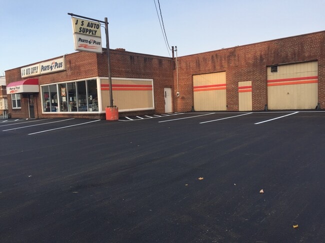
Property Record
1215 E 2Nd St, Jamestown, NY 14701
NEARBY LISTINGS FOR SALE OR LEASE
Property Detail
1215 E 2Nd St
Jamestown-Dunkirk-Fredonia, NY
Chautauqua
060800-370-016-0003-005-000
New York
Storesoffices
5.000
2025
0.72 AC
2024
New York West Area
030100
Other Market Areas
7,975 SF
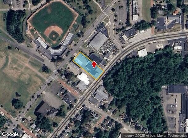
DEMOGRAPHICS near 1215 E 2Nd St
1 Mile
3 Mile
5 Mile
2024 Total Population
6,742
31,354
40,070
2029 Population
6,576
30,635
39,180
Pop Growth 2024-2029
(2.46%)
(2.29%)
(2.22%)
Average Age
41
41
42
2024 Total Households
2,803
13,715
17,491
HH Growth 2024-2029
(2.57%)
(2.39%)
(2.31%)
Median Household Inc
$32,795
$35,598
$39,534
Avg Household Size
2.20
2.20
2.20
2024 Avg HH Vehicles
1.00
1.00
1.00
Median Home Value
$63,405
$64,541
$73,767
Median Year Built
1947
1948
1948
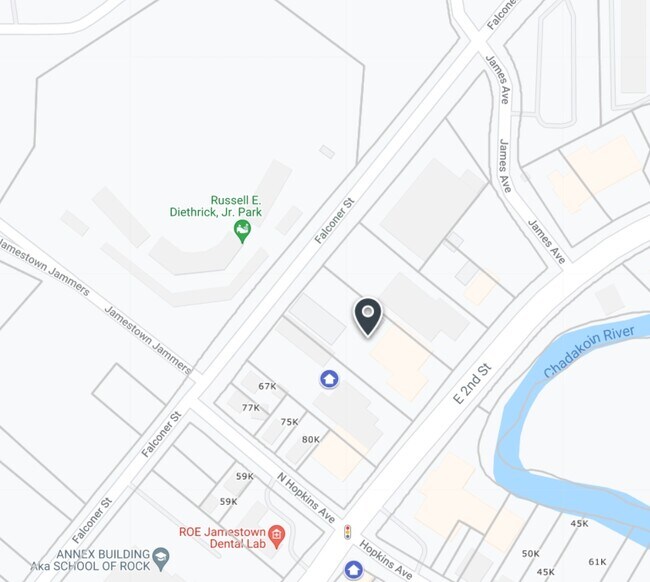
Nearby Places
Map Layers
Map Styles
 Street
 Aerial
- Restaurants
- Banks
- Shops
- Fitness
- Groceries
SALE & LEASE HISTORY
LISTING DATE
SALE/LEASE

Sep 18, 2021
For Sale
Nearby Properties
Address
Land Use
TOTAL SIZE
Lot Size
Zoning
Address
Land Use
TOTAL SIZE
Lot Size
Zoning
Address
Land Use
TOTAL SIZE
Lot Size
Zoning
66,921 SF
98.70 AC
Address
Land Use
TOTAL SIZE
Lot Size
Zoning
131,198 SF
10.20 AC
Address
Land Use
TOTAL SIZE
Lot Size
Zoning
Address
Land Use
TOTAL SIZE
Lot Size
Zoning
97,461 SF
1.41 AC
Address
Land Use
TOTAL SIZE
Lot Size
Zoning
68,532 SF
2 AC
Address
Land Use
TOTAL SIZE
Lot Size
Zoning
81,213 SF
1.75 AC
Address
Land Use
TOTAL SIZE
Lot Size
Zoning
Address
Land Use
TOTAL SIZE
Lot Size
Zoning
395,580 SF
61.80 AC
06 - INDUS
Address
Land Use
TOTAL SIZE
Lot Size
Zoning
106,027 SF
20.60 AC
Address
Land Use
TOTAL SIZE
Lot Size
Zoning
82,624 SF
5.70 AC
Address
Land Use
TOTAL SIZE
Lot Size
Zoning
0.27 AC
06 - INDUS
Address
Land Use
TOTAL SIZE
Lot Size
Zoning
252,460 SF
5.32 AC
Address
Land Use
TOTAL SIZE
Lot Size
Zoning
66,500 SF
1.10 AC
06 - INDUS
Address
Land Use
TOTAL SIZE
Lot Size
Zoning
134,858 SF
31.10 AC
06 - INDUS
Address
Land Use
TOTAL SIZE
Lot Size
Zoning
107,016 SF
4.70 AC
03 - MULTI
Address
Land Use
TOTAL SIZE
Lot Size
Zoning
58,905 SF
1.47 AC
Address
Land Use
TOTAL SIZE
Lot Size
Zoning
85,514 SF
10.80 AC
Address
Land Use
TOTAL SIZE
Lot Size
Zoning
35,850 SF
1.17 AC
Address
Land Use
TOTAL SIZE
Lot Size
Zoning
190,436 SF
34.70 AC
06 - INDUS
Address
Land Use
TOTAL SIZE
Lot Size
Zoning
0.69 AC
Address
Land Use
TOTAL SIZE
Lot Size
Zoning
122,500 SF
10.30 AC
06 - INDUS
Address
Land Use
TOTAL SIZE
Lot Size
Zoning
2.80 AC
Address
Land Use
TOTAL SIZE
Lot Size
Zoning
318,800 SF
18.10 AC
06 - INDUS
Address
Land Use
TOTAL SIZE
Lot Size
Zoning
63,081 SF
0.88 AC
Address
Land Use
TOTAL SIZE
Lot Size
Zoning
194,301 SF
4.10 AC
06 - INDUS
Address
Land Use
TOTAL SIZE
Lot Size
Zoning
22,456 SF
0.87 AC
Address
Land Use
TOTAL SIZE
Lot Size
Zoning
38,885 SF
3.40 AC
05 - COMME
Address
Land Use
TOTAL SIZE
Lot Size
Zoning
59,327 SF
15.60 AC
Address
Land Use
TOTAL SIZE
Lot Size
Zoning
9,720 SF
0.69 AC
The World's #1 Commercial Real Estate Marketplace
Connect with us
© 2026 CoStar Group
The information above has been obtained from sources believed reliable. While we do not doubt its accuracy we have not verified it and make no guarantee, warranty or representation about it. It is your responsibility to independently confirm its accuracy and completeness. Any projections, opinions, assumptions, or estimates used are for example only and do not represent the current or future performance of the property. The value of this transaction to you depends on tax and other factors which should be evaluated by your tax, financial, and legal advisors. You and your advisors should conduct a careful, independent investigation of the property to determine to your satisfaction the suitability of the property for your needs.