Property Record
1217 S Walnut St, South Bend, IN 46619
NEARBY LISTINGS FOR SALE OR LEASE
Property Detail
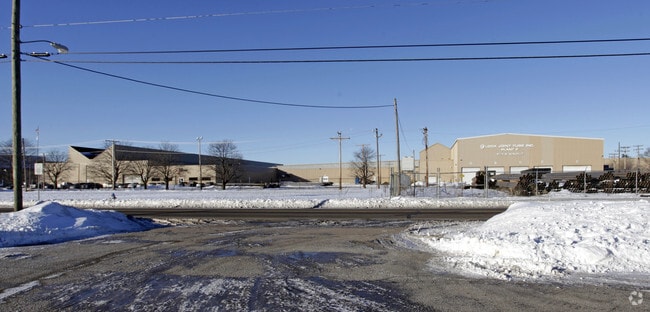
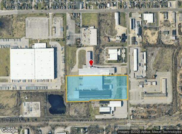
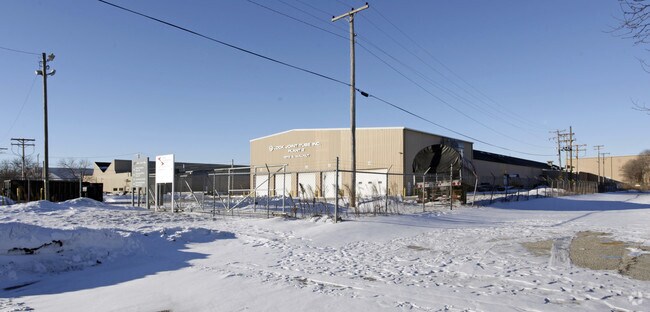
1217 S Walnut St
71-08-15-276-003.000-026
Sample & Walnut
Heavyindustrial
PT NW1/4 SEC.14 & NE1/4 SEC 15-37-2E BEG. 1239.7 SO. OF SW COR OF SAMPLE & WALNUT CONT. 13.455 AC & OR -
X
St Joseph
18141C0192D
Indiana
2023
13.45 AC
2024
Greater South Bend
002700
South Bend/Mishawaka
278,376 SF
South Bend-Mishawaka, IN-MI
DEMOGRAPHICS near 1217 S Walnut St
1 Mile
3 Mile
5 Mile
2024 Total Population
10,195
81,557
154,894
2029 Population
10,304
82,379
155,482
Pop Growth 2024-2029
+ 1.07%
+ 1.01%
+ 0.38%
Average Age
34
35
37
2024 Total Households
3,330
29,747
60,415
HH Growth 2024-2029
+ 1.11%
+ 1.02%
+ 0.39%
Median Household Inc
$40,030
$45,315
$48,741
Avg Household Size
2.80
2.50
2.30
2024 Avg HH Vehicles
2.00
2.00
2.00
Median Home Value
$63,551
$91,122
$124,482
Median Year Built
1949
1952
1958
Nearby Places
Map Layers
Map Styles
 Street
 Aerial
- Restaurants
- Banks
- Shops
- Fitness
- Groceries
PUBLIC TRANSPORTATION
COMMUTER RAIL
South Bend Amtrak Station (Capitol Limited - Amtrak, Lake Shore Limited - Amtrak)
DRIVE
WALK
Distance
South Bend Amtrak Station (Capitol Limited - Amtrak, Lake Shore Limited - Amtrak)
5 min
2.1 mi
South Bend Airport Station (South Shore Line - Northern Indiana Commuter Transportation District (South Shore Line))
DRIVE
WALK
Distance
South Bend Airport Station (South Shore Line - Northern Indiana Commuter Transportation District (South Shore Line))
10 min
4.2 mi
AIRPORT
South Bend International
DRIVE
WALK
Distance
South Bend International
19 min
6.4 mi
Freight Ports
Port Milwaukee
DRIVE
WALK
Distance
Port Milwaukee
220 min
175.2 mi
Nearby Properties
Address
Land Use
TOTAL SIZE
Lot Size
Zoning
Address
Land Use
TOTAL SIZE
Lot Size
Zoning
685,709 SF
44 SF
Address
Land Use
TOTAL SIZE
Lot Size
Zoning
291,729 SF
0.79 AC
Address
Land Use
TOTAL SIZE
Lot Size
Zoning
319,715 SF
2.57 AC
Address
Land Use
TOTAL SIZE
Lot Size
Zoning
206,651 SF
1.68 AC
Address
Land Use
TOTAL SIZE
Lot Size
Zoning
393,123 SF
2.91 AC
Address
Land Use
TOTAL SIZE
Lot Size
Zoning
207,846 SF
2.33 AC
Address
Land Use
TOTAL SIZE
Lot Size
Zoning
158,616 SF
0.85 AC
Address
Land Use
TOTAL SIZE
Lot Size
Zoning
148,524 SF
1.66 AC
Address
Land Use
TOTAL SIZE
Lot Size
Zoning
231,450 SF
87 SF
Address
Land Use
TOTAL SIZE
Lot Size
Zoning
167,261 SF
1.58 AC
Address
Land Use
TOTAL SIZE
Lot Size
Zoning
194,931 SF
44 SF
Address
Land Use
TOTAL SIZE
Lot Size
Zoning
159,834 SF
44 SF
Address
Land Use
TOTAL SIZE
Lot Size
Zoning
346,860 SF
2.20 AC
Address
Land Use
TOTAL SIZE
Lot Size
Zoning
161,548 SF
44 SF
Address
Land Use
TOTAL SIZE
Lot Size
Zoning
205,586 SF
4.18 AC
Address
Land Use
TOTAL SIZE
Lot Size
Zoning
544,872 SF
70.95 AC
Address
Land Use
TOTAL SIZE
Lot Size
Zoning
178,111 SF
44 SF
Address
Land Use
TOTAL SIZE
Lot Size
Zoning
260,370 SF
Address
Land Use
TOTAL SIZE
Lot Size
Zoning
172,368 SF
2.22 AC
Address
Land Use
TOTAL SIZE
Lot Size
Zoning
221,887 SF
87 SF
Address
Land Use
TOTAL SIZE
Lot Size
Zoning
55,995 SF
0.78 AC
Address
Land Use
TOTAL SIZE
Lot Size
Zoning
80,070 SF
1.81 AC
Address
Land Use
TOTAL SIZE
Lot Size
Zoning
633,136 SF
2.59 AC
Address
Land Use
TOTAL SIZE
Lot Size
Zoning
81,672 SF
1.30 AC
Address
Land Use
TOTAL SIZE
Lot Size
Zoning
165,725 SF
0.01 AC
Address
Land Use
TOTAL SIZE
Lot Size
Zoning
100,368 SF
44 SF
Address
Land Use
TOTAL SIZE
Lot Size
Zoning
138,993 SF
0.38 AC
Address
Land Use
TOTAL SIZE
Lot Size
Zoning
201,264 SF
1.45 AC
Address
Land Use
TOTAL SIZE
Lot Size
Zoning
90,855 SF
3.07 AC
Address
Land Use
TOTAL SIZE
Lot Size
Zoning
85,389 SF
1.09 AC
The World's #1 Commercial Real Estate Marketplace
Connect with us
© 2026 CoStar Group
The information above has been obtained from sources believed reliable. While we do not doubt its accuracy we have not verified it and make no guarantee, warranty or representation about it. It is your responsibility to independently confirm its accuracy and completeness. Any projections, opinions, assumptions, or estimates used are for example only and do not represent the current or future performance of the property. The value of this transaction to you depends on tax and other factors which should be evaluated by your tax, financial, and legal advisors. You and your advisors should conduct a careful, independent investigation of the property to determine to your satisfaction the suitability of the property for your needs.