Property Record
1220 N Haverhill Rd, El Dorado, KS 67042
NEARBY LISTINGS FOR SALE OR LEASE
-
-
View all El Dorado listings for lease on LoopNet.com
Property Detail
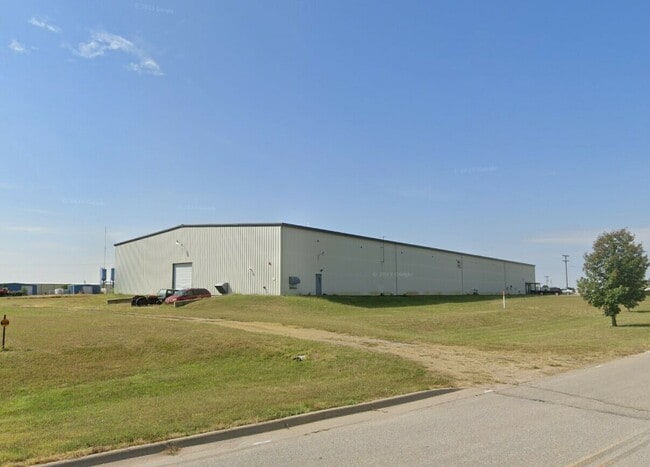
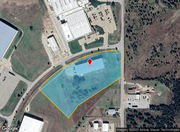
1220 N Haverhill Rd
168-33-0-00-00-001-06-0
S33, T25, R05E, ACRES 7.6, BEG 72.9S 891.2W SE/C NE/4 SE433.7 NE162.5 NELY498.9 TO W ROW OILHILL RD N250.6 TO S ROW HAVERHILL
Heavyindustrial
Butler
X
Kansas
20015C0359E
7.60 AC
2024
Augusta/El Dorado
2025
Wichita
020205
Wichita, KS
30,000 SF
DEMOGRAPHICS near 1220 N Haverhill Rd
1 Mile
3 Mile
5 Mile
2024 Total Population
1,536
13,871
14,702
2029 Population
1,585
14,350
15,192
Pop Growth 2024-2029
+ 3.19%
+ 3.45%
+ 3.33%
Average Age
38
40
40
2024 Total Households
602
5,613
5,909
HH Growth 2024-2029
+ 3.32%
+ 3.56%
+ 3.45%
Median Household Inc
$53,711
$52,771
$53,703
Avg Household Size
2.30
2.30
2.30
2024 Avg HH Vehicles
2.00
2.00
2.00
Median Home Value
$93,283
$104,046
$110,670
Median Year Built
1966
1960
1962
Nearby Places
Map Layers
Map Styles
 Street
 Aerial
- Restaurants
- Banks
- Shops
- Fitness
- Groceries
SALE & LEASE HISTORY
LISTING DATE
SALE/LEASE

Jul 10, 2024
For Lease
Apr 24, 2024
For Lease
Nearby Properties
Address
Land Use
TOTAL SIZE
Lot Size
Zoning
Address
Land Use
TOTAL SIZE
Lot Size
Zoning
349.90 AC
Address
Land Use
TOTAL SIZE
Lot Size
Zoning
31,128 SF
77.10 AC
Address
Land Use
TOTAL SIZE
Lot Size
Zoning
9,000 SF
34.50 AC
Address
Land Use
TOTAL SIZE
Lot Size
Zoning
231,043 SF
7.80 AC
Address
Land Use
TOTAL SIZE
Lot Size
Zoning
216,404 SF
37.60 AC
Address
Land Use
TOTAL SIZE
Lot Size
Zoning
82,161 SF
41.10 AC
Address
Land Use
TOTAL SIZE
Lot Size
Zoning
70,579 SF
16.90 AC
Address
Land Use
TOTAL SIZE
Lot Size
Zoning
60,520 SF
15.90 AC
Address
Land Use
TOTAL SIZE
Lot Size
Zoning
28,160 SF
268.60 AC
Address
Land Use
TOTAL SIZE
Lot Size
Zoning
75,973 SF
8.10 AC
Address
Land Use
TOTAL SIZE
Lot Size
Zoning
59,696 SF
34.50 AC
Address
Land Use
TOTAL SIZE
Lot Size
Zoning
62,556 SF
2.90 AC
C2
Address
Land Use
TOTAL SIZE
Lot Size
Zoning
3.10 AC
Address
Land Use
TOTAL SIZE
Lot Size
Zoning
26,202 SF
2 AC
Address
Land Use
TOTAL SIZE
Lot Size
Zoning
12,918 SF
33.60 AC
Address
Land Use
TOTAL SIZE
Lot Size
Zoning
57,849 SF
8.70 AC
Address
Land Use
TOTAL SIZE
Lot Size
Zoning
19,869 SF
36.10 AC
Address
Land Use
TOTAL SIZE
Lot Size
Zoning
14,910 SF
24.70 AC
O1
Address
Land Use
TOTAL SIZE
Lot Size
Zoning
43,670 SF
0.86 AC
R3
Address
Land Use
TOTAL SIZE
Lot Size
Zoning
45,861 SF
3.30 AC
Address
Land Use
TOTAL SIZE
Lot Size
Zoning
45,050 SF
1 AC
R3
Address
Land Use
TOTAL SIZE
Lot Size
Zoning
28,484 SF
Address
Land Use
TOTAL SIZE
Lot Size
Zoning
193,828 SF
34.40 AC
Address
Land Use
TOTAL SIZE
Lot Size
Zoning
37,978 SF
0.95 AC
Address
Land Use
TOTAL SIZE
Lot Size
Zoning
20,896 SF
2.70 AC
Address
Land Use
TOTAL SIZE
Lot Size
Zoning
24,590 SF
2 AC
Address
Land Use
TOTAL SIZE
Lot Size
Zoning
1.70 AC
C1
Address
Land Use
TOTAL SIZE
Lot Size
Zoning
Address
Land Use
TOTAL SIZE
Lot Size
Zoning
1.80 AC
Address
Land Use
TOTAL SIZE
Lot Size
Zoning
16,926 SF
1.70 AC
O1
The World's #1 Commercial Real Estate Marketplace
Connect with us
© 2026 CoStar Group
The information above has been obtained from sources believed reliable. While we do not doubt its accuracy we have not verified it and make no guarantee, warranty or representation about it. It is your responsibility to independently confirm its accuracy and completeness. Any projections, opinions, assumptions, or estimates used are for example only and do not represent the current or future performance of the property. The value of this transaction to you depends on tax and other factors which should be evaluated by your tax, financial, and legal advisors. You and your advisors should conduct a careful, independent investigation of the property to determine to your satisfaction the suitability of the property for your needs.