Property Record
1220 Roosevelt Rd, Niagara, WI 54151


NEARBY LISTINGS FOR SALE OR LEASE
Property Detail
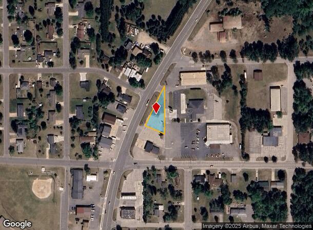
1220 Roosevelt Rd
Marinette, WI-MI
0.31AC PRT SW SE S4 T38N R20E COM 320'E & 174.12'N SW COR; NW 111.35' TO USH 141 NE ALG CUR ON E/L HWY 232.01' S252. 03' TO P
261-00015.017
Marinette
Commercialnec
Wisconsin
2024
0.31 AC
2024
Other Market Areas
960100
DEMOGRAPHICS near 1220 Roosevelt Rd
1 Mile
3 Mile
5 Mile
2024 Total Population
1,089
5,108
21,278
2029 Population
1,068
5,066
21,213
Pop Growth 2024-2029
(1.93%)
(0.82%)
(0.31%)
Average Age
46
44
44
2024 Total Households
462
2,307
9,548
HH Growth 2024-2029
(1.95%)
(0.78%)
(0.28%)
Median Household Inc
$57,222
$55,403
$54,565
Avg Household Size
2.30
2.20
2.20
2024 Avg HH Vehicles
2.00
2.00
2.00
Median Home Value
$125,157
$96,185
$114,457
Median Year Built
1969
1972
1968
Nearby Places
Map Layers
Map Styles
 Street
 Aerial
- Restaurants
- Banks
- Shops
- Fitness
- Groceries
SALE & LEASE HISTORY
LISTING DATE
SALE/LEASE

Sep 11, 2018
For Sale
Nearby Properties
Address
Land Use
TOTAL SIZE
Lot Size
Zoning
Address
Land Use
TOTAL SIZE
Lot Size
Zoning
1,255,948 SF
2,284.87 AC
Address
Land Use
TOTAL SIZE
Lot Size
Zoning
214,256 SF
10.79 AC
Address
Land Use
TOTAL SIZE
Lot Size
Zoning
14,792 SF
6 AC
Address
Land Use
TOTAL SIZE
Lot Size
Zoning
45,426 SF
4.61 AC
Address
Land Use
TOTAL SIZE
Lot Size
Zoning
50,111 SF
3.96 AC
Address
Land Use
TOTAL SIZE
Lot Size
Zoning
4.03 AC
Address
Land Use
TOTAL SIZE
Lot Size
Zoning
Address
Land Use
TOTAL SIZE
Lot Size
Zoning
101,680 SF
8.90 AC
Address
Land Use
TOTAL SIZE
Lot Size
Zoning
10,041 SF
64.42 AC
Address
Land Use
TOTAL SIZE
Lot Size
Zoning
14,781 SF
8.32 AC
Address
Land Use
TOTAL SIZE
Lot Size
Zoning
8,664 SF
2.03 AC
Address
Land Use
TOTAL SIZE
Lot Size
Zoning
38,000 SF
5.63 AC
Address
Land Use
TOTAL SIZE
Lot Size
Zoning
97,356 SF
17.69 AC
Address
Land Use
TOTAL SIZE
Lot Size
Zoning
34,375 SF
5.52 AC
Address
Land Use
TOTAL SIZE
Lot Size
Zoning
2.31 AC
Address
Land Use
TOTAL SIZE
Lot Size
Zoning
82.09 AC
Address
Land Use
TOTAL SIZE
Lot Size
Zoning
13,208 SF
40 AC
Address
Land Use
TOTAL SIZE
Lot Size
Zoning
54,552 SF
34.51 AC
Address
Land Use
TOTAL SIZE
Lot Size
Zoning
2.08 AC
Address
Land Use
TOTAL SIZE
Lot Size
Zoning
7,000 SF
0.72 AC
Address
Land Use
TOTAL SIZE
Lot Size
Zoning
4,373 SF
1.24 AC
Address
Land Use
TOTAL SIZE
Lot Size
Zoning
4,050 SF
0.69 AC
Address
Land Use
TOTAL SIZE
Lot Size
Zoning
153.62 AC
C-2
Address
Land Use
TOTAL SIZE
Lot Size
Zoning
20,180 SF
0.92 AC
Address
Land Use
TOTAL SIZE
Lot Size
Zoning
2,094 SF
15.52 AC
R-1
Address
Land Use
TOTAL SIZE
Lot Size
Zoning
2,740 SF
0.73 AC
Address
Land Use
TOTAL SIZE
Lot Size
Zoning
Address
Land Use
TOTAL SIZE
Lot Size
Zoning
25,314 SF
1.84 AC
Address
Land Use
TOTAL SIZE
Lot Size
Zoning
15.23 AC
The World's #1 Commercial Real Estate Marketplace
Connect with us
© 2026 CoStar Group
The information above has been obtained from sources believed reliable. While we do not doubt its accuracy we have not verified it and make no guarantee, warranty or representation about it. It is your responsibility to independently confirm its accuracy and completeness. Any projections, opinions, assumptions, or estimates used are for example only and do not represent the current or future performance of the property. The value of this transaction to you depends on tax and other factors which should be evaluated by your tax, financial, and legal advisors. You and your advisors should conduct a careful, independent investigation of the property to determine to your satisfaction the suitability of the property for your needs.