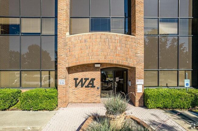
Property Record
1221 Abrams Rd, Richardson, TX 75081


Property Detail
1221 Abrams Rd
421473000102A0000
RICHLAND BUSINESS PARK REP BLK 1 LT 2A ACS 3.0833 INT201500011923 DD12312014 CO-DC 1473000102A00 34214730001
Officebuilding
DALLAS
Z137
Texas
B and X Area of moderate flood hazard, usually the area between the limits of the 100-year and 500-year floods.
2a
2025
3.08 AC
2025
Richardson
019041
Dallas/Ft Worth
62,496 SF
Dallas-Fort Worth-Arlington, TX
NEARBY LISTINGS FOR SALE OR LEASE
DEMOGRAPHICS near 1221 Abrams Rd
1 mile
3 mile
5 mile
2025 Total Population
16,600
166,483
425,090
2030 Population
17,177
171,118
439,312
Pop Growth 2025-2030
+ 3.48%
+ 2.78%
+ 3.35%
Average Age
38
37
37
2025 Total Households
6,811
65,864
171,708
HH Growth 2025-2030
+ 3.44%
+ 2.89%
+ 3.48%
Median Household Inc
$71,208
$66,060
$73,249
Avg Household Size
2.40
2.40
2.40
2025 Avg HH Vehicles
2.00
2.00
2.00
Median Home Value
$379,107
$386,263
$435,433
Median Year Built
1982
1977
1978
Nearby Places
Map Layers
Map Styles
 Street
 Aerial
Layers
 Traffic
 Biking
Places
Listings with unknown addresses are not visible on the map
- Restaurants
- Banks
- Shops
- Fitness
- Groceries
PUBLIC TRANSPORTATION
AIRPORT
Dallas Love Field
Drive
Walk
Distance
Dallas Love Field
23 min
14.8 mi
Dallas-Fort Worth International
Drive
Walk
Distance
Dallas-Fort Worth International
30 min
23.5 mi
SALE & LEASE HISTORY
LISTING DATE
SALE/LEASE

Sep 25, 2016
For Lease
Oct 18, 2023
For Lease
Nearby Properties
Address
Land Use
TOTAL SIZE
Lot Size
Zoning
Address
Land Use
TOTAL SIZE
Lot Size
Zoning
7,706,477 SF
245.55 AC
Z116
Address
Land Use
TOTAL SIZE
Lot Size
Zoning
1,252,860 SF
57.08 AC
Z239
Address
Land Use
TOTAL SIZE
Lot Size
Zoning
3,423,779 SF
32.42 AC
Z151
Address
Land Use
TOTAL SIZE
Lot Size
Zoning
557,392 SF
10.06 AC
Z239
Address
Land Use
TOTAL SIZE
Lot Size
Zoning
421,798 SF
9 AC
Z151
Address
Land Use
TOTAL SIZE
Lot Size
Zoning
852,562 SF
13.86 AC
Z151
Address
Land Use
TOTAL SIZE
Lot Size
Zoning
706,061 SF
36.76 AC
Z109
Address
Land Use
TOTAL SIZE
Lot Size
Zoning
428,956 SF
18.76 AC
Z291
Address
Land Use
TOTAL SIZE
Lot Size
Zoning
462,916 SF
15.67 AC
Z248
Address
Land Use
TOTAL SIZE
Lot Size
Zoning
249,692 SF
244.62 AC
Z239
Address
Land Use
TOTAL SIZE
Lot Size
Zoning
379,592 SF
12.75 AC
Z248
Address
Land Use
TOTAL SIZE
Lot Size
Zoning
537,928 SF
11.13 AC
Z109
Address
Land Use
TOTAL SIZE
Lot Size
Zoning
424,666 SF
12.19 AC
Z151
Address
Land Use
TOTAL SIZE
Lot Size
Zoning
316,085 SF
13.73 AC
Z107
Address
Land Use
TOTAL SIZE
Lot Size
Zoning
347,933 SF
12.61 AC
Z164
Address
Land Use
TOTAL SIZE
Lot Size
Zoning
595,526 SF
6.92 AC
Z151
Address
Land Use
TOTAL SIZE
Lot Size
Zoning
479,179 SF
5 AC
Z151
Address
Land Use
TOTAL SIZE
Lot Size
Zoning
593,252 SF
8.50 AC
Z164
Address
Land Use
TOTAL SIZE
Lot Size
Zoning
1,099,201 SF
107.82 AC
Z116
Address
Land Use
TOTAL SIZE
Lot Size
Zoning
439,215 SF
3.89 AC
Z151
Address
Land Use
TOTAL SIZE
Lot Size
Zoning
201,226 SF
14.55 AC
Z143
Address
Land Use
TOTAL SIZE
Lot Size
Zoning
1,633,601 SF
12.53 AC
Z248
Address
Land Use
TOTAL SIZE
Lot Size
Zoning
187.94 AC
Z31
Address
Land Use
TOTAL SIZE
Lot Size
Zoning
291,579 SF
13.79 AC
Z151
Address
Land Use
TOTAL SIZE
Lot Size
Zoning
144,728 SF
46.87 AC
Z239
Address
Land Use
TOTAL SIZE
Lot Size
Zoning
635,227 SF
3.57 AC
Z151
Address
Land Use
TOTAL SIZE
Lot Size
Zoning
767,700 SF
4.89 AC
Z248
Address
Land Use
TOTAL SIZE
Lot Size
Zoning
310,119 SF
9.65 AC
Z150
Address
Land Use
TOTAL SIZE
Lot Size
Zoning
699,105 SF
5.12 AC
Z137
Address
Land Use
TOTAL SIZE
Lot Size
Zoning
334,910 SF
14.26 AC
Z151
The World's #1 Commercial Real Estate Marketplace
Connect with us
© 2026 CoStar Group
The information above has been obtained from sources believed reliable. While we do not doubt its accuracy we have not verified it and make no guarantee, warranty or representation about it. It is your responsibility to independently confirm its accuracy and completeness. Any projections, opinions, assumptions, or estimates used are for example only and do not represent the current or future performance of the property. The value of this transaction to you depends on tax and other factors which should be evaluated by your tax, financial, and legal advisors. You and your advisors should conduct a careful, independent investigation of the property to determine to your satisfaction the suitability of the property for your needs.