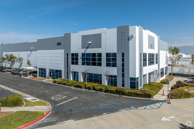
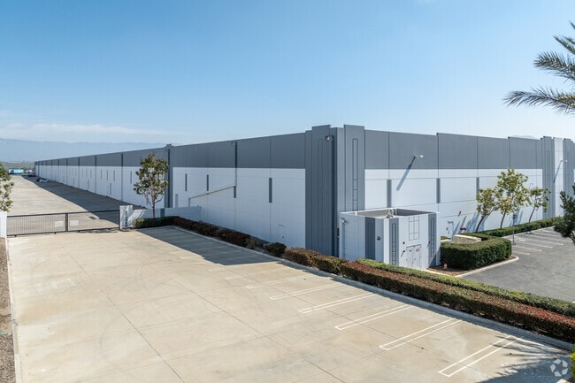
Property Record
12249 Holly St N, Bloomington, CA 92316

Property Detail
12249 Holly St N
0260-113-16
PARCEL MAP 17029 PARCEL 2 BOOK 216 PAGE 31
Miscellaneous
SAN BERNARDINO
AMSP
California
B and X Area of moderate flood hazard, usually the area between the limits of the 100-year and 500-year floods.
20.66 AC
2025
San Bernardino
2025
Inland Empire (California)
004001
Riverside-San Bernardino-Ontario, CA
457,120 SF
NEARBY LISTINGS FOR SALE OR LEASE
DEMOGRAPHICS near 12249 Holly St N
1 mile
3 mile
5 mile
2025 Total Population
648
48,583
281,137
2030 Population
656
49,368
285,479
Pop Growth 2025-2030
+ 1.23%
+ 1.62%
+ 1.54%
Average Age
36
35
35
2025 Total Households
143
12,960
78,714
HH Growth 2025-2030
+ 1.40%
+ 1.50%
+ 1.43%
Median Household Inc
$80,288
$90,441
$80,857
Avg Household Size
4.10
3.60
3.40
2025 Avg HH Vehicles
2.00
2.00
2.00
Median Home Value
$585,937
$493,096
$489,832
Median Year Built
1968
1973
1976
Nearby Places
Map Layers
Map Styles
 Street
 Aerial
Layers
 Traffic
 Biking
Places
Listings with unknown addresses are not visible on the map
- Restaurants
- Banks
- Shops
- Fitness
- Groceries
PUBLIC TRANSPORTATION
COMMUTER RAIL
Riverside-Hunter Park/Ucr (Metrolink 91-Perris Valley Line - Metrolink Trains)
Drive
Walk
Distance
Riverside-Hunter Park/Ucr (Metrolink 91-Perris Valley Line - Metrolink Trains)
7 min
4.1 mi
Riverside-Downtown (91 Line - Southern California Regional Rail Authority (Metrolink), Inland Empire-Orange County Line - Southern California Regional Rail Authority (Metrolink), Riverside Line - Southern California Regional Rail Authority (Metrolink))
Drive
Walk
Distance
Riverside-Downtown (91 Line - Southern California Regional Rail Authority (Metrolink), Inland Empire-Orange County Line - Southern California Regional Rail Authority (Metrolink), Riverside Line - Southern California Regional Rail Authority (Metrolink))
10 min
4.8 mi
AIRPORT
Ontario International
Drive
Walk
Distance
Ontario International
23 min
16.5 mi
Freight Ports
Port of Long Beach
Drive
Walk
Distance
Port of Long Beach
78 min
60.7 mi
SALE & LEASE HISTORY
LISTING DATE
SALE/LEASE

Oct 13, 2023
For Lease
Mar 01, 2023
For Lease
Apr 13, 2018
For Lease
Nearby Properties
Address
Land Use
TOTAL SIZE
Lot Size
Zoning
Address
Land Use
TOTAL SIZE
Lot Size
Zoning
1,186,950 SF
54.77 AC
Address
Land Use
TOTAL SIZE
Lot Size
Zoning
1,025,132 SF
46.44 AC
Address
Land Use
TOTAL SIZE
Lot Size
Zoning
1,264,064 SF
64.44 AC
Address
Land Use
TOTAL SIZE
Lot Size
Zoning
1,000,177 SF
46 AC
Address
Land Use
TOTAL SIZE
Lot Size
Zoning
798,304 SF
42.64 AC
AMSP
Address
Land Use
TOTAL SIZE
Lot Size
Zoning
494,575 SF
25.33 AC
MP
Address
Land Use
TOTAL SIZE
Lot Size
Zoning
505,152 SF
28.88 AC
Address
Land Use
TOTAL SIZE
Lot Size
Zoning
677,280 SF
34.53 AC
BLRS1AA
Address
Land Use
TOTAL SIZE
Lot Size
Zoning
615,310 SF
49.91 AC
Address
Land Use
TOTAL SIZE
Lot Size
Zoning
599,735 SF
33.25 AC
AMSP
Address
Land Use
TOTAL SIZE
Lot Size
Zoning
311,363 SF
34.60 AC
BLRS20M
Address
Land Use
TOTAL SIZE
Lot Size
Zoning
411,707 SF
19.34 AC
Address
Land Use
TOTAL SIZE
Lot Size
Zoning
401,106 SF
16.91 AC
Address
Land Use
TOTAL SIZE
Lot Size
Zoning
340,120 SF
36.36 AC
Address
Land Use
TOTAL SIZE
Lot Size
Zoning
272,120 SF
13.05 AC
Address
Land Use
TOTAL SIZE
Lot Size
Zoning
525,110 SF
24.25 AC
Address
Land Use
TOTAL SIZE
Lot Size
Zoning
492,631 SF
21 AC
Address
Land Use
TOTAL SIZE
Lot Size
Zoning
35,260 SF
9.55 AC
Address
Land Use
TOTAL SIZE
Lot Size
Zoning
447,190 SF
21.08 AC
Address
Land Use
TOTAL SIZE
Lot Size
Zoning
182,624 SF
16.07 AC
Address
Land Use
TOTAL SIZE
Lot Size
Zoning
424,904 SF
23.03 AC
Address
Land Use
TOTAL SIZE
Lot Size
Zoning
261,632 SF
13.16 AC
Address
Land Use
TOTAL SIZE
Lot Size
Zoning
1,056,072 SF
51.85 AC
AMSP
Address
Land Use
TOTAL SIZE
Lot Size
Zoning
55.22 AC
AMSP
Address
Land Use
TOTAL SIZE
Lot Size
Zoning
72,860 SF
7.71 AC
Address
Land Use
TOTAL SIZE
Lot Size
Zoning
750,700 SF
32.81 AC
AMSP
Address
Land Use
TOTAL SIZE
Lot Size
Zoning
47,809 SF
11.73 AC
Address
Land Use
TOTAL SIZE
Lot Size
Zoning
210,004 SF
11.68 AC
Address
Land Use
TOTAL SIZE
Lot Size
Zoning
12,372 SF
9.07 AC
BLRS20M
Address
Land Use
TOTAL SIZE
Lot Size
Zoning
394,232 SF
53.90 AC
The World's #1 Commercial Real Estate Marketplace
Connect with us
© 2026 CoStar Group
The information above has been obtained from sources believed reliable. While we do not doubt its accuracy we have not verified it and make no guarantee, warranty or representation about it. It is your responsibility to independently confirm its accuracy and completeness. Any projections, opinions, assumptions, or estimates used are for example only and do not represent the current or future performance of the property. The value of this transaction to you depends on tax and other factors which should be evaluated by your tax, financial, and legal advisors. You and your advisors should conduct a careful, independent investigation of the property to determine to your satisfaction the suitability of the property for your needs.