Property Record
12303 Airport Way, Broomfield, CO 80021


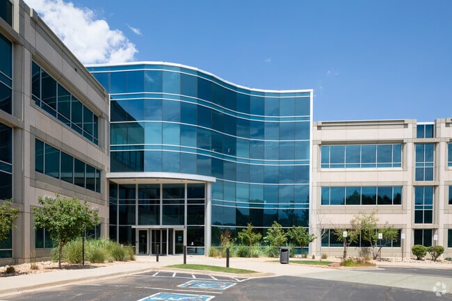

Property Detail
12303 Airport Way
1575-34-3-02-001
SUBD: LINCOLN SOUTHPOINT LOT: 1
Officebuilding
Jefferson
GA; PUD
Colorado
B and X Area of moderate flood hazard, usually the area between the limits of the 100-year and 500-year floods.
1
2024
6.48 AC
2025
Broomfield County
0311001131
Denver
118,750 SF
Denver-Aurora-Centennial, CO
NEARBY LISTINGS FOR SALE OR LEASE
DEMOGRAPHICS near 12303 Airport Way
1 mile
3 mile
5 mile
2025 Total Population
2,194
65,397
175,726
2030 Population
2,355
66,822
178,394
Pop Growth 2025-2030
+ 7.34%
+ 2.18%
+ 1.52%
Average Age
34
40
40
2025 Total Households
1,267
27,914
71,240
HH Growth 2025-2030
+ 7.81%
+ 2.82%
+ 1.81%
Median Household Inc
$103,413
$106,201
$116,184
Avg Household Size
1.70
2.30
2.40
2025 Avg HH Vehicles
2.00
2.00
2.00
Median Home Value
$495,587
$666,131
$688,770
Median Year Built
2011
1995
1992
Nearby Places
Map Layers
Map Styles
 Street
 Aerial
Transit
 Traffic
 Biking
Places
Listings with unknown addresses are not visible on the map
- Restaurants
- Banks
- Shops
- Fitness
- Groceries
SALE & LEASE HISTORY
LISTING DATE
SALE/LEASE

Sep 26, 2016
For Lease
Sep 25, 2016
For Lease
Sep 19, 2018
For Lease
Sep 14, 2020
For Lease
Nov 24, 2020
For Lease
Nov 10, 2022
For Lease
Jan 29, 2024
For Lease
Jan 26, 2024
For Lease
Aug 14, 2018
For Lease
Nearby Properties
Address
Land Use
TOTAL SIZE
Lot Size
Zoning
Address
Land Use
TOTAL SIZE
Lot Size
Zoning
776,625 SF
41.29 AC
PUD
Address
Land Use
TOTAL SIZE
Lot Size
Zoning
431,902 SF
17.63 AC
Address
Land Use
TOTAL SIZE
Lot Size
Zoning
305,331 SF
14.41 AC
PUD
Address
Land Use
TOTAL SIZE
Lot Size
Zoning
117,775 SF
34.58 AC
GA; PUD
Address
Land Use
TOTAL SIZE
Lot Size
Zoning
57.62 AC
Address
Land Use
TOTAL SIZE
Lot Size
Zoning
211,191 SF
30.46 AC
Address
Land Use
TOTAL SIZE
Lot Size
Zoning
254,500 SF
13.42 AC
PUD
Address
Land Use
TOTAL SIZE
Lot Size
Zoning
279.72 AC
A
Address
Land Use
TOTAL SIZE
Lot Size
Zoning
49.69 AC
Address
Land Use
TOTAL SIZE
Lot Size
Zoning
41.05 AC
Address
Land Use
TOTAL SIZE
Lot Size
Zoning
233.17 AC
A
Address
Land Use
TOTAL SIZE
Lot Size
Zoning
209,009 SF
22.30 AC
Address
Land Use
TOTAL SIZE
Lot Size
Zoning
320,771 SF
18.60 AC
PUD
Address
Land Use
TOTAL SIZE
Lot Size
Zoning
254,500 SF
13 AC
PUD
Address
Land Use
TOTAL SIZE
Lot Size
Zoning
130,769 SF
18.61 AC
PUD
Address
Land Use
TOTAL SIZE
Lot Size
Zoning
643,992 SF
13.24 AC
PUD
Address
Land Use
TOTAL SIZE
Lot Size
Zoning
174,398 SF
33.34 AC
PF; PROL;
Address
Land Use
TOTAL SIZE
Lot Size
Zoning
212,852 SF
12.82 AC
Address
Land Use
TOTAL SIZE
Lot Size
Zoning
187,920 SF
10.57 AC
PUD
Address
Land Use
TOTAL SIZE
Lot Size
Zoning
281,167 SF
19.52 AC
Address
Land Use
TOTAL SIZE
Lot Size
Zoning
159,724 SF
8.11 AC
Address
Land Use
TOTAL SIZE
Lot Size
Zoning
19.16 AC
Address
Land Use
TOTAL SIZE
Lot Size
Zoning
25.01 AC
Address
Land Use
TOTAL SIZE
Lot Size
Zoning
577,088 SF
18.94 AC
PUD
Address
Land Use
TOTAL SIZE
Lot Size
Zoning
211,827 SF
25.67 AC
Address
Land Use
TOTAL SIZE
Lot Size
Zoning
22.16 AC
Address
Land Use
TOTAL SIZE
Lot Size
Zoning
453,015 SF
12.10 AC
B-PUD
Address
Land Use
TOTAL SIZE
Lot Size
Zoning
250,701 SF
14.14 AC
Address
Land Use
TOTAL SIZE
Lot Size
Zoning
154,700 SF
9.03 AC
PUD
Address
Land Use
TOTAL SIZE
Lot Size
Zoning
446,461 SF
18.19 AC
B-PUD
The World's #1 Commercial Real Estate Marketplace
Connect with us
© 2026 CoStar Group
The information above has been obtained from sources believed reliable. While we do not doubt its accuracy we have not verified it and make no guarantee, warranty or representation about it. It is your responsibility to independently confirm its accuracy and completeness. Any projections, opinions, assumptions, or estimates used are for example only and do not represent the current or future performance of the property. The value of this transaction to you depends on tax and other factors which should be evaluated by your tax, financial, and legal advisors. You and your advisors should conduct a careful, independent investigation of the property to determine to your satisfaction the suitability of the property for your needs.