Property Record
1231 S Parker Rd, Denver, CO 80231
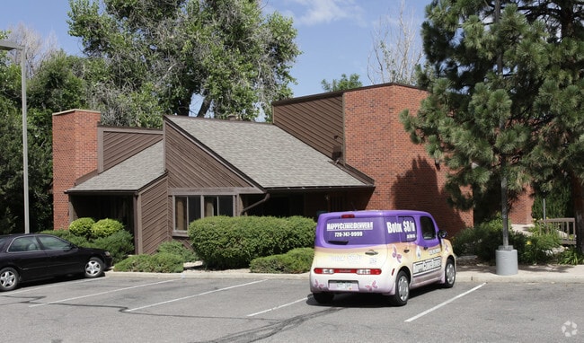
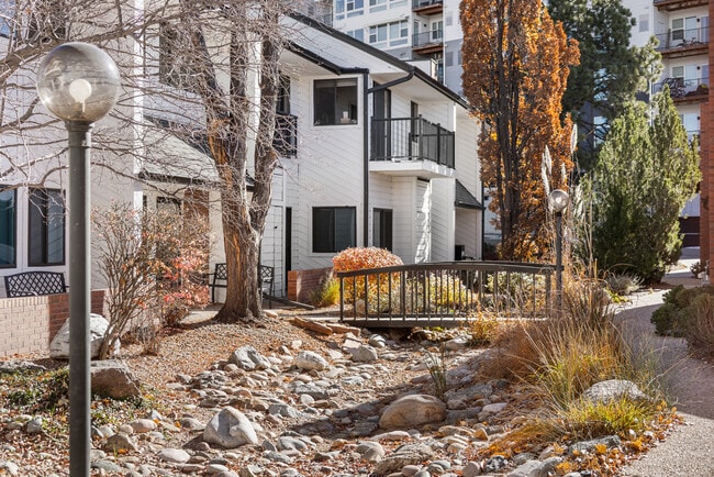
This Property Is For Sale
NEARBY LISTINGS FOR SALE OR LEASE
Property Detail
1231 S Parker Rd
Denver-Aurora-Lakewood, CO
Creekside At Highline Condominiums
1973-21-2-25-006
BUILDING 1231
Commercialcondominium
Arapahoe
X
Colorado
08005C0159K
105
2023
0.06 AC
2024
Aurora
086801
Denver
1,954 SF
DEMOGRAPHICS near 1231 S Parker Rd
1 Mile
3 Mile
5 Mile
2024 Total Population
29,360
199,249
504,446
2029 Population
30,155
202,164
510,565
Pop Growth 2024-2029
+ 2.71%
+ 1.46%
+ 1.21%
Average Age
39
39
39
2024 Total Households
14,127
89,471
224,669
HH Growth 2024-2029
+ 2.53%
+ 1.40%
+ 1.17%
Median Household Inc
$63,063
$70,233
$75,226
Avg Household Size
2.00
2.20
2.20
2024 Avg HH Vehicles
1.00
2.00
2.00
Median Home Value
$385,187
$495,198
$567,759
Median Year Built
1986
1978
1976
Nearby Places
Map Layers
Map Styles
 Street
 Aerial
- Restaurants
- Banks
- Shops
- Fitness
- Groceries
PUBLIC TRANSPORTATION
COMMUTER RAIL
DRIVE
WALK
Distance
15 min
6.8 mi
DRIVE
WALK
Distance
15 min
6.9 mi
AIRPORT
Denver International
DRIVE
WALK
Distance
Denver International
32 min
22.6 mi
Nearby Properties
Address
Land Use
TOTAL SIZE
Lot Size
Zoning
Address
Land Use
TOTAL SIZE
Lot Size
Zoning
453,280 SF
5.45 AC
B-4
Address
Land Use
TOTAL SIZE
Lot Size
Zoning
416,096 SF
5.20 AC
C-MX-20
Address
Land Use
TOTAL SIZE
Lot Size
Zoning
240,545 SF
2.35 AC
C-MX-20
Address
Land Use
TOTAL SIZE
Lot Size
Zoning
281,456 SF
36.55 AC
R-5
Address
Land Use
TOTAL SIZE
Lot Size
Zoning
174,244 SF
17.26 AC
E-SU-DX
Address
Land Use
TOTAL SIZE
Lot Size
Zoning
1,054,198 SF
6.62 AC
PUD
Address
Land Use
TOTAL SIZE
Lot Size
Zoning
379,927 SF
8.06 AC
PUD
Address
Land Use
TOTAL SIZE
Lot Size
Zoning
476,186 SF
42.62 AC
Address
Land Use
TOTAL SIZE
Lot Size
Zoning
167,621 SF
6.59 AC
E-SU-D
Address
Land Use
TOTAL SIZE
Lot Size
Zoning
231,867 SF
19.33 AC
S-MX-3A
Address
Land Use
TOTAL SIZE
Lot Size
Zoning
479,448 SF
5.37 AC
Address
Land Use
TOTAL SIZE
Lot Size
Zoning
205,129 SF
2.94 AC
C-MX-20
Address
Land Use
TOTAL SIZE
Lot Size
Zoning
169,350 SF
19.74 AC
H-1-B
Address
Land Use
TOTAL SIZE
Lot Size
Zoning
384,886 SF
18.66 AC
R-2-A
Address
Land Use
TOTAL SIZE
Lot Size
Zoning
282,798 SF
3.61 AC
C-MX-5
Address
Land Use
TOTAL SIZE
Lot Size
Zoning
451,335 SF
8.39 AC
B-A-3
Address
Land Use
TOTAL SIZE
Lot Size
Zoning
270,301 SF
2.26 AC
C-MX-8
Address
Land Use
TOTAL SIZE
Lot Size
Zoning
89,205 SF
6.83 AC
E-SU-DX
Address
Land Use
TOTAL SIZE
Lot Size
Zoning
380,376 SF
24.52 AC
E-SU-DX
Address
Land Use
TOTAL SIZE
Lot Size
Zoning
148,088 SF
10.61 AC
B-3
Address
Land Use
TOTAL SIZE
Lot Size
Zoning
325,778 SF
3.65 AC
PUD
Address
Land Use
TOTAL SIZE
Lot Size
Zoning
277,719 SF
1.27 AC
C-MX-12
Address
Land Use
TOTAL SIZE
Lot Size
Zoning
368,676 SF
17.71 AC
R-2-A
Address
Land Use
TOTAL SIZE
Lot Size
Zoning
478,994 SF
26.07 AC
Address
Land Use
TOTAL SIZE
Lot Size
Zoning
208,192 SF
1.80 AC
S-MX-12
Address
Land Use
TOTAL SIZE
Lot Size
Zoning
341,616 SF
4.88 AC
S-MX-5
Address
Land Use
TOTAL SIZE
Lot Size
Zoning
130,531 SF
3.41 AC
Address
Land Use
TOTAL SIZE
Lot Size
Zoning
540,380 SF
26.03 AC
RR3
Address
Land Use
TOTAL SIZE
Lot Size
Zoning
551,531 SF
5.09 AC
C-MX
Address
Land Use
TOTAL SIZE
Lot Size
Zoning
275,318 SF
3.49 AC
C-MX-5
The World's #1 Commercial Real Estate Marketplace
Connect with us
© 2025 CoStar Group
The information above has been obtained from sources believed reliable. While we do not doubt its accuracy we have not verified it and make no guarantee, warranty or representation about it. It is your responsibility to independently confirm its accuracy and completeness. Any projections, opinions, assumptions, or estimates used are for example only and do not represent the current or future performance of the property. The value of this transaction to you depends on tax and other factors which should be evaluated by your tax, financial, and legal advisors. You and your advisors should conduct a careful, independent investigation of the property to determine to your satisfaction the suitability of the property for your needs.