Property Record
1233 N Courthouse Rd, Arlington, VA 22201
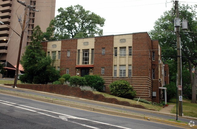

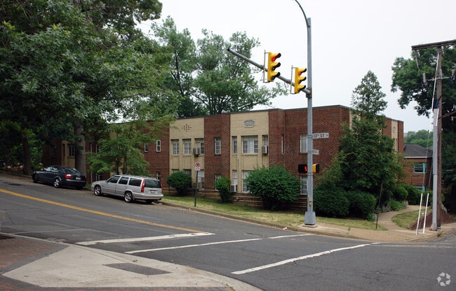
Property Detail
1233 N Courthouse Rd
17-017-002
LTS 2 3 4 PT 1 BK 17 FT MYER HEIGHTS 21461.5 SQ FT
Apartment
Arlington
RA8-18
Virginia
B and X Area of moderate flood hazard, usually the area between the limits of the 100-year and 500-year floods.
2
2025
0.49 AC
2025
Clarendon/Courthouse
101701
Washington, DC
12,868 SF
Washington-Arlington-Alexandria, DC-VA-MD-WV
NEARBY LISTINGS FOR SALE OR LEASE
DEMOGRAPHICS near 1233 N Courthouse Rd
1 mile
3 mile
5 mile
2025 Total Population
49,141
271,334
760,519
2030 Population
51,367
282,313
796,262
Pop Growth 2025-2030
+ 4.53%
+ 4.05%
+ 4.70%
Average Age
36
38
38
2025 Total Households
26,094
132,502
363,770
HH Growth 2025-2030
+ 4.19%
+ 4.45%
+ 5.38%
Median Household Inc
$135,738
$135,788
$135,341
Avg Household Size
1.80
1.90
2.00
2025 Avg HH Vehicles
1.00
1.00
1.00
Median Home Value
$874,739
$703,799
$595,620
Median Year Built
1991
1972
1968
Nearby Places
Map Layers
Map Styles
 Street
 Aerial
Layers
 Traffic
 Biking
Places
Listings with unknown addresses are not visible on the map
- Restaurants
- Banks
- Shops
- Fitness
- Groceries
PUBLIC TRANSPORTATION
TRANSIT/SUBWAY
Clarendon (Orange Line - Washington Metropolitan Area Transit Authority Metrorail (Metrorail), Silver Line - Washington Metropolitan Area Transit Authority Metrorail (Metrorail))
Drive
Walk
Distance
Clarendon (Orange Line - Washington Metropolitan Area Transit Authority Metrorail (Metrorail), Silver Line - Washington Metropolitan Area Transit Authority Metrorail (Metrorail))
3 min
16 min
0.8 mi
Rosslyn (Blue Line - Washington Metropolitan Area Transit Authority Metrorail (Metrorail), Orange Line - Washington Metropolitan Area Transit Authority Metrorail (Metrorail), Silver Line - Washington Metropolitan Area Transit Authority Metrorail (Metrorail))
Drive
Walk
Distance
Rosslyn (Blue Line - Washington Metropolitan Area Transit Authority Metrorail (Metrorail), Orange Line - Washington Metropolitan Area Transit Authority Metrorail (Metrorail), Silver Line - Washington Metropolitan Area Transit Authority Metrorail (Metrorail))
4 min
18 min
0.9 mi
COMMUTER RAIL
Drive
Walk
Distance
9 min
4.2 mi
Drive
Walk
Distance
11 min
5.3 mi
AIRPORT
Ronald Reagan Washington Ntl
Drive
Walk
Distance
Ronald Reagan Washington Ntl
13 min
5.6 mi
Washington Dulles International
Drive
Walk
Distance
Washington Dulles International
41 min
24.5 mi
Baltimore/Washington International Thurgood Marshall
Drive
Walk
Distance
Baltimore/Washington International Thurgood Marshall
54 min
35.3 mi
Freight Ports
Port of Baltimore
Drive
Walk
Distance
Port of Baltimore
63 min
41.6 mi
SALE & LEASE HISTORY
LISTING DATE
SALE/LEASE

Apr 22, 2021
For Sale
Nearby Properties
Address
Land Use
TOTAL SIZE
Lot Size
Zoning
Address
Land Use
TOTAL SIZE
Lot Size
Zoning
128,439 SF
373.22 AC
UNZONED
Address
Land Use
TOTAL SIZE
Lot Size
Zoning
533,778 SF
18.08 AC
UNZONED
Address
Land Use
TOTAL SIZE
Lot Size
Zoning
2,493,936 SF
8.99 AC
UNZONED
Address
Land Use
TOTAL SIZE
Lot Size
Zoning
3.71 AC
UNZONED
Address
Land Use
TOTAL SIZE
Lot Size
Zoning
3,750,395 SF
10.82 AC
UNZONED
Address
Land Use
TOTAL SIZE
Lot Size
Zoning
6,500,000 SF
92.03 AC
S-3A
Address
Land Use
TOTAL SIZE
Lot Size
Zoning
2,455,000 SF
11.08 AC
MU-2
Address
Land Use
TOTAL SIZE
Lot Size
Zoning
52.44 AC
UNZONED
Address
Land Use
TOTAL SIZE
Lot Size
Zoning
1,100,000 SF
2.13 AC
D-6
Address
Land Use
TOTAL SIZE
Lot Size
Zoning
1,310,661 SF
3.38 AC
D-6
Address
Land Use
TOTAL SIZE
Lot Size
Zoning
1,738,573 SF
2.11 AC
D-7
Address
Land Use
TOTAL SIZE
Lot Size
Zoning
1.57 AC
D-5
Address
Land Use
TOTAL SIZE
Lot Size
Zoning
1,185,122 SF
2.43 AC
D-6
Address
Land Use
TOTAL SIZE
Lot Size
Zoning
4.95 AC
UNZONED
Address
Land Use
TOTAL SIZE
Lot Size
Zoning
1,214,044 SF
1.48 AC
D-6
Address
Land Use
TOTAL SIZE
Lot Size
Zoning
469,183 SF
1.20 AC
D-5
Address
Land Use
TOTAL SIZE
Lot Size
Zoning
900,000 SF
260 AC
S-3A
Address
Land Use
TOTAL SIZE
Lot Size
Zoning
626,543 SF
5.29 AC
UNZONED
Address
Land Use
TOTAL SIZE
Lot Size
Zoning
4.87 AC
D-6
Address
Land Use
TOTAL SIZE
Lot Size
Zoning
787,000 SF
1.17 AC
D-7
Address
Land Use
TOTAL SIZE
Lot Size
Zoning
900,000 SF
12.60 AC
RA-4
Address
Land Use
TOTAL SIZE
Lot Size
Zoning
5.26 AC
UNZONED
Address
Land Use
TOTAL SIZE
Lot Size
Zoning
77.26 AC
R-3/GT
Address
Land Use
TOTAL SIZE
Lot Size
Zoning
636,768 SF
1.91 AC
C-O-ROSSLY
Address
Land Use
TOTAL SIZE
Lot Size
Zoning
1,018,056 SF
1.14 AC
D-6
Address
Land Use
TOTAL SIZE
Lot Size
Zoning
508,547 SF
4.58 AC
C-O-2.5
Address
Land Use
TOTAL SIZE
Lot Size
Zoning
994,605 SF
1.34 AC
UNZONED
The World's #1 Commercial Real Estate Marketplace
Connect with us
© 2026 CoStar Group
The information above has been obtained from sources believed reliable. While we do not doubt its accuracy we have not verified it and make no guarantee, warranty or representation about it. It is your responsibility to independently confirm its accuracy and completeness. Any projections, opinions, assumptions, or estimates used are for example only and do not represent the current or future performance of the property. The value of this transaction to you depends on tax and other factors which should be evaluated by your tax, financial, and legal advisors. You and your advisors should conduct a careful, independent investigation of the property to determine to your satisfaction the suitability of the property for your needs.