Property Record
12340 Firestone Blvd, Norwalk, CA 90650

Property Detail
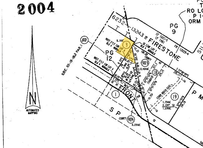
12340 Firestone Blvd
8056-012-016
NORWALK (EX OF ST) LOT 7 BLK 4
Officebuilding
Los Angeles
NOC3*
California
B and X Area of moderate flood hazard, usually the area between the limits of the 100-year and 500-year floods.
7
2025
0.20 AC
2025
Mid-Cities
552200
Los Angeles
3,448 SF
Los Angeles-Long Beach-Glendale, CA
NEARBY LISTINGS FOR SALE OR LEASE
DEMOGRAPHICS near 12340 Firestone Blvd
1 mile
3 mile
5 mile
2025 Total Population
27,699
196,315
621,015
2030 Population
27,237
193,487
614,146
Pop Growth 2025-2030
(1.67%)
(1.44%)
(1.11%)
Average Age
40
40
40
2025 Total Households
7,926
54,832
183,773
HH Growth 2025-2030
(1.97%)
(1.75%)
(1.33%)
Median Household Inc
$82,013
$102,756
$97,029
Avg Household Size
3.40
3.40
3.30
2025 Avg HH Vehicles
2.00
2.00
2.00
Median Home Value
$702,696
$741,567
$755,645
Median Year Built
1958
1959
1960
Nearby Places
Map Layers
Map Styles
 Street
 Aerial
Transit
 Traffic
 Biking
Places
Listings with unknown addresses are not visible on the map
- Restaurants
- Banks
- Shops
- Fitness
- Groceries
PUBLIC TRANSPORTATION
COMMUTER RAIL
Norwalk/Santa Fe Springs (91 Line - Southern California Regional Rail Authority (Metrolink), Orange County Line - Southern California Regional Rail Authority (Metrolink))
Drive
Walk
Distance
Norwalk/Santa Fe Springs (91 Line - Southern California Regional Rail Authority (Metrolink), Orange County Line - Southern California Regional Rail Authority (Metrolink))
4 min
1.7 mi
Buena Park (91 Line - Southern California Regional Rail Authority (Metrolink), Orange County Line - Southern California Regional Rail Authority (Metrolink))
Drive
Walk
Distance
Buena Park (91 Line - Southern California Regional Rail Authority (Metrolink), Orange County Line - Southern California Regional Rail Authority (Metrolink))
11 min
6.6 mi
AIRPORT
Long Beach (Daugherty Field)
Drive
Walk
Distance
Long Beach (Daugherty Field)
21 min
12.8 mi
Los Angeles International
Drive
Walk
Distance
Los Angeles International
29 min
21.7 mi
John Wayne/Orange County
Drive
Walk
Distance
John Wayne/Orange County
29 min
23.6 mi
SALE & LEASE HISTORY
LISTING DATE
SALE/LEASE

Sep 25, 2016
For Lease
Jun 30, 2021
For Sale
Jul 30, 2018
For Sale
Nearby Properties
Address
Land Use
TOTAL SIZE
Lot Size
Zoning
Address
Land Use
TOTAL SIZE
Lot Size
Zoning
634,060 SF
76.06 AC
SSM2
Address
Land Use
TOTAL SIZE
Lot Size
Zoning
564,705 SF
14.35 AC
LCA25*
Address
Land Use
TOTAL SIZE
Lot Size
Zoning
383,495 SF
11.60 AC
DOR3PUD*
Address
Land Use
TOTAL SIZE
Lot Size
Zoning
369,940 SF
8.70 AC
CEM
Address
Land Use
TOTAL SIZE
Lot Size
Zoning
166,712 SF
8.53 AC
NOM1(PF)-P
Address
Land Use
TOTAL SIZE
Lot Size
Zoning
322,048 SF
15.54 AC
SSM2-M1*
Address
Land Use
TOTAL SIZE
Lot Size
Zoning
224,131 SF
9.03 AC
CEM
Address
Land Use
TOTAL SIZE
Lot Size
Zoning
371,464 SF
9.28 AC
DOM2-P*
Address
Land Use
TOTAL SIZE
Lot Size
Zoning
345,200 SF
8.51 AC
LMM2
Address
Land Use
TOTAL SIZE
Lot Size
Zoning
518,296 SF
13.94 AC
NOCO(PF)*
Address
Land Use
TOTAL SIZE
Lot Size
Zoning
266,337 SF
2.40 AC
CE-ADP-16
Address
Land Use
TOTAL SIZE
Lot Size
Zoning
288,000 SF
13.56 AC
SSM2-BP*
Address
Land Use
TOTAL SIZE
Lot Size
Zoning
163,350 SF
7.58 AC
CEM
Address
Land Use
TOTAL SIZE
Lot Size
Zoning
154,616 SF
7.53 AC
CEM
Address
Land Use
TOTAL SIZE
Lot Size
Zoning
176,103 SF
SSM2YY
Address
Land Use
TOTAL SIZE
Lot Size
Zoning
444,784 SF
18.92 AC
SSM2*
Address
Land Use
TOTAL SIZE
Lot Size
Zoning
41,100 SF
8.42 AC
SSM2*
Address
Land Use
TOTAL SIZE
Lot Size
Zoning
289,454 SF
13.66 AC
SSM2*
Address
Land Use
TOTAL SIZE
Lot Size
Zoning
158,272 SF
7.09 AC
SSPF*
Address
Land Use
TOTAL SIZE
Lot Size
Zoning
73,661 SF
4.25 AC
SSR1
Address
Land Use
TOTAL SIZE
Lot Size
Zoning
834,952 SF
33.06 AC
SSM2
Address
Land Use
TOTAL SIZE
Lot Size
Zoning
168,912 SF
8.09 AC
CEM
Address
Land Use
TOTAL SIZE
Lot Size
Zoning
124,820 SF
4.11 AC
NOM2*
Address
Land Use
TOTAL SIZE
Lot Size
Zoning
161,650 SF
6 AC
CEM(D1)*
Address
Land Use
TOTAL SIZE
Lot Size
Zoning
500,374 SF
9.46 AC
SSM2*
Address
Land Use
TOTAL SIZE
Lot Size
Zoning
300,102 SF
11.94 AC
SSM2*
Address
Land Use
TOTAL SIZE
Lot Size
Zoning
145,520 SF
6.64 AC
CEADP1
Address
Land Use
TOTAL SIZE
Lot Size
Zoning
62,612 SF
21.49 AC
SSM2
Address
Land Use
TOTAL SIZE
Lot Size
Zoning
145,372 SF
7.21 AC
SSM2*
Address
Land Use
TOTAL SIZE
Lot Size
Zoning
64,160 SF
6.62 AC
CEADP1
The World's #1 Commercial Real Estate Marketplace
Connect with us
© 2026 CoStar Group
The information above has been obtained from sources believed reliable. While we do not doubt its accuracy we have not verified it and make no guarantee, warranty or representation about it. It is your responsibility to independently confirm its accuracy and completeness. Any projections, opinions, assumptions, or estimates used are for example only and do not represent the current or future performance of the property. The value of this transaction to you depends on tax and other factors which should be evaluated by your tax, financial, and legal advisors. You and your advisors should conduct a careful, independent investigation of the property to determine to your satisfaction the suitability of the property for your needs.