Property Record
124 Maple Ave, Norfolk, VA 23503


Property Detail
124 Maple Ave
44275901
B BAY SHORE PK CORP
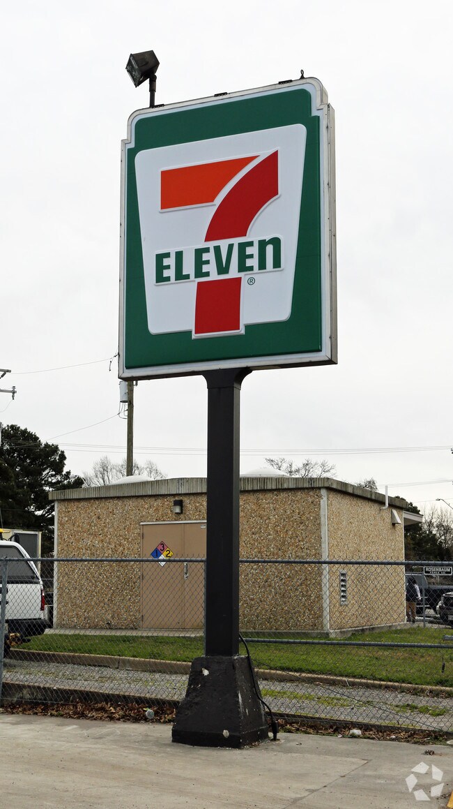
Conveniencestore
Norfolk City
C1
Virginia
B and X Area of moderate flood hazard, usually the area between the limits of the 100-year and 500-year floods.
0.32 AC
2025
Little Creek
2025
Hampton Roads
000500
Virginia Beach-Chesapeake-Norfolk, VA-NC
2,735 SF
NEARBY LISTINGS FOR SALE OR LEASE
DEMOGRAPHICS near 124 Maple Ave
1 mile
3 mile
5 mile
2025 Total Population
15,530
70,098
146,525
2030 Population
15,259
68,790
144,311
Pop Growth 2025-2030
(1.75%)
(1.87%)
(1.51%)
Average Age
37
37
37
2025 Total Households
6,375
27,662
56,261
HH Growth 2025-2030
(1.80%)
(1.99%)
(1.60%)
Median Household Inc
$59,949
$59,002
$66,301
Avg Household Size
2.20
2.20
2.30
2025 Avg HH Vehicles
2.00
2.00
2.00
Median Home Value
$319,648
$293,127
$317,631
Median Year Built
1959
1963
1964
Nearby Places
Map Layers
Map Styles
 Street
 Aerial
Transit
 Traffic
 Biking
Places
Listings with unknown addresses are not visible on the map
- Restaurants
- Banks
- Shops
- Fitness
- Groceries
PUBLIC TRANSPORTATION
COMMUTER RAIL
Drive
Walk
Distance
15 min
8.2 mi
AIRPORT
Norfolk International
Drive
Walk
Distance
Norfolk International
13 min
6.1 mi
Newport News/Williamsburg International
Drive
Walk
Distance
Newport News/Williamsburg International
34 min
21.8 mi
Freight Ports
Virginia Port Authority - Norfolk
Drive
Walk
Distance
Virginia Port Authority - Norfolk
16 min
6.2 mi
Nearby Properties
Address
Land Use
TOTAL SIZE
Lot Size
Zoning
Address
Land Use
TOTAL SIZE
Lot Size
Zoning
1,190.45 AC
Address
Land Use
TOTAL SIZE
Lot Size
Zoning
777.89 AC
Address
Land Use
TOTAL SIZE
Lot Size
Zoning
8,423 SF
53.95 AC
Address
Land Use
TOTAL SIZE
Lot Size
Zoning
40.37 AC
R6
Address
Land Use
TOTAL SIZE
Lot Size
Zoning
213 AC
I5
Address
Land Use
TOTAL SIZE
Lot Size
Zoning
167,279 SF
9.97 AC
IN1
Address
Land Use
TOTAL SIZE
Lot Size
Zoning
103,496 SF
25.81 AC
IN1
Address
Land Use
TOTAL SIZE
Lot Size
Zoning
6,170 SF
18.46 AC
R13
Address
Land Use
TOTAL SIZE
Lot Size
Zoning
52,612 SF
4.94 AC
Address
Land Use
TOTAL SIZE
Lot Size
Zoning
14.02 AC
Address
Land Use
TOTAL SIZE
Lot Size
Zoning
41,754 SF
6.01 AC
Address
Land Use
TOTAL SIZE
Lot Size
Zoning
68.02 AC
Address
Land Use
TOTAL SIZE
Lot Size
Zoning
25,880 SF
31.21 AC
91
Address
Land Use
TOTAL SIZE
Lot Size
Zoning
23.85 AC
IN1
Address
Land Use
TOTAL SIZE
Lot Size
Zoning
21.89 AC
IN1
Address
Land Use
TOTAL SIZE
Lot Size
Zoning
15,898 SF
9.91 AC
IN1
Address
Land Use
TOTAL SIZE
Lot Size
Zoning
21.65 AC
Address
Land Use
TOTAL SIZE
Lot Size
Zoning
177,766 SF
21.65 AC
C3
Address
Land Use
TOTAL SIZE
Lot Size
Zoning
18.39 AC
R11
Address
Land Use
TOTAL SIZE
Lot Size
Zoning
3,944 SF
10.73 AC
R7
Address
Land Use
TOTAL SIZE
Lot Size
Zoning
213,832 SF
20.36 AC
C3
Address
Land Use
TOTAL SIZE
Lot Size
Zoning
41,140 SF
7.80 AC
BC1
Address
Land Use
TOTAL SIZE
Lot Size
Zoning
3.22 AC
PDR6
Address
Land Use
TOTAL SIZE
Lot Size
Zoning
213,832 SF
15.61 AC
Address
Land Use
TOTAL SIZE
Lot Size
Zoning
3,696 SF
8.23 AC
R11
Address
Land Use
TOTAL SIZE
Lot Size
Zoning
3,596 SF
10.13 AC
R12
Address
Land Use
TOTAL SIZE
Lot Size
Zoning
28,064 SF
7.48 AC
C2
Address
Land Use
TOTAL SIZE
Lot Size
Zoning
11.04 AC
R13
Address
Land Use
TOTAL SIZE
Lot Size
Zoning
63,459 SF
20.06 AC
IN1
Address
Land Use
TOTAL SIZE
Lot Size
Zoning
51,849 SF
3.13 AC
PDR6
The World's #1 Commercial Real Estate Marketplace
Connect with us
© 2026 CoStar Group
The information above has been obtained from sources believed reliable. While we do not doubt its accuracy we have not verified it and make no guarantee, warranty or representation about it. It is your responsibility to independently confirm its accuracy and completeness. Any projections, opinions, assumptions, or estimates used are for example only and do not represent the current or future performance of the property. The value of this transaction to you depends on tax and other factors which should be evaluated by your tax, financial, and legal advisors. You and your advisors should conduct a careful, independent investigation of the property to determine to your satisfaction the suitability of the property for your needs.