Property Record
12435 E 42Nd Ave, Denver, CO 80239


Property Detail
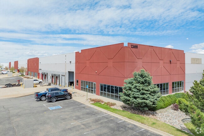
12435 E 42Nd Ave
1243-00-021
S24/T3/R67 COM W/4 COR S24 N 39.03FT E 620FT TPOB TH E 1278FT S 769.35FT CV/R 43.81FT CV/L 76.33FT S75.5104W 82.74FT CV/R 243.12FT N85.0221W 74.6FT CV/R 163.81FT
Warehouse
DENVER
I-0
Colorado
B and X Area of moderate flood hazard, usually the area between the limits of the 100-year and 500-year floods.
22.91 AC
2024
SW DIA/Pena Blvd
2025
Denver
008312
Denver-Aurora-Centennial, CO
400,000 SF
NEARBY LISTINGS FOR SALE OR LEASE
DEMOGRAPHICS near 12435 E 42Nd Ave
1 mile
3 mile
5 mile
2025 Total Population
11,494
114,095
276,546
2030 Population
11,682
117,241
284,231
Pop Growth 2025-2030
+ 1.64%
+ 2.76%
+ 2.78%
Average Age
35
35
36
2025 Total Households
3,404
36,628
94,352
HH Growth 2025-2030
+ 1.73%
+ 3.10%
+ 3.00%
Median Household Inc
$73,216
$86,185
$84,285
Avg Household Size
3.10
2.90
2.80
2025 Avg HH Vehicles
2.00
2.00
2.00
Median Home Value
$374,302
$479,248
$478,640
Median Year Built
1982
1993
1985
Nearby Places
Map Layers
Map Styles
 Street
 Aerial
Layers
 Traffic
 Biking
Places
Listings with unknown addresses are not visible on the map
- Restaurants
- Banks
- Shops
- Fitness
- Groceries
PUBLIC TRANSPORTATION
COMMUTER RAIL
Peoria Station Track 1 (Union Station to Denver Airport Station - Regional Transportation District)
Drive
Walk
Distance
Peoria Station Track 1 (Union Station to Denver Airport Station - Regional Transportation District)
3 min
1.1 mi
Peoria Station Track 2 (Union Station to Denver Airport Station - Regional Transportation District)
Drive
Walk
Distance
Peoria Station Track 2 (Union Station to Denver Airport Station - Regional Transportation District)
3 min
1.2 mi
AIRPORT
Denver International
Drive
Walk
Distance
Denver International
20 min
15.2 mi
Freight Ports
Tulsa Port Of Catoosa
Drive
Walk
Distance
Tulsa Port Of Catoosa
718 min
700.7 mi
SALE & LEASE HISTORY
LISTING DATE
SALE/LEASE

May 30, 2025
For Lease
Jun 07, 2018
For Lease
Aug 01, 2024
For Lease
Nearby Properties
Address
Land Use
TOTAL SIZE
Lot Size
Zoning
Address
Land Use
TOTAL SIZE
Lot Size
Zoning
368,450 SF
48.59 AC
Address
Land Use
TOTAL SIZE
Lot Size
Zoning
353,829 SF
4.51 AC
Address
Land Use
TOTAL SIZE
Lot Size
Zoning
880,442 SF
67.95 AC
I-B
Address
Land Use
TOTAL SIZE
Lot Size
Zoning
244,271 SF
15.30 AC
Address
Land Use
TOTAL SIZE
Lot Size
Zoning
525,050 SF
105.06 AC
Address
Land Use
TOTAL SIZE
Lot Size
Zoning
169,941 SF
4.08 AC
I-B
Address
Land Use
TOTAL SIZE
Lot Size
Zoning
723,053 SF
32.44 AC
M-IMX-12
Address
Land Use
TOTAL SIZE
Lot Size
Zoning
269,025 SF
18.86 AC
M-RX-5
Address
Land Use
TOTAL SIZE
Lot Size
Zoning
87,346 SF
1.76 AC
RFBAD
Address
Land Use
TOTAL SIZE
Lot Size
Zoning
45,803 SF
1.96 AC
M-IMX-5
Address
Land Use
TOTAL SIZE
Lot Size
Zoning
335,757 SF
36.88 AC
CMP-EI2
Address
Land Use
TOTAL SIZE
Lot Size
Zoning
102,444 SF
3.76 AC
GTWY
Address
Land Use
TOTAL SIZE
Lot Size
Zoning
691,200 SF
38.09 AC
Address
Land Use
TOTAL SIZE
Lot Size
Zoning
109,982 SF
2.92 AC
M-IMX-12
Address
Land Use
TOTAL SIZE
Lot Size
Zoning
390,822 SF
13.47 AC
O-1
Address
Land Use
TOTAL SIZE
Lot Size
Zoning
57,392 SF
0.72 AC
Address
Land Use
TOTAL SIZE
Lot Size
Zoning
135,803 SF
3.36 AC
Address
Land Use
TOTAL SIZE
Lot Size
Zoning
273,184 SF
1.89 AC
Address
Land Use
TOTAL SIZE
Lot Size
Zoning
6.97 AC
C-MU-20
Address
Land Use
TOTAL SIZE
Lot Size
Zoning
651,423 SF
82.50 AC
I-2
Address
Land Use
TOTAL SIZE
Lot Size
Zoning
131,544 SF
3.92 AC
Address
Land Use
TOTAL SIZE
Lot Size
Zoning
646,975 SF
32.60 AC
M-IMX-8
Address
Land Use
TOTAL SIZE
Lot Size
Zoning
185,207 SF
9.94 AC
C-MU-20
Address
Land Use
TOTAL SIZE
Lot Size
Zoning
269,622 SF
12.90 AC
Address
Land Use
TOTAL SIZE
Lot Size
Zoning
124,526 SF
10 AC
M-RH-3
Address
Land Use
TOTAL SIZE
Lot Size
Zoning
58,997 SF
2.05 AC
S-CC-5X
Address
Land Use
TOTAL SIZE
Lot Size
Zoning
178,235 SF
1.38 AC
RFBAD
Address
Land Use
TOTAL SIZE
Lot Size
Zoning
92,598 SF
2.78 AC
G-TW
Address
Land Use
TOTAL SIZE
Lot Size
Zoning
74,966 SF
1.79 AC
The World's #1 Commercial Real Estate Marketplace
Connect with us
© 2026 CoStar Group
The information above has been obtained from sources believed reliable. While we do not doubt its accuracy we have not verified it and make no guarantee, warranty or representation about it. It is your responsibility to independently confirm its accuracy and completeness. Any projections, opinions, assumptions, or estimates used are for example only and do not represent the current or future performance of the property. The value of this transaction to you depends on tax and other factors which should be evaluated by your tax, financial, and legal advisors. You and your advisors should conduct a careful, independent investigation of the property to determine to your satisfaction the suitability of the property for your needs.