Property Record
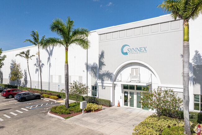
12650 Nw 25Th St, Miami, FL 33182


NEARBY LISTINGS FOR SALE OR LEASE
Property Detail
12650 Nw 25Th St
Miami-Miami Beach-Kendall, FL
Beacon Lakes West
30-3936-003-0030
BEACON LAKES WEST PB 167-013 T-22474 LOT 3 BLK 1 & PORT DESC BEG SW COR OF LOT 3 BLK 1 OF PB 167-13 TH N 89 DEG E 22.46FT TH SWLY AD 33.84FT N 01 DEG W 25.28FT TO POB LOT SIZE 463172 SQ FT FAU 30 3936 000 0061 0070 0071 & 0080 F/A/U 3039360030030
Warehouse
Miami/Dade
AH
Florida
12086C0267L
3
2024
10.63 AC
2025
Miami Airport West
014100
South Florida
190,586 SF
DEMOGRAPHICS near 12650 Nw 25Th St
1 Mile
3 Mile
5 Mile
2024 Total Population
1,781
82,752
278,398
2029 Population
1,715
79,865
273,009
Pop Growth 2024-2029
(3.71%)
(3.49%)
(1.94%)
Average Age
42
42
41
2024 Total Households
535
26,242
89,654
HH Growth 2024-2029
(4.11%)
(4.00%)
(2.28%)
Median Household Inc
$69,149
$63,523
$66,887
Avg Household Size
3.30
3.00
3.00
2024 Avg HH Vehicles
2.00
2.00
2.00
Median Home Value
$354,857
$349,942
$389,543
Median Year Built
1994
1987
1988
Nearby Places
Map Layers
Map Styles
 Street
 Aerial
- Restaurants
- Banks
- Shops
- Fitness
- Groceries
PUBLIC TRANSPORTATION
COMMUTER RAIL
Palmetto (Metrorail Green Line - Miami-Dade Transit (Metrorail/Metromover))
DRIVE
WALK
Distance
Palmetto (Metrorail Green Line - Miami-Dade Transit (Metrorail/Metromover))
17 min
8.2 mi
Okeechobee (Metrorail Green Line - Miami-Dade Transit (Metrorail/Metromover))
DRIVE
WALK
Distance
Okeechobee (Metrorail Green Line - Miami-Dade Transit (Metrorail/Metromover))
19 min
9.9 mi
AIRPORT
Miami International
DRIVE
WALK
Distance
Miami International
17 min
7.4 mi
Fort Lauderdale/Hollywood International
DRIVE
WALK
Distance
Fort Lauderdale/Hollywood International
43 min
31.6 mi
SALE & LEASE HISTORY
LISTING DATE
SALE/LEASE

Mar 22, 2017
For Lease
Jun 23, 2020
For Lease
Jan 24, 2019
For Lease
Nearby Properties
Address
Land Use
TOTAL SIZE
Lot Size
Zoning
Address
Land Use
TOTAL SIZE
Lot Size
Zoning
2,512,642 SF
100.78 AC
6400
Address
Land Use
TOTAL SIZE
Lot Size
Zoning
4,384,261 SF
343.66 AC
6400
Address
Land Use
TOTAL SIZE
Lot Size
Zoning
784,416 SF
1.72 AC
6480
Address
Land Use
TOTAL SIZE
Lot Size
Zoning
585,943 SF
22.41 AC
3800
Address
Land Use
TOTAL SIZE
Lot Size
Zoning
475,423 SF
14.56 AC
9450
Address
Land Use
TOTAL SIZE
Lot Size
Zoning
899,162 SF
9.89 AC
7700
Address
Land Use
TOTAL SIZE
Lot Size
Zoning
448,531 SF
37 AC
6400
Address
Land Use
TOTAL SIZE
Lot Size
Zoning
868,154 SF
1.71 AC
6480
Address
Land Use
TOTAL SIZE
Lot Size
Zoning
540,427 SF
26.86 AC
3700
Address
Land Use
TOTAL SIZE
Lot Size
Zoning
762,624 SF
1.70 AC
6480
Address
Land Use
TOTAL SIZE
Lot Size
Zoning
145.77 AC
7700
Address
Land Use
TOTAL SIZE
Lot Size
Zoning
755,156 SF
29.44 AC
7100
Address
Land Use
TOTAL SIZE
Lot Size
Zoning
359,107 SF
9.58 AC
9450
Address
Land Use
TOTAL SIZE
Lot Size
Zoning
468,411 SF
21.36 AC
7100
Address
Land Use
TOTAL SIZE
Lot Size
Zoning
476,094 SF
1.09 AC
6480
Address
Land Use
TOTAL SIZE
Lot Size
Zoning
318,775 SF
18.88 AC
3700
Address
Land Use
TOTAL SIZE
Lot Size
Zoning
1,182,342 SF
14.60 AC
7100
Address
Land Use
TOTAL SIZE
Lot Size
Zoning
301,695 SF
17.60 AC
3700
Address
Land Use
TOTAL SIZE
Lot Size
Zoning
477,987 SF
26.98 AC
7100
Address
Land Use
TOTAL SIZE
Lot Size
Zoning
267,129 SF
16.55 AC
3800
Address
Land Use
TOTAL SIZE
Lot Size
Zoning
312,456 SF
15.66 AC
7100
Address
Land Use
TOTAL SIZE
Lot Size
Zoning
197,776 SF
20.15 AC
6600
Address
Land Use
TOTAL SIZE
Lot Size
Zoning
126,793 SF
5.86 AC
6400
Address
Land Use
TOTAL SIZE
Lot Size
Zoning
400,278 SF
18.37 AC
7100
Address
Land Use
TOTAL SIZE
Lot Size
Zoning
398,620 SF
17.39 AC
7600
Address
Land Use
TOTAL SIZE
Lot Size
Zoning
236,116 SF
3.59 AC
6400
Address
Land Use
TOTAL SIZE
Lot Size
Zoning
157,214 SF
12.82 AC
7100
Address
Land Use
TOTAL SIZE
Lot Size
Zoning
356,472 SF
11.66 AC
8900
Address
Land Use
TOTAL SIZE
Lot Size
Zoning
401,745 SF
23.07 AC
7100
Address
Land Use
TOTAL SIZE
Lot Size
Zoning
336,559 SF
24.23 AC
7100
The World's #1 Commercial Real Estate Marketplace
Connect with us
© 2026 CoStar Group
The information above has been obtained from sources believed reliable. While we do not doubt its accuracy we have not verified it and make no guarantee, warranty or representation about it. It is your responsibility to independently confirm its accuracy and completeness. Any projections, opinions, assumptions, or estimates used are for example only and do not represent the current or future performance of the property. The value of this transaction to you depends on tax and other factors which should be evaluated by your tax, financial, and legal advisors. You and your advisors should conduct a careful, independent investigation of the property to determine to your satisfaction the suitability of the property for your needs.