Property Record
12672 County Road 6 1/4, Fort Lupton, CO 80621
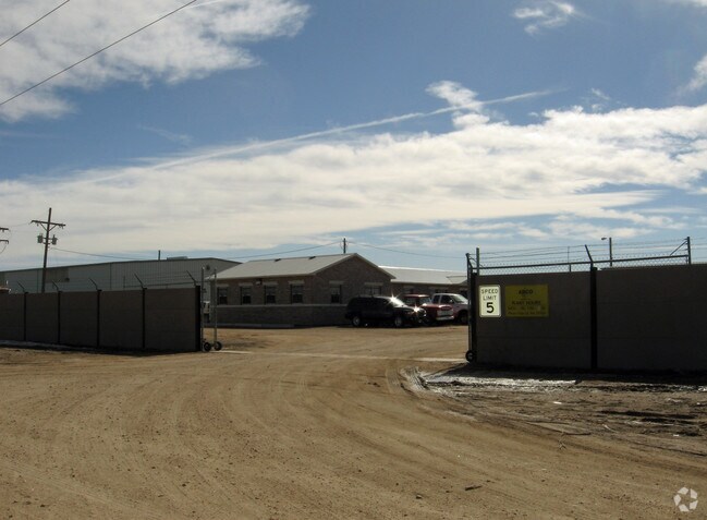


Property Detail
12672 County Road 6 1/4
R6239686
15917-A PT SE4 19 1 66 BEG SE COR OF SEC W2025.5 N39D01E 813.49 TO TRUE POB N39D01E 57.31 N37D47E 783.5 THENCE S89D55W 1233.7 S07D53E 478.8 S06D05W 103.4 S08D11E 102.23 THENCE E631.89 TO POB (14.54A M/L)
Industrialgeneral
Weld
B and X Area of moderate flood hazard, usually the area between the limits of the 100-year and 500-year floods.
Colorado
2024
15 AC
2025
Weld County
001911
Denver
23,028 SF
Greeley, CO
NEARBY LISTINGS FOR SALE OR LEASE
DEMOGRAPHICS near 12672 County Road 6 1/4
1 mile
3 mile
5 mile
2025 Total Population
237
8,571
60,235
2030 Population
261
9,145
64,619
Pop Growth 2025-2030
+ 10.13%
+ 6.70%
+ 7.28%
Average Age
42
39
37
2025 Total Households
81
2,628
19,885
HH Growth 2025-2030
+ 11.11%
+ 7.31%
+ 7.54%
Median Household Inc
$87,500
$93,996
$102,727
Avg Household Size
3.00
3.00
3.00
2025 Avg HH Vehicles
3.00
2.00
2.00
Median Home Value
$632,353
$467,259
$492,065
Median Year Built
1999
1989
2000
Nearby Places
Map Layers
Map Styles
 Street
 Aerial
Transit
 Traffic
 Biking
Places
Listings with unknown addresses are not visible on the map
- Restaurants
- Banks
- Shops
- Fitness
- Groceries
PUBLIC TRANSPORTATION
AIRPORT
Denver International
Drive
Walk
Distance
Denver International
31 min
24.4 mi
Freight Ports
Tulsa Port Of Catoosa
Drive
Walk
Distance
Tulsa Port Of Catoosa
737 min
718.5 mi
Nearby Properties
Address
Land Use
TOTAL SIZE
Lot Size
Zoning
Address
Land Use
TOTAL SIZE
Lot Size
Zoning
116,223 SF
7.38 AC
Address
Land Use
TOTAL SIZE
Lot Size
Zoning
533,981 SF
112.40 AC
Address
Land Use
TOTAL SIZE
Lot Size
Zoning
124,238 SF
62.61 AC
Address
Land Use
TOTAL SIZE
Lot Size
Zoning
161,096 SF
82.69 AC
Address
Land Use
TOTAL SIZE
Lot Size
Zoning
198,777 SF
59.19 AC
Address
Land Use
TOTAL SIZE
Lot Size
Zoning
274,367 SF
65.77 AC
Address
Land Use
TOTAL SIZE
Lot Size
Zoning
217,236 SF
55.97 AC
Address
Land Use
TOTAL SIZE
Lot Size
Zoning
85,398 SF
15 AC
Address
Land Use
TOTAL SIZE
Lot Size
Zoning
276,393 SF
40 AC
Address
Land Use
TOTAL SIZE
Lot Size
Zoning
60,400 SF
19.12 AC
Address
Land Use
TOTAL SIZE
Lot Size
Zoning
37,126 SF
33.04 AC
Address
Land Use
TOTAL SIZE
Lot Size
Zoning
103,400 SF
15.15 AC
Address
Land Use
TOTAL SIZE
Lot Size
Zoning
34,345 SF
13.11 AC
A1
Address
Land Use
TOTAL SIZE
Lot Size
Zoning
59,015 SF
9.44 AC
Address
Land Use
TOTAL SIZE
Lot Size
Zoning
78,700 SF
23.10 AC
Address
Land Use
TOTAL SIZE
Lot Size
Zoning
2,035 SF
93.30 AC
A1
Address
Land Use
TOTAL SIZE
Lot Size
Zoning
57,450 SF
30 AC
Address
Land Use
TOTAL SIZE
Lot Size
Zoning
61,640 SF
8.10 AC
Address
Land Use
TOTAL SIZE
Lot Size
Zoning
37,470 SF
12.04 AC
Address
Land Use
TOTAL SIZE
Lot Size
Zoning
48,393 SF
15 AC
Address
Land Use
TOTAL SIZE
Lot Size
Zoning
30,000 SF
5.86 AC
Address
Land Use
TOTAL SIZE
Lot Size
Zoning
47,705 SF
25.50 AC
Address
Land Use
TOTAL SIZE
Lot Size
Zoning
42,500 SF
7.73 AC
Address
Land Use
TOTAL SIZE
Lot Size
Zoning
77,552 SF
10 AC
Address
Land Use
TOTAL SIZE
Lot Size
Zoning
132,967 SF
3.93 AC
Address
Land Use
TOTAL SIZE
Lot Size
Zoning
23,763 SF
5.86 AC
Address
Land Use
TOTAL SIZE
Lot Size
Zoning
63,187 SF
22.21 AC
I3
Address
Land Use
TOTAL SIZE
Lot Size
Zoning
9,100 SF
51.39 AC
Address
Land Use
TOTAL SIZE
Lot Size
Zoning
The World's #1 Commercial Real Estate Marketplace
Connect with us
© 2026 CoStar Group
The information above has been obtained from sources believed reliable. While we do not doubt its accuracy we have not verified it and make no guarantee, warranty or representation about it. It is your responsibility to independently confirm its accuracy and completeness. Any projections, opinions, assumptions, or estimates used are for example only and do not represent the current or future performance of the property. The value of this transaction to you depends on tax and other factors which should be evaluated by your tax, financial, and legal advisors. You and your advisors should conduct a careful, independent investigation of the property to determine to your satisfaction the suitability of the property for your needs.