Property Record
1283 Willow Rd, Menlo Park, CA 94025


Property Detail
1283 Willow Rd
San Francisco-San Mateo-Redwood City, CA
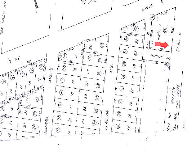
PARCEL 1 PARCEL MAP VOL 59/53 & ABND PTN WILLOW RD 2008-106805
062-103-640
SAN MATEO
Vacantlandnec
California
CL00C3
23-25
C and X Area of minimal flood hazard, usually depicted on FIRMs as above the 500-year flood level.
0.66 AC
2024
Menlo Park
2025
San Francisco
611700
NEARBY LISTINGS FOR SALE OR LEASE
DEMOGRAPHICS near 1283 Willow Rd
1 mile
3 mile
5 mile
2025 Total Population
20,124
101,509
240,263
2030 Population
19,939
102,628
244,419
Pop Growth 2025-2030
(0.92%)
+ 1.10%
+ 1.73%
Average Age
37
40
39
2025 Total Households
5,290
33,825
81,630
HH Growth 2025-2030
(0.98%)
+ 1.43%
+ 1.96%
Median Household Inc
$140,049
$164,481
$158,304
Avg Household Size
3.50
2.80
2.60
2025 Avg HH Vehicles
3.00
2.00
2.00
Median Home Value
$1,076,007
$1,114,014
$1,125,834
Median Year Built
1956
1960
1965
Nearby Places
Map Layers
Map Styles
 Street
 Aerial
Layers
 Traffic
 Biking
Places
Listings with unknown addresses are not visible on the map
- Restaurants
- Banks
- Shops
- Fitness
- Groceries
PUBLIC TRANSPORTATION
COMMUTER RAIL
Palo Alto Caltrain Station Southbound (Express - Caltrain (Caltrain), Limited - Caltrain (Caltrain), Local Weekday - Caltrain (Caltrain), Local Weekend - Caltrain (Caltrain))
Drive
Walk
Distance
Palo Alto Caltrain Station Southbound (Express - Caltrain (Caltrain), Limited - Caltrain (Caltrain), Local Weekday - Caltrain (Caltrain), Local Weekend - Caltrain (Caltrain))
8 min
2.8 mi
Menlo Park Caltrain Station Southbound (Limited - Caltrain (Caltrain), Local Weekday - Caltrain (Caltrain), Local Weekend - Caltrain (Caltrain))
Drive
Walk
Distance
Menlo Park Caltrain Station Southbound (Limited - Caltrain (Caltrain), Local Weekday - Caltrain (Caltrain), Local Weekend - Caltrain (Caltrain))
8 min
3.1 mi
AIRPORT
Norman Y Mineta San Jose International
Drive
Walk
Distance
Norman Y Mineta San Jose International
21 min
15.9 mi
San Francisco International
Drive
Walk
Distance
San Francisco International
24 min
18.4 mi
Metro Oakland International
Drive
Walk
Distance
Metro Oakland International
34 min
26.2 mi
Freight Ports
Port of Redwood City
Drive
Walk
Distance
Port of Redwood City
9 min
5.3 mi
Nearby Properties
Address
Land Use
TOTAL SIZE
Lot Size
Zoning
Address
Land Use
TOTAL SIZE
Lot Size
Zoning
719,052 SF
56.03 AC
Address
Land Use
TOTAL SIZE
Lot Size
Zoning
999,999 SF
56.91 AC
Address
Land Use
TOTAL SIZE
Lot Size
Zoning
1,395,540 SF
51.72 AC
C3
Address
Land Use
TOTAL SIZE
Lot Size
Zoning
22.07 AC
Address
Land Use
TOTAL SIZE
Lot Size
Zoning
Address
Land Use
TOTAL SIZE
Lot Size
Zoning
520,988 SF
8.88 AC
Address
Land Use
TOTAL SIZE
Lot Size
Zoning
918,926 SF
17.54 AC
PC442
Address
Land Use
TOTAL SIZE
Lot Size
Zoning
373,238 SF
7.94 AC
Address
Land Use
TOTAL SIZE
Lot Size
Zoning
Address
Land Use
TOTAL SIZE
Lot Size
Zoning
528,437 SF
9.69 AC
Address
Land Use
TOTAL SIZE
Lot Size
Zoning
210,000 SF
10.79 AC
Address
Land Use
TOTAL SIZE
Lot Size
Zoning
247,567 SF
3.52 AC
Address
Land Use
TOTAL SIZE
Lot Size
Zoning
212,924 SF
1.83 AC
Address
Land Use
TOTAL SIZE
Lot Size
Zoning
368,000 SF
11.32 AC
Address
Land Use
TOTAL SIZE
Lot Size
Zoning
164,853 SF
3.89 AC
Address
Land Use
TOTAL SIZE
Lot Size
Zoning
145,617 SF
8.24 AC
EA00C1
Address
Land Use
TOTAL SIZE
Lot Size
Zoning
61.20 AC
R10000
Address
Land Use
TOTAL SIZE
Lot Size
Zoning
190,389 SF
11.20 AC
M20000
Address
Land Use
TOTAL SIZE
Lot Size
Zoning
143,429 SF
2.12 AC
Address
Land Use
TOTAL SIZE
Lot Size
Zoning
149,700 SF
2.28 AC
Address
Land Use
TOTAL SIZE
Lot Size
Zoning
222,234 SF
6.39 AC
Address
Land Use
TOTAL SIZE
Lot Size
Zoning
Address
Land Use
TOTAL SIZE
Lot Size
Zoning
16.43 AC
Address
Land Use
TOTAL SIZE
Lot Size
Zoning
190,000 SF
3.37 AC
Address
Land Use
TOTAL SIZE
Lot Size
Zoning
171,563 SF
3.57 AC
Address
Land Use
TOTAL SIZE
Lot Size
Zoning
2,024 SF
1.38 AC
Address
Land Use
TOTAL SIZE
Lot Size
Zoning
68,488 SF
1.38 AC
M20000
Address
Land Use
TOTAL SIZE
Lot Size
Zoning
170,495 SF
7.15 AC
Address
Land Use
TOTAL SIZE
Lot Size
Zoning
259,586 SF
17.92 AC
LMD
Address
Land Use
TOTAL SIZE
Lot Size
Zoning
102,690 SF
6.71 AC
The World's #1 Commercial Real Estate Marketplace
Connect with us
© 2026 CoStar Group
The information above has been obtained from sources believed reliable. While we do not doubt its accuracy we have not verified it and make no guarantee, warranty or representation about it. It is your responsibility to independently confirm its accuracy and completeness. Any projections, opinions, assumptions, or estimates used are for example only and do not represent the current or future performance of the property. The value of this transaction to you depends on tax and other factors which should be evaluated by your tax, financial, and legal advisors. You and your advisors should conduct a careful, independent investigation of the property to determine to your satisfaction the suitability of the property for your needs.