Property Record
1285 Appleton Rd, Elkton, MD 21921

Property Detail
1285 Appleton Rd
04-024710
47.6196 ACRES 1285 APPLETON ROAD S OF BARKSDALE
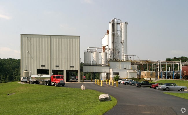
Distributionwarehouseregional
Cecil
M1
Maryland
A Areas with a 1% annual chance of flooding and a 26% chance of flooding over the life of a 30-year mortgage.
47.61 AC
2025
Cecil County
2025
Baltimore
030601
Philadelphia-Camden-Wilmington, PA-NJ-DE-MD
800 SF
NEARBY LISTINGS FOR SALE OR LEASE
-
-
View all Elkton listings for sale on LoopNet.com
DEMOGRAPHICS near 1285 Appleton Rd
1 mile
3 mile
5 mile
2025 Total Population
2,059
26,394
93,483
2030 Population
2,130
27,302
97,641
Pop Growth 2025-2030
+ 3.45%
+ 3.44%
+ 4.45%
Average Age
37
39
37
2025 Total Households
796
10,549
33,324
HH Growth 2025-2030
+ 3.39%
+ 3.55%
+ 4.63%
Median Household Inc
$81,250
$85,554
$79,569
Avg Household Size
2.50
2.50
2.50
2025 Avg HH Vehicles
2.00
2.00
2.00
Median Home Value
$275,277
$349,821
$347,428
Median Year Built
1992
1984
1983
Nearby Places
Map Layers
Map Styles
 Street
 Aerial
Transit
 Traffic
 Biking
Places
Listings with unknown addresses are not visible on the map
- Restaurants
- Banks
- Shops
- Fitness
- Groceries
PUBLIC TRANSPORTATION
COMMUTER RAIL
Newark (R2 - Southeastern Pennsylvania Transportation Authority Regional Rail (SEPTA Regional Rail))
Drive
Walk
Distance
Newark (R2 - Southeastern Pennsylvania Transportation Authority Regional Rail (SEPTA Regional Rail))
9 min
5.3 mi
Churchmans Crossing (R2 - Southeastern Pennsylvania Transportation Authority Regional Rail (SEPTA Regional Rail))
Drive
Walk
Distance
Churchmans Crossing (R2 - Southeastern Pennsylvania Transportation Authority Regional Rail (SEPTA Regional Rail))
16 min
9.9 mi
Freight Ports
Port of Wilmington, RI
Drive
Walk
Distance
Port of Wilmington, RI
28 min
19.5 mi
Nearby Properties
Address
Land Use
TOTAL SIZE
Lot Size
Zoning
Address
Land Use
TOTAL SIZE
Lot Size
Zoning
756,122 SF
70.18 AC
M1
Address
Land Use
TOTAL SIZE
Lot Size
Zoning
142,774 SF
131.33 AC
M1
Address
Land Use
TOTAL SIZE
Lot Size
Zoning
70,092 SF
41.59 AC
UR
Address
Land Use
TOTAL SIZE
Lot Size
Zoning
19.26 AC
RM
Address
Land Use
TOTAL SIZE
Lot Size
Zoning
383,319 SF
234.70 AC
I
Address
Land Use
TOTAL SIZE
Lot Size
Zoning
64,148 SF
31.54 AC
M1
Address
Land Use
TOTAL SIZE
Lot Size
Zoning
20,973 SF
75.14 AC
M1
Address
Land Use
TOTAL SIZE
Lot Size
Zoning
81,072 SF
12.86 AC
RM
Address
Land Use
TOTAL SIZE
Lot Size
Zoning
41,000 SF
32.49 AC
M1
Address
Land Use
TOTAL SIZE
Lot Size
Zoning
131,806 SF
21.97 AC
BI
Address
Land Use
TOTAL SIZE
Lot Size
Zoning
17.50 AC
R3
Address
Land Use
TOTAL SIZE
Lot Size
Zoning
159,038 SF
22.52 AC
R3
Address
Land Use
TOTAL SIZE
Lot Size
Zoning
40,074 SF
90.98 AC
M1
Address
Land Use
TOTAL SIZE
Lot Size
Zoning
46,754 SF
20.78 AC
M1
Address
Land Use
TOTAL SIZE
Lot Size
Zoning
35,947 SF
50 AC
NAR
Address
Land Use
TOTAL SIZE
Lot Size
Zoning
64,800 SF
14.01 AC
C3
Address
Land Use
TOTAL SIZE
Lot Size
Zoning
15,374 SF
15.37 AC
18RH
Address
Land Use
TOTAL SIZE
Lot Size
Zoning
14,136 SF
9.81 AC
UR
Address
Land Use
TOTAL SIZE
Lot Size
Zoning
82,079 SF
13.60 AC
R2
Address
Land Use
TOTAL SIZE
Lot Size
Zoning
15,215 SF
20.22 AC
18RH
Address
Land Use
TOTAL SIZE
Lot Size
Zoning
44,705 SF
6.95 AC
18AC
Address
Land Use
TOTAL SIZE
Lot Size
Zoning
306,221 SF
17.44 AC
18OFD
Address
Land Use
TOTAL SIZE
Lot Size
Zoning
51,609 SF
9.84 AC
UR
Address
Land Use
TOTAL SIZE
Lot Size
Zoning
217,027 SF
12.98 AC
18MOR
Address
Land Use
TOTAL SIZE
Lot Size
Zoning
64,800 SF
Address
Land Use
TOTAL SIZE
Lot Size
Zoning
56,656 SF
2.07 AC
BI
Address
Land Use
TOTAL SIZE
Lot Size
Zoning
91,879 SF
19.57 AC
18BC
Address
Land Use
TOTAL SIZE
Lot Size
Zoning
1,828 SF
10.37 AC
18RM
Address
Land Use
TOTAL SIZE
Lot Size
Zoning
72,725 SF
18.48 AC
18OFD
Address
Land Use
TOTAL SIZE
Lot Size
Zoning
294,288 SF
22.25 AC
NCAP
The World's #1 Commercial Real Estate Marketplace
Connect with us
© 2026 CoStar Group
The information above has been obtained from sources believed reliable. While we do not doubt its accuracy we have not verified it and make no guarantee, warranty or representation about it. It is your responsibility to independently confirm its accuracy and completeness. Any projections, opinions, assumptions, or estimates used are for example only and do not represent the current or future performance of the property. The value of this transaction to you depends on tax and other factors which should be evaluated by your tax, financial, and legal advisors. You and your advisors should conduct a careful, independent investigation of the property to determine to your satisfaction the suitability of the property for your needs.