Property Record
1298 Watson Rd, Mansfield, TX 76063


Property Detail
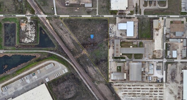
1298 Watson Rd
Dallas-Fort Worth-Arlington, TX
HIBBINS, JOHN SURVEY ABSTRACT 638 TRACT 1C
03912817
TARRANT
Residentialacreage
Texas
B and X Area of moderate flood hazard, usually the area between the limits of the 100-year and 500-year floods.
8.20 AC
2024
East Northeast Ft Worth
2025
Dallas/Ft Worth
111307
NEARBY LISTINGS FOR SALE OR LEASE
DEMOGRAPHICS near 1298 Watson Rd
1 mile
3 mile
5 mile
2025 Total Population
2,763
84,196
274,276
2030 Population
2,901
88,587
290,373
Pop Growth 2025-2030
+ 4.99%
+ 5.22%
+ 5.87%
Average Age
38
35
35
2025 Total Households
918
28,120
89,871
HH Growth 2025-2030
+ 5.12%
+ 5.42%
+ 6.07%
Median Household Inc
$77,895
$84,667
$83,212
Avg Household Size
3.00
2.90
3.00
2025 Avg HH Vehicles
2.00
2.00
2.00
Median Home Value
$199,642
$306,315
$300,349
Median Year Built
1970
2003
2000
Nearby Places
Map Layers
Map Styles
 Street
 Aerial
Transit
 Traffic
 Biking
Places
Listings with unknown addresses are not visible on the map
- Restaurants
- Banks
- Shops
- Fitness
- Groceries
PUBLIC TRANSPORTATION
COMMUTER RAIL
Fort Worth (Heartland Flyer - Amtrak, Texas Eagle - Amtrak)
Drive
Walk
Distance
Fort Worth (Heartland Flyer - Amtrak, Texas Eagle - Amtrak)
14 min
9.3 mi
Fort Worth Intermodal Transit Center (TRINITY RAILWAY - Dallas Area Rapid Transit (DART))
Drive
Walk
Distance
Fort Worth Intermodal Transit Center (TRINITY RAILWAY - Dallas Area Rapid Transit (DART))
14 min
9.3 mi
AIRPORT
Dallas-Fort Worth International
Drive
Walk
Distance
Dallas-Fort Worth International
31 min
23.8 mi
Dallas Love Field
Drive
Walk
Distance
Dallas Love Field
41 min
32.4 mi
Freight Ports
Port of Shreveport
Drive
Walk
Distance
Port of Shreveport
252 min
231.7 mi
Nearby Properties
Address
Land Use
TOTAL SIZE
Lot Size
Zoning
Address
Land Use
TOTAL SIZE
Lot Size
Zoning
1,291,500 SF
61.22 AC
Address
Land Use
TOTAL SIZE
Lot Size
Zoning
586,500 SF
159.54 AC
Address
Land Use
TOTAL SIZE
Lot Size
Zoning
1,440,000 SF
73.42 AC
Address
Land Use
TOTAL SIZE
Lot Size
Zoning
431,028 SF
126.62 AC
Address
Land Use
TOTAL SIZE
Lot Size
Zoning
473,562 SF
24.63 AC
Address
Land Use
TOTAL SIZE
Lot Size
Zoning
1,020,300 SF
64.61 AC
Address
Land Use
TOTAL SIZE
Lot Size
Zoning
1,009,800 SF
49.98 AC
Address
Land Use
TOTAL SIZE
Lot Size
Zoning
935,532 SF
95.08 AC
Address
Land Use
TOTAL SIZE
Lot Size
Zoning
307,139 SF
14.02 AC
Address
Land Use
TOTAL SIZE
Lot Size
Zoning
715,000 SF
47.87 AC
Address
Land Use
TOTAL SIZE
Lot Size
Zoning
278,292 SF
16.35 AC
Address
Land Use
TOTAL SIZE
Lot Size
Zoning
263,411 SF
7.32 AC
Address
Land Use
TOTAL SIZE
Lot Size
Zoning
656,390 SF
33.33 AC
Address
Land Use
TOTAL SIZE
Lot Size
Zoning
269,995 SF
14.72 AC
Address
Land Use
TOTAL SIZE
Lot Size
Zoning
329,091 SF
21.73 AC
Address
Land Use
TOTAL SIZE
Lot Size
Zoning
290,034 SF
11.04 AC
Address
Land Use
TOTAL SIZE
Lot Size
Zoning
251,933 SF
86.07 AC
Address
Land Use
TOTAL SIZE
Lot Size
Zoning
270,394 SF
16.43 AC
Address
Land Use
TOTAL SIZE
Lot Size
Zoning
689,600 SF
47.04 AC
Address
Land Use
TOTAL SIZE
Lot Size
Zoning
586,242 SF
59.44 AC
Address
Land Use
TOTAL SIZE
Lot Size
Zoning
304,361 SF
7.13 AC
Address
Land Use
TOTAL SIZE
Lot Size
Zoning
354,246 SF
16.14 AC
Address
Land Use
TOTAL SIZE
Lot Size
Zoning
249,997 SF
11.47 AC
Address
Land Use
TOTAL SIZE
Lot Size
Zoning
569,345 SF
33.77 AC
Address
Land Use
TOTAL SIZE
Lot Size
Zoning
588,300 SF
37.67 AC
Address
Land Use
TOTAL SIZE
Lot Size
Zoning
540,414 SF
28.67 AC
Address
Land Use
TOTAL SIZE
Lot Size
Zoning
238,120 SF
13.03 AC
Address
Land Use
TOTAL SIZE
Lot Size
Zoning
191,534 SF
10.88 AC
Address
Land Use
TOTAL SIZE
Lot Size
Zoning
229,150 SF
13.45 AC
Address
Land Use
TOTAL SIZE
Lot Size
Zoning
728,054 SF
33.51 AC
The World's #1 Commercial Real Estate Marketplace
Connect with us
© 2026 CoStar Group
The information above has been obtained from sources believed reliable. While we do not doubt its accuracy we have not verified it and make no guarantee, warranty or representation about it. It is your responsibility to independently confirm its accuracy and completeness. Any projections, opinions, assumptions, or estimates used are for example only and do not represent the current or future performance of the property. The value of this transaction to you depends on tax and other factors which should be evaluated by your tax, financial, and legal advisors. You and your advisors should conduct a careful, independent investigation of the property to determine to your satisfaction the suitability of the property for your needs.