Property Record
1300 Malloy Bridge Cir, Ferris, TX 75125


NEARBY LISTINGS FOR SALE OR LEASE
-
-
View all Ferris listings for sale on LoopNet.com
Property Detail
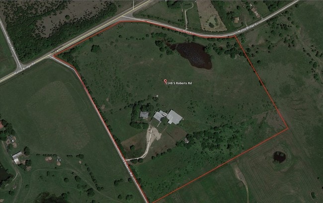
1300 Malloy Bridge Cir
65098829010030000
Harrison Masters
Privatepreserveopenspacevacantlandforestlandconservation
HARRISON MASTERS ABST 988 PG 290 TR 3 ACS 1102.62 CALC JURIS SPLIT ALSO PT ABST 856 & 857 VOL2002222/11141 DD01012002 CO-DC 0988290100300 5NT09882901
AE
Dallas
48113C0660K
Texas
2024
20.02 AC
2025
Southeast Outlying
060104
Dallas/Ft Worth
900 SF
Dallas-Fort Worth-Arlington, TX
DEMOGRAPHICS near 1300 Malloy Bridge Cir
1 Mile
3 Mile
5 Mile
2024 Total Population
85
6,723
14,803
2029 Population
92
7,715
17,000
Pop Growth 2024-2029
+ 8.24%
+ 14.76%
+ 14.84%
Average Age
33
34
35
2024 Total Households
26
2,109
4,663
HH Growth 2024-2029
+ 3.85%
+ 15.36%
+ 15.40%
Median Household Inc
$55,000
$54,183
$56,711
Avg Household Size
3.30
3.10
3.10
2024 Avg HH Vehicles
2.00
2.00
2.00
Median Home Value
$116,667
$107,912
$141,041
Median Year Built
2006
1991
1995
Nearby Places
Map Layers
Map Styles
 Street
 Aerial
- Restaurants
- Banks
- Shops
- Fitness
- Groceries
PUBLIC TRANSPORTATION
AIRPORT
Dallas Love Field
DRIVE
WALK
Distance
Dallas Love Field
37 min
26.1 mi
Freight Ports
Port of Shreveport
DRIVE
WALK
Distance
Port of Shreveport
213 min
190.4 mi
SALE & LEASE HISTORY
LISTING DATE
SALE/LEASE

Oct 31, 2016
For Sale
Dec 12, 2016
For Sale
Nearby Properties
Address
Land Use
TOTAL SIZE
Lot Size
Zoning
Address
Land Use
TOTAL SIZE
Lot Size
Zoning
62.41 AC
Z31
Address
Land Use
TOTAL SIZE
Lot Size
Zoning
1,021,601 SF
79.42 AC
Z268
Address
Land Use
TOTAL SIZE
Lot Size
Zoning
202,439 SF
12.48 AC
Z31
Address
Land Use
TOTAL SIZE
Lot Size
Zoning
392,066 SF
23.52 AC
Address
Land Use
TOTAL SIZE
Lot Size
Zoning
266,199 SF
33.27 AC
Address
Land Use
TOTAL SIZE
Lot Size
Zoning
370,139 SF
15.42 AC
Z268
Address
Land Use
TOTAL SIZE
Lot Size
Zoning
174,802 SF
8.67 AC
Address
Land Use
TOTAL SIZE
Lot Size
Zoning
143,771 SF
130.33 AC
Z123
Address
Land Use
TOTAL SIZE
Lot Size
Zoning
174,802 SF
8.67 AC
Z05
Address
Land Use
TOTAL SIZE
Lot Size
Zoning
97,372 SF
42.82 AC
Z31
Address
Land Use
TOTAL SIZE
Lot Size
Zoning
12,444 SF
5 AC
Address
Land Use
TOTAL SIZE
Lot Size
Zoning
84.71 AC
Z268
Address
Land Use
TOTAL SIZE
Lot Size
Zoning
1,400 SF
75.81 AC
Z05
Address
Land Use
TOTAL SIZE
Lot Size
Zoning
13,000 SF
4.99 AC
Address
Land Use
TOTAL SIZE
Lot Size
Zoning
20.01 AC
Z05
Address
Land Use
TOTAL SIZE
Lot Size
Zoning
129.50 AC
Z268
Address
Land Use
TOTAL SIZE
Lot Size
Zoning
25,780 SF
100.30 AC
Z05
Address
Land Use
TOTAL SIZE
Lot Size
Zoning
122.47 AC
Z268
Address
Land Use
TOTAL SIZE
Lot Size
Zoning
26.47 AC
Z05
Address
Land Use
TOTAL SIZE
Lot Size
Zoning
22,736 SF
9.03 AC
Address
Land Use
TOTAL SIZE
Lot Size
Zoning
87.15 AC
Z268
Address
Land Use
TOTAL SIZE
Lot Size
Zoning
4,820.86 AC
Address
Land Use
TOTAL SIZE
Lot Size
Zoning
17,175 SF
30.59 AC
Address
Land Use
TOTAL SIZE
Lot Size
Zoning
30,000 SF
30.55 AC
Z05
Address
Land Use
TOTAL SIZE
Lot Size
Zoning
85.83 AC
Z05
Address
Land Use
TOTAL SIZE
Lot Size
Zoning
58.31 AC
Z268
Address
Land Use
TOTAL SIZE
Lot Size
Zoning
8,544 SF
1.65 AC
Address
Land Use
TOTAL SIZE
Lot Size
Zoning
17,030 SF
1.08 AC
Address
Land Use
TOTAL SIZE
Lot Size
Zoning
22.77 AC
Z31
Address
Land Use
TOTAL SIZE
Lot Size
Zoning
56.52 AC
Z31
The World's #1 Commercial Real Estate Marketplace
Connect with us
© 2026 CoStar Group
The information above has been obtained from sources believed reliable. While we do not doubt its accuracy we have not verified it and make no guarantee, warranty or representation about it. It is your responsibility to independently confirm its accuracy and completeness. Any projections, opinions, assumptions, or estimates used are for example only and do not represent the current or future performance of the property. The value of this transaction to you depends on tax and other factors which should be evaluated by your tax, financial, and legal advisors. You and your advisors should conduct a careful, independent investigation of the property to determine to your satisfaction the suitability of the property for your needs.