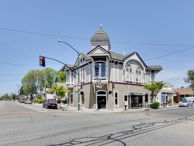
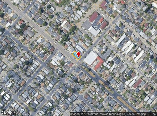
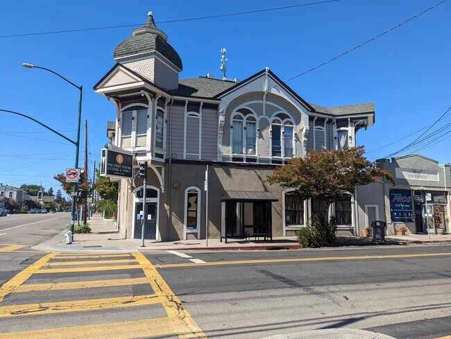
Property Record
1301 High St, Alameda, CA 94501
NEARBY LISTINGS FOR SALE OR LEASE
Property Detail
1301 High St
Oakland-Fremont-Berkeley, CA
Alameda & Adjacent Land
069-0077-011-00
LOT: 00010 BLK: AR: 0069 PAGE: 0077 ;LOT: 00011 BLK: AR: 0069 PAGE: 0077
Storesoffices
Alameda
X
California
06001C0088H
1&2
2024
0.12 AC
2025
Alameda
428100
East Bay/Oakland
4,807 SF
DEMOGRAPHICS near 1301 High St
1 mile
3 mile
5 mile
2024 Total Population
19,689
194,646
450,910
2029 Population
19,049
187,873
437,284
Pop Growth 2024-2029
(3.25%)
(3.48%)
(3.02%)
Average Age
44
40
40
2024 Total Households
7,795
66,308
168,991
HH Growth 2024-2029
(3.46%)
(3.61%)
(3.05%)
Median Household Inc
$113,183
$77,959
$86,383
Avg Household Size
2.40
2.70
2.50
2024 Avg HH Vehicles
2.00
2.00
2.00
Median Home Value
$1,083,100
$843,234
$871,903
Median Year Built
1948
1952
1955
Nearby Places
Map Layers
Map Styles
 Street
 Aerial
Transit
 Traffic
 Biking
Places
Listings with unknown addresses are not visible on the map
- Restaurants
- Banks
- Shops
- Fitness
- Groceries
PUBLIC TRANSPORTATION
COMMUTER RAIL
Drive
Walk
Distance
9 min
4.7 mi
Drive
Walk
Distance
17 min
9.7 mi
AIRPORT
Metro Oakland International
Drive
Walk
Distance
Metro Oakland International
8 min
3.6 mi
San Francisco International
Drive
Walk
Distance
San Francisco International
43 min
33.1 mi
Norman Y Mineta San Jose International
Drive
Walk
Distance
Norman Y Mineta San Jose International
48 min
37.6 mi
Freight Ports
Port of Oakland
Drive
Walk
Distance
Port of Oakland
10 min
5.2 mi
SALE & LEASE HISTORY
LISTING DATE
SALE/LEASE

Sep 26, 2022
For Sale
Sep 20, 2022
For Lease
Nov 30, 2020
For Lease
Jun 02, 2024
For Sale
Jul 12, 2021
For Sale
Jul 10, 2023
For Sale
Dec 17, 2024
For Sale
Nearby Properties
Address
Land Use
TOTAL SIZE
Lot Size
Zoning
Address
Land Use
TOTAL SIZE
Lot Size
Zoning
Address
Land Use
TOTAL SIZE
Lot Size
Zoning
546,164 SF
6.02 AC
Address
Land Use
TOTAL SIZE
Lot Size
Zoning
Address
Land Use
TOTAL SIZE
Lot Size
Zoning
219,200 SF
5.49 AC
Address
Land Use
TOTAL SIZE
Lot Size
Zoning
2.05 AC
Address
Land Use
TOTAL SIZE
Lot Size
Zoning
371,504 SF
4.08 AC
Address
Land Use
TOTAL SIZE
Lot Size
Zoning
534,208 SF
23.18 AC
Address
Land Use
TOTAL SIZE
Lot Size
Zoning
273,623 SF
1.44 AC
Address
Land Use
TOTAL SIZE
Lot Size
Zoning
297,617 SF
1.54 AC
Address
Land Use
TOTAL SIZE
Lot Size
Zoning
259,247 SF
5.44 AC
R5PD
Address
Land Use
TOTAL SIZE
Lot Size
Zoning
215,226 SF
3.86 AC
Address
Land Use
TOTAL SIZE
Lot Size
Zoning
190,786 SF
3.75 AC
Address
Land Use
TOTAL SIZE
Lot Size
Zoning
128,650 SF
6.38 AC
Address
Land Use
TOTAL SIZE
Lot Size
Zoning
180,959 SF
9.38 AC
Address
Land Use
TOTAL SIZE
Lot Size
Zoning
374,725 SF
18.63 AC
Address
Land Use
TOTAL SIZE
Lot Size
Zoning
336,680 SF
9.93 AC
M40
Address
Land Use
TOTAL SIZE
Lot Size
Zoning
284,255 SF
5.07 AC
Address
Land Use
TOTAL SIZE
Lot Size
Zoning
165,042 SF
13.50 AC
Address
Land Use
TOTAL SIZE
Lot Size
Zoning
169,558 SF
1.65 AC
Address
Land Use
TOTAL SIZE
Lot Size
Zoning
200,238 SF
9.28 AC
Address
Land Use
TOTAL SIZE
Lot Size
Zoning
Address
Land Use
TOTAL SIZE
Lot Size
Zoning
133,678 SF
4.33 AC
Address
Land Use
TOTAL SIZE
Lot Size
Zoning
77,660 SF
1.94 AC
Address
Land Use
TOTAL SIZE
Lot Size
Zoning
138,196 SF
8.47 AC
Address
Land Use
TOTAL SIZE
Lot Size
Zoning
155,000 SF
8.41 AC
Address
Land Use
TOTAL SIZE
Lot Size
Zoning
136,127 SF
8.21 AC
Address
Land Use
TOTAL SIZE
Lot Size
Zoning
232,068 SF
31.82 AC
Address
Land Use
TOTAL SIZE
Lot Size
Zoning
93,964 SF
24.21 AC
Address
Land Use
TOTAL SIZE
Lot Size
Zoning
76,114 SF
6 AC
Address
Land Use
TOTAL SIZE
Lot Size
Zoning
129,726 SF
5.38 AC
The World's #1 Commercial Real Estate Marketplace
Connect with us
© 2026 CoStar Group
The information above has been obtained from sources believed reliable. While we do not doubt its accuracy we have not verified it and make no guarantee, warranty or representation about it. It is your responsibility to independently confirm its accuracy and completeness. Any projections, opinions, assumptions, or estimates used are for example only and do not represent the current or future performance of the property. The value of this transaction to you depends on tax and other factors which should be evaluated by your tax, financial, and legal advisors. You and your advisors should conduct a careful, independent investigation of the property to determine to your satisfaction the suitability of the property for your needs.