Property Record
1320 N Eldorado St, Boise, ID 83704
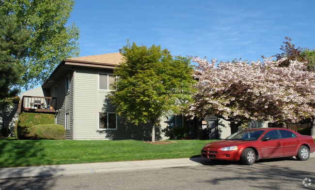
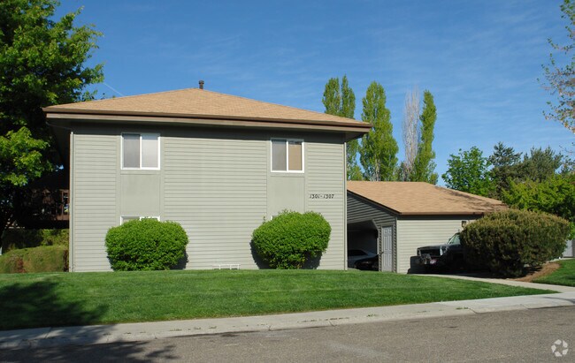
Property Detail
1320 N Eldorado St
S1007223251
PORTION GOVERNMENT LOT1
Commercialbuilding
Ada
R-2D
Idaho
B and X Area of moderate flood hazard, usually the area between the limits of the 100-year and 500-year floods.
1
2025
2 AC
2025
West Bench
001204
Boise City/Nampa
20,736 SF
Boise City, ID
NEARBY LISTINGS FOR SALE OR LEASE
DEMOGRAPHICS near 1320 N Eldorado St
1 mile
3 mile
5 mile
2025 Total Population
15,466
113,267
250,873
2030 Population
16,100
118,256
262,707
Pop Growth 2025-2030
+ 4.10%
+ 4.40%
+ 4.72%
Average Age
38
40
40
2025 Total Households
6,659
48,106
104,758
HH Growth 2025-2030
+ 4.55%
+ 4.86%
+ 5.22%
Median Household Inc
$63,665
$68,717
$79,616
Avg Household Size
2.10
2.30
2.30
2025 Avg HH Vehicles
2.00
2.00
2.00
Median Home Value
$385,332
$438,798
$484,694
Median Year Built
1982
1984
1989
Nearby Places
Map Layers
Map Styles
 Street
 Aerial
Layers
 Traffic
 Biking
Places
Listings with unknown addresses are not visible on the map
- Restaurants
- Banks
- Shops
- Fitness
- Groceries
PUBLIC TRANSPORTATION
AIRPORT
Boise Air Trml/Gowen Field
Drive
Walk
Distance
Boise Air Trml/Gowen Field
27 min
10.0 mi
Freight Ports
Port of Portland
Drive
Walk
Distance
Port of Portland
476 min
430.3 mi
Nearby Properties
Address
Land Use
TOTAL SIZE
Lot Size
Zoning
Address
Land Use
TOTAL SIZE
Lot Size
Zoning
646,787 SF
27.37 AC
C-2D
Address
Land Use
TOTAL SIZE
Lot Size
Zoning
13.90 AC
R-2D
Address
Land Use
TOTAL SIZE
Lot Size
Zoning
4.02 AC
C-2
Address
Land Use
TOTAL SIZE
Lot Size
Zoning
279,694 SF
2.09 AC
R-ODD/DA
Address
Land Use
TOTAL SIZE
Lot Size
Zoning
402,504 SF
5.78 AC
C-5DD
Address
Land Use
TOTAL SIZE
Lot Size
Zoning
334,334 SF
3.21 AC
R-OD
Address
Land Use
TOTAL SIZE
Lot Size
Zoning
207,033 SF
10.67 AC
L-OD
Address
Land Use
TOTAL SIZE
Lot Size
Zoning
225,032 SF
12.75 AC
R-3D
Address
Land Use
TOTAL SIZE
Lot Size
Zoning
249,800 SF
12.99 AC
C-2D
Address
Land Use
TOTAL SIZE
Lot Size
Zoning
245,000 SF
12.28 AC
R-2D
Address
Land Use
TOTAL SIZE
Lot Size
Zoning
319,052 SF
24.33 AC
C-2D
Address
Land Use
TOTAL SIZE
Lot Size
Zoning
151,285 SF
9.54 AC
R-1C
Address
Land Use
TOTAL SIZE
Lot Size
Zoning
222,379 SF
1.37 AC
M
Address
Land Use
TOTAL SIZE
Lot Size
Zoning
211,039 SF
12.21 AC
C-3D
Address
Land Use
TOTAL SIZE
Lot Size
Zoning
247,435 SF
2.90 AC
C-2DC
Address
Land Use
TOTAL SIZE
Lot Size
Zoning
162,432 SF
8.31 AC
R-3D
Address
Land Use
TOTAL SIZE
Lot Size
Zoning
72,579 SF
4.48 AC
M-1D
Address
Land Use
TOTAL SIZE
Lot Size
Zoning
125,241 SF
1.42 AC
C-5DD
Address
Land Use
TOTAL SIZE
Lot Size
Zoning
246,944 SF
2.29 AC
R-OD
Address
Land Use
TOTAL SIZE
Lot Size
Zoning
7.16 AC
C-2D
Address
Land Use
TOTAL SIZE
Lot Size
Zoning
176,494 SF
10.16 AC
R-1C
Address
Land Use
TOTAL SIZE
Lot Size
Zoning
290,239 SF
4.73 AC
ZC-243
Address
Land Use
TOTAL SIZE
Lot Size
Zoning
10.32 AC
C-2D
Address
Land Use
TOTAL SIZE
Lot Size
Zoning
292,885 SF
13.76 AC
C-1
Address
Land Use
TOTAL SIZE
Lot Size
Zoning
136,244 SF
8.56 AC
R-3D/DA
Address
Land Use
TOTAL SIZE
Lot Size
Zoning
84,180 SF
1.11 AC
C-5DD
Address
Land Use
TOTAL SIZE
Lot Size
Zoning
118,345 SF
5.20 AC
R-2D
Address
Land Use
TOTAL SIZE
Lot Size
Zoning
137,752 SF
5.13 AC
ZC-268
Address
Land Use
TOTAL SIZE
Lot Size
Zoning
127,136 SF
7.59 AC
R-3D
Address
Land Use
TOTAL SIZE
Lot Size
Zoning
91,740 SF
3.63 AC
C-4D
The World's #1 Commercial Real Estate Marketplace
Connect with us
© 2026 CoStar Group
The information above has been obtained from sources believed reliable. While we do not doubt its accuracy we have not verified it and make no guarantee, warranty or representation about it. It is your responsibility to independently confirm its accuracy and completeness. Any projections, opinions, assumptions, or estimates used are for example only and do not represent the current or future performance of the property. The value of this transaction to you depends on tax and other factors which should be evaluated by your tax, financial, and legal advisors. You and your advisors should conduct a careful, independent investigation of the property to determine to your satisfaction the suitability of the property for your needs.