Property Record
1328 Forestdale Blvd, Birmingham, AL 35214

NEARBY LISTINGS FOR SALE OR LEASE
-
-
View all Birmingham listings for sale on LoopNet.com
Property Detail
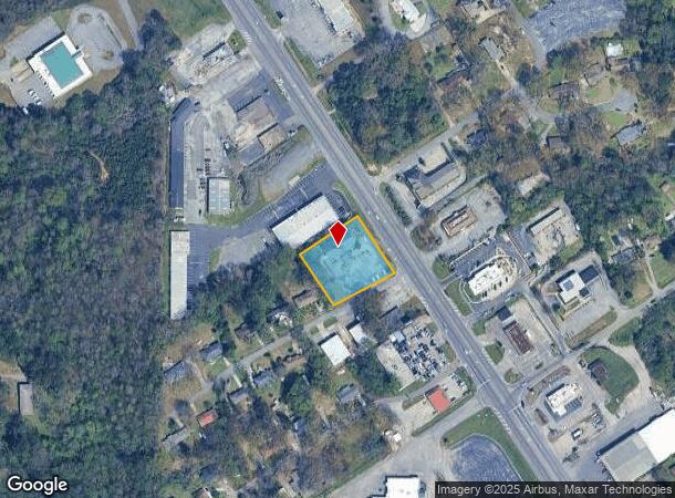
1328 Forestdale Blvd
Birmingham-Hoover, AL
Hubbert Surv
22-00-18-2-010-043.000
BEG NW INTER FORESTDALE BLVD & CINDY LN IN NW 1/4 SEC 18 TP 17 R 3 TH NW 203 FT TH SW 205 FT TH SE 179.9 FT TH NE 206.3 TO POB SECT 18 TWSP 17S RANGE 3W
Publicschool
Jefferson
X
Alabama
01073C0367H
11,12
2023
0.90 AC
2024
Bessemer
012402
Birmingham
7,176 SF
DEMOGRAPHICS near 1328 Forestdale Blvd
1 Mile
3 Mile
5 Mile
2024 Total Population
4,912
18,986
68,834
2029 Population
4,763
18,709
68,906
Pop Growth 2024-2029
(3.03%)
(1.46%)
+ 0.10%
Average Age
41
42
42
2024 Total Households
2,028
7,716
28,778
HH Growth 2024-2029
(3.06%)
(1.49%)
+ 0.19%
Median Household Inc
$55,253
$52,294
$38,824
Avg Household Size
2.40
2.40
2.20
2024 Avg HH Vehicles
2.00
2.00
2.00
Median Home Value
$141,458
$136,751
$96,124
Median Year Built
1971
1972
1963
Nearby Places
Map Layers
Map Styles
 Street
 Aerial
- Restaurants
- Banks
- Shops
- Fitness
- Groceries
PUBLIC TRANSPORTATION
COMMUTER RAIL
DRIVE
WALK
Distance
13 min
7.3 mi
AIRPORT
Birmingham-Shuttlesworth International
DRIVE
WALK
Distance
Birmingham-Shuttlesworth International
19 min
12.2 mi
SALE & LEASE HISTORY
LISTING DATE
SALE/LEASE

Dec 20, 2019
For Sale
Nearby Properties
Address
Land Use
TOTAL SIZE
Lot Size
Zoning
Address
Land Use
TOTAL SIZE
Lot Size
Zoning
186,000 SF
12.63 AC
QM1
Address
Land Use
TOTAL SIZE
Lot Size
Zoning
186,911 SF
12 AC
QM1
Address
Land Use
TOTAL SIZE
Lot Size
Zoning
140,000 SF
4.80 AC
M3
Address
Land Use
TOTAL SIZE
Lot Size
Zoning
32,922 SF
15 AC
I3
Address
Land Use
TOTAL SIZE
Lot Size
Zoning
181,399 SF
20.91 AC
A1
Address
Land Use
TOTAL SIZE
Lot Size
Zoning
137,177 SF
10 AC
INST
Address
Land Use
TOTAL SIZE
Lot Size
Zoning
123,937 SF
7.79 AC
R4
Address
Land Use
TOTAL SIZE
Lot Size
Zoning
31,817 SF
2.17 AC
CP-C
Address
Land Use
TOTAL SIZE
Lot Size
Zoning
109,753 SF
6.18 AC
R5
Address
Land Use
TOTAL SIZE
Lot Size
Zoning
70,900 SF
13.53 AC
QM1
Address
Land Use
TOTAL SIZE
Lot Size
Zoning
147,113 SF
18.31 AC
M2
Address
Land Use
TOTAL SIZE
Lot Size
Zoning
49,235 SF
9.90 AC
R7/P
Address
Land Use
TOTAL SIZE
Lot Size
Zoning
46,584 SF
14.50 AC
R4
Address
Land Use
TOTAL SIZE
Lot Size
Zoning
86,118 SF
11.70 AC
I3
Address
Land Use
TOTAL SIZE
Lot Size
Zoning
45,661 SF
6.40 AC
I3
Address
Land Use
TOTAL SIZE
Lot Size
Zoning
106,501 SF
10.50 AC
I3
Address
Land Use
TOTAL SIZE
Lot Size
Zoning
70,850 SF
7.50 AC
M3
Address
Land Use
TOTAL SIZE
Lot Size
Zoning
78,317 SF
8.20 AC
M2
Address
Land Use
TOTAL SIZE
Lot Size
Zoning
24,920 SF
6 AC
I3
Address
Land Use
TOTAL SIZE
Lot Size
Zoning
66,000 SF
6.90 AC
M3
Address
Land Use
TOTAL SIZE
Lot Size
Zoning
44,194 SF
3 AC
I
Address
Land Use
TOTAL SIZE
Lot Size
Zoning
115,210 SF
32 AC
M2
Address
Land Use
TOTAL SIZE
Lot Size
Zoning
48,558 SF
20.02 AC
QM1
Address
Land Use
TOTAL SIZE
Lot Size
Zoning
87,260 SF
8.20 AC
A1-C
Address
Land Use
TOTAL SIZE
Lot Size
Zoning
33,516 SF
2.95 AC
R4
Address
Land Use
TOTAL SIZE
Lot Size
Zoning
82,172 SF
4.39 AC
R4
Address
Land Use
TOTAL SIZE
Lot Size
Zoning
46,492 SF
4.62 AC
A1-C
Address
Land Use
TOTAL SIZE
Lot Size
Zoning
40,000 SF
6.01 AC
I3
Address
Land Use
TOTAL SIZE
Lot Size
Zoning
297,492 SF
34.06 AC
M2
Address
Land Use
TOTAL SIZE
Lot Size
Zoning
26,458 SF
3.88 AC
INST
The World's #1 Commercial Real Estate Marketplace
Connect with us
© 2025 CoStar Group
The information above has been obtained from sources believed reliable. While we do not doubt its accuracy we have not verified it and make no guarantee, warranty or representation about it. It is your responsibility to independently confirm its accuracy and completeness. Any projections, opinions, assumptions, or estimates used are for example only and do not represent the current or future performance of the property. The value of this transaction to you depends on tax and other factors which should be evaluated by your tax, financial, and legal advisors. You and your advisors should conduct a careful, independent investigation of the property to determine to your satisfaction the suitability of the property for your needs.