Property Record
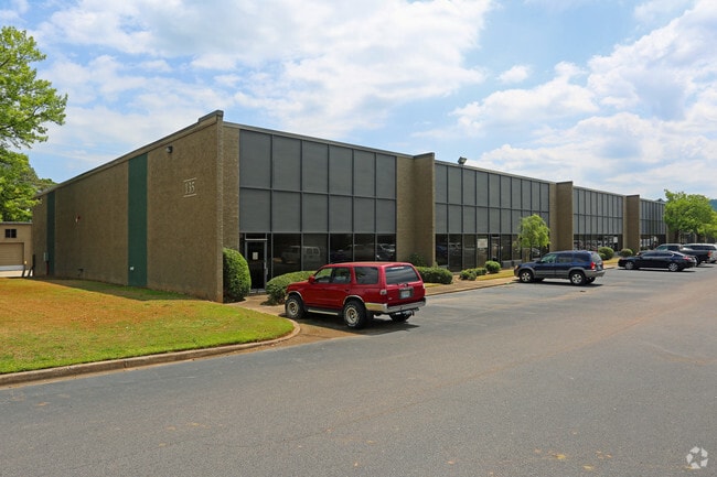
135 W Oxmoor Rd, Birmingham, AL 35209


NEARBY LISTINGS FOR SALE OR LEASE
Property Detail
135 W Oxmoor Rd
Birmingham-Hoover, AL
Republic Indl Park 1St Sector
29-00-27-2-000-014.000
COMM NE COR OF NW 1/4 TH S 510 FT S TO P O B TH S 510 FT S TH W 535 S TO W OXMOOR RD TH N 512 S TH E 505 S TO P O B SECT 27 TWSP 18S RANGE 3W
Warehouse
Jefferson
X
Alabama
01073C0554J
9-a
2023
6.09 AC
2024
Vulcan/Oxmoor
010706
Birmingham
150,000 SF
DEMOGRAPHICS near 135 W Oxmoor Rd
1 Mile
3 Mile
5 Mile
2024 Total Population
2,418
58,838
180,216
2029 Population
2,276
57,654
178,258
Pop Growth 2024-2029
(5.87%)
(2.01%)
(1.09%)
Average Age
35
38
39
2024 Total Households
1,076
25,742
76,280
HH Growth 2024-2029
(6.41%)
(1.99%)
(0.97%)
Median Household Inc
$77,583
$56,293
$52,810
Avg Household Size
2.20
2.20
2.20
2024 Avg HH Vehicles
2.00
2.00
2.00
Median Home Value
$317,293
$289,771
$272,835
Median Year Built
1990
1974
1970
Nearby Places
Map Layers
Map Styles
 Street
 Aerial
- Restaurants
- Banks
- Shops
- Fitness
- Groceries
SALE & LEASE HISTORY
LISTING DATE
SALE/LEASE

Sep 24, 2016
For Lease
Nearby Properties
Address
Land Use
TOTAL SIZE
Lot Size
Zoning
Address
Land Use
TOTAL SIZE
Lot Size
Zoning
978,879 SF
43.50 AC
I3
Address
Land Use
TOTAL SIZE
Lot Size
Zoning
242,746 SF
20.96 AC
MXDE
Address
Land Use
TOTAL SIZE
Lot Size
Zoning
334,805 SF
32.50 AC
MXD/
Address
Land Use
TOTAL SIZE
Lot Size
Zoning
200,927 SF
19 AC
PMUD
Address
Land Use
TOTAL SIZE
Lot Size
Zoning
209,765 SF
19.20 AC
I-3
Address
Land Use
TOTAL SIZE
Lot Size
Zoning
186,070 SF
16.60 AC
QB2
Address
Land Use
TOTAL SIZE
Lot Size
Zoning
311,982 SF
30 AC
R6
Address
Land Use
TOTAL SIZE
Lot Size
Zoning
282,421 SF
24.33 AC
R7
Address
Land Use
TOTAL SIZE
Lot Size
Zoning
92,332 SF
8.40 AC
Address
Land Use
TOTAL SIZE
Lot Size
Zoning
265,418 SF
26.55 AC
R2
Address
Land Use
TOTAL SIZE
Lot Size
Zoning
133,396 SF
19 AC
QR6
Address
Land Use
TOTAL SIZE
Lot Size
Zoning
403,758 SF
22.36 AC
R3
Address
Land Use
TOTAL SIZE
Lot Size
Zoning
285,719 SF
18 AC
R-4
Address
Land Use
TOTAL SIZE
Lot Size
Zoning
180,412 SF
14.89 AC
R6
Address
Land Use
TOTAL SIZE
Lot Size
Zoning
313,404 SF
19 AC
PMUD
Address
Land Use
TOTAL SIZE
Lot Size
Zoning
218,354 SF
15.23 AC
R4
Address
Land Use
TOTAL SIZE
Lot Size
Zoning
195,150 SF
11 AC
R-5
Address
Land Use
TOTAL SIZE
Lot Size
Zoning
52,239 SF
9 AC
PMUD
Address
Land Use
TOTAL SIZE
Lot Size
Zoning
267,289 SF
18.40 AC
L1
Address
Land Use
TOTAL SIZE
Lot Size
Zoning
517,500 SF
29 AC
I1
Address
Land Use
TOTAL SIZE
Lot Size
Zoning
189,182 SF
23.40 AC
PMUD
Address
Land Use
TOTAL SIZE
Lot Size
Zoning
246,696 SF
13.89 AC
R4
Address
Land Use
TOTAL SIZE
Lot Size
Zoning
199,445 SF
27 AC
PMUD
Address
Land Use
TOTAL SIZE
Lot Size
Zoning
261,834 SF
12.21 AC
R7
Address
Land Use
TOTAL SIZE
Lot Size
Zoning
182,026 SF
2.80 AC
I2
Address
Land Use
TOTAL SIZE
Lot Size
Zoning
224,856 SF
15 AC
R5
Address
Land Use
TOTAL SIZE
Lot Size
Zoning
96,446 SF
10 AC
I3
Address
Land Use
TOTAL SIZE
Lot Size
Zoning
168,589 SF
9.55 AC
R5
The World's #1 Commercial Real Estate Marketplace
Connect with us
© 2026 CoStar Group
The information above has been obtained from sources believed reliable. While we do not doubt its accuracy we have not verified it and make no guarantee, warranty or representation about it. It is your responsibility to independently confirm its accuracy and completeness. Any projections, opinions, assumptions, or estimates used are for example only and do not represent the current or future performance of the property. The value of this transaction to you depends on tax and other factors which should be evaluated by your tax, financial, and legal advisors. You and your advisors should conduct a careful, independent investigation of the property to determine to your satisfaction the suitability of the property for your needs.