Property Record
1351 S 8Th St, Springfield, IL 62703


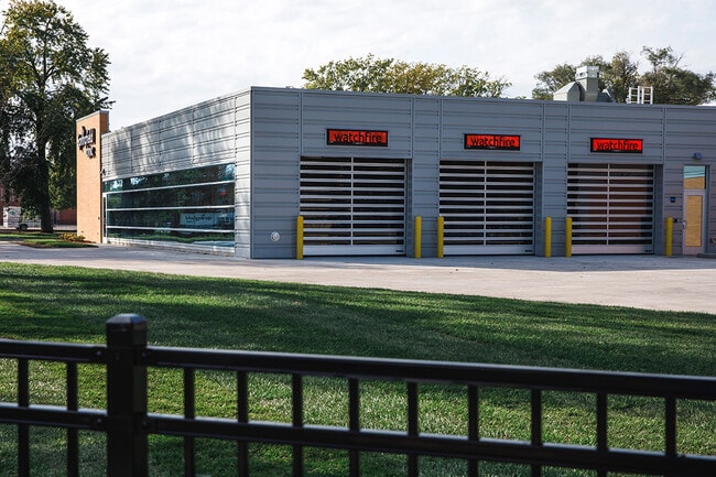
Property Detail
1351 S 8Th St
Other Market Areas
LOTS 1 THRU 16 E ILES 2ND ADD & VAC ALLEY BLK 8 34-16-5
Springfield, IL
SANGAMON
14-34.0-386-004
Illinois
Commercialnec
1-16
2025
2.32 AC
2025
Springfield/Decatur
001800
NEARBY LISTINGS FOR SALE OR LEASE
DEMOGRAPHICS near 1351 S 8Th St
1 mile
3 mile
5 mile
2025 Total Population
14,052
80,811
120,620
2030 Population
14,345
81,184
120,544
Pop Growth 2025-2030
+ 2.09%
+ 0.46%
(0.06%)
Average Age
38
40
42
2025 Total Households
6,405
36,938
54,269
HH Growth 2025-2030
+ 2.06%
+ 0.36%
(0.14%)
Median Household Inc
$42,883
$51,018
$61,092
Avg Household Size
2.00
2.10
2.10
2025 Avg HH Vehicles
1.00
1.00
2.00
Median Home Value
$80,224
$113,325
$150,396
Median Year Built
1948
1956
1965
Nearby Places
Map Layers
Map Styles
 Street
 Aerial
Layers
 Traffic
 Biking
Places
Listings with unknown addresses are not visible on the map
- Restaurants
- Banks
- Shops
- Fitness
- Groceries
PUBLIC TRANSPORTATION
COMMUTER RAIL
Springfield (Lincoln Service - Amtrak, Lincoln Service Missouri River Runner - Amtrak, Texas Eagle - Amtrak)
Drive
Walk
Distance
Springfield (Lincoln Service - Amtrak, Lincoln Service Missouri River Runner - Amtrak, Texas Eagle - Amtrak)
3 min
1.4 mi
AIRPORT
Abraham Lincoln Capital
Drive
Walk
Distance
Abraham Lincoln Capital
12 min
5.0 mi
Freight Ports
Port Milwaukee
Drive
Walk
Distance
Port Milwaukee
316 min
275.5 mi
SALE & LEASE HISTORY
LISTING DATE
SALE/LEASE

May 07, 2025
For Sale
Nearby Properties
Address
Land Use
TOTAL SIZE
Lot Size
Zoning
Address
Land Use
TOTAL SIZE
Lot Size
Zoning
19.94 AC
Address
Land Use
TOTAL SIZE
Lot Size
Zoning
1.16 AC
Address
Land Use
TOTAL SIZE
Lot Size
Zoning
1.90 AC
Address
Land Use
TOTAL SIZE
Lot Size
Zoning
1.05 AC
Address
Land Use
TOTAL SIZE
Lot Size
Zoning
Address
Land Use
TOTAL SIZE
Lot Size
Zoning
Address
Land Use
TOTAL SIZE
Lot Size
Zoning
4.50 AC
Address
Land Use
TOTAL SIZE
Lot Size
Zoning
Address
Land Use
TOTAL SIZE
Lot Size
Zoning
Address
Land Use
TOTAL SIZE
Lot Size
Zoning
12.88 AC
Address
Land Use
TOTAL SIZE
Lot Size
Zoning
12.77 AC
Address
Land Use
TOTAL SIZE
Lot Size
Zoning
Address
Land Use
TOTAL SIZE
Lot Size
Zoning
Address
Land Use
TOTAL SIZE
Lot Size
Zoning
1.22 AC
Address
Land Use
TOTAL SIZE
Lot Size
Zoning
3.17 AC
Address
Land Use
TOTAL SIZE
Lot Size
Zoning
Address
Land Use
TOTAL SIZE
Lot Size
Zoning
Address
Land Use
TOTAL SIZE
Lot Size
Zoning
2.36 AC
Address
Land Use
TOTAL SIZE
Lot Size
Zoning
1.39 AC
Address
Land Use
TOTAL SIZE
Lot Size
Zoning
10.13 AC
Address
Land Use
TOTAL SIZE
Lot Size
Zoning
6.34 AC
Address
Land Use
TOTAL SIZE
Lot Size
Zoning
Address
Land Use
TOTAL SIZE
Lot Size
Zoning
7.80 AC
Address
Land Use
TOTAL SIZE
Lot Size
Zoning
Address
Land Use
TOTAL SIZE
Lot Size
Zoning
Address
Land Use
TOTAL SIZE
Lot Size
Zoning
Address
Land Use
TOTAL SIZE
Lot Size
Zoning
Address
Land Use
TOTAL SIZE
Lot Size
Zoning
9.42 AC
Address
Land Use
TOTAL SIZE
Lot Size
Zoning
Address
Land Use
TOTAL SIZE
Lot Size
Zoning
The World's #1 Commercial Real Estate Marketplace
Connect with us
© 2026 CoStar Group
The information above has been obtained from sources believed reliable. While we do not doubt its accuracy we have not verified it and make no guarantee, warranty or representation about it. It is your responsibility to independently confirm its accuracy and completeness. Any projections, opinions, assumptions, or estimates used are for example only and do not represent the current or future performance of the property. The value of this transaction to you depends on tax and other factors which should be evaluated by your tax, financial, and legal advisors. You and your advisors should conduct a careful, independent investigation of the property to determine to your satisfaction the suitability of the property for your needs.