Property Record
13637 S State Highway 51, Coweta, OK 74429
NEARBY LISTINGS FOR SALE OR LEASE
Property Detail
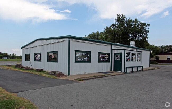
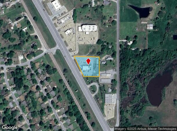
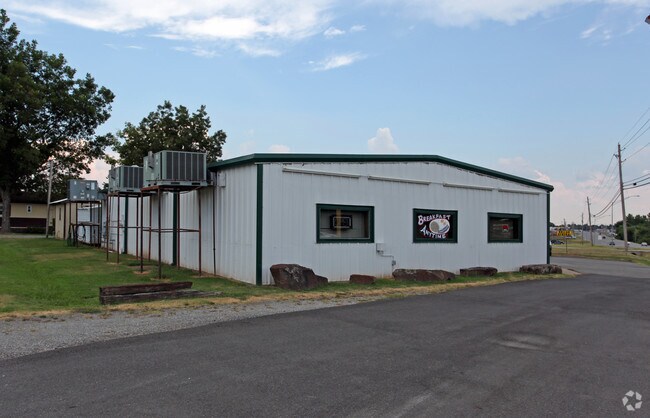
13637 S State Highway 51
730020017
Flat Rock Acres
Restaurantbuilding
12-17-15 BEG 208'W & 60' S OF NE COR OF NE SE SEC-N89DEG 57'W 286.4' TO E R/W LINE HWY 51 -S28 DEG 36' E 249.4' ALONG R/W LN
X
Wagoner
40145C0260H
Oklahoma
2024
1.09 AC
2025
Wagoner County
030603
Tulsa
2,400 SF
Tulsa, OK
DEMOGRAPHICS near 13637 S State Highway 51
1 Mile
3 Mile
5 Mile
2024 Total Population
3,625
14,400
23,711
2029 Population
4,220
16,830
27,757
Pop Growth 2024-2029
+ 16.41%
+ 16.88%
+ 17.06%
Average Age
38
39
39
2024 Total Households
1,381
5,349
8,673
HH Growth 2024-2029
+ 16.22%
+ 16.69%
+ 16.87%
Median Household Inc
$49,446
$65,877
$74,512
Avg Household Size
2.60
2.70
2.70
2024 Avg HH Vehicles
2.00
2.00
2.00
Median Home Value
$154,799
$194,657
$234,452
Median Year Built
1977
1993
1996
Nearby Places
Map Layers
Map Styles
 Street
 Aerial
- Restaurants
- Banks
- Shops
- Fitness
- Groceries
PUBLIC TRANSPORTATION
AIRPORT
Tulsa International
DRIVE
WALK
Distance
Tulsa International
36 min
26.3 mi
Freight Ports
DRIVE
WALK
Distance
41 min
24.8 mi
Nearby Properties
Address
Land Use
TOTAL SIZE
Lot Size
Zoning
Address
Land Use
TOTAL SIZE
Lot Size
Zoning
1,936 SF
4.74 AC
Address
Land Use
TOTAL SIZE
Lot Size
Zoning
1,896 SF
2.25 AC
Address
Land Use
TOTAL SIZE
Lot Size
Zoning
14,995 SF
1.68 AC
Address
Land Use
TOTAL SIZE
Lot Size
Zoning
3,800 SF
4.66 AC
Address
Land Use
TOTAL SIZE
Lot Size
Zoning
154 SF
1.36 AC
Address
Land Use
TOTAL SIZE
Lot Size
Zoning
1,344 SF
160 AC
Address
Land Use
TOTAL SIZE
Lot Size
Zoning
4,000 SF
0.51 AC
Address
Land Use
TOTAL SIZE
Lot Size
Zoning
18,120 SF
2 AC
Address
Land Use
TOTAL SIZE
Lot Size
Zoning
8,000 SF
3.91 AC
Address
Land Use
TOTAL SIZE
Lot Size
Zoning
276 SF
3.29 AC
Address
Land Use
TOTAL SIZE
Lot Size
Zoning
3,600 SF
3.35 AC
Address
Land Use
TOTAL SIZE
Lot Size
Zoning
3,304 SF
1.84 AC
Address
Land Use
TOTAL SIZE
Lot Size
Zoning
2,863 SF
1.18 AC
Address
Land Use
TOTAL SIZE
Lot Size
Zoning
6,810 SF
1.37 AC
Address
Land Use
TOTAL SIZE
Lot Size
Zoning
1,846 SF
0.80 AC
Address
Land Use
TOTAL SIZE
Lot Size
Zoning
3,431 SF
0.53 AC
Address
Land Use
TOTAL SIZE
Lot Size
Zoning
3,360 SF
0.32 AC
Address
Land Use
TOTAL SIZE
Lot Size
Zoning
2,400 SF
81.08 AC
Address
Land Use
TOTAL SIZE
Lot Size
Zoning
7,968 SF
0.17 AC
Address
Land Use
TOTAL SIZE
Lot Size
Zoning
1,620 SF
1.65 AC
Address
Land Use
TOTAL SIZE
Lot Size
Zoning
Address
Land Use
TOTAL SIZE
Lot Size
Zoning
16,067 SF
1.91 AC
Address
Land Use
TOTAL SIZE
Lot Size
Zoning
2,346 SF
0.39 AC
Address
Land Use
TOTAL SIZE
Lot Size
Zoning
4,640 SF
0.86 AC
Address
Land Use
TOTAL SIZE
Lot Size
Zoning
4,857 SF
1.19 AC
The World's #1 Commercial Real Estate Marketplace
Connect with us
© 2026 CoStar Group
The information above has been obtained from sources believed reliable. While we do not doubt its accuracy we have not verified it and make no guarantee, warranty or representation about it. It is your responsibility to independently confirm its accuracy and completeness. Any projections, opinions, assumptions, or estimates used are for example only and do not represent the current or future performance of the property. The value of this transaction to you depends on tax and other factors which should be evaluated by your tax, financial, and legal advisors. You and your advisors should conduct a careful, independent investigation of the property to determine to your satisfaction the suitability of the property for your needs.