Property Record
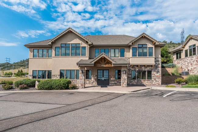
13986 W Bowles Ave, Littleton, CO 80127
This Property Is For Sale
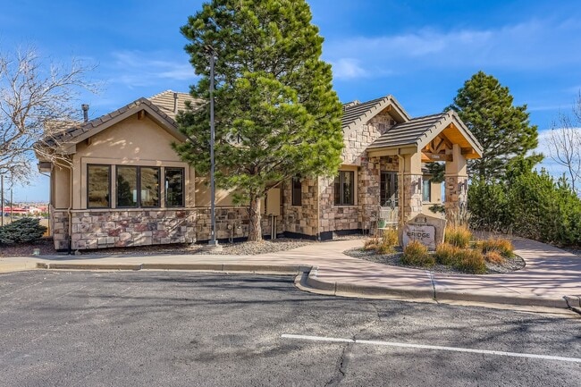
NEARBY LISTINGS FOR SALE OR LEASE
Property Detail
13986 W Bowles Ave
Denver-Aurora-Lakewood, CO
Dakota Ridge Commons Condos
59-191-01-015
SECTION 19 TOWNSHIP 05 RANGE 69 QTR NE SUBDIVISIONCD 188605 SUBDIVISIONNAME DAKOTA RIDGE COMMONS CONDOS BLOCK 00F LOT 000B TRACT
Commercialcondominium
Jefferson
X
Colorado
08059C0382F
b
2023
0.02 AC
2024
Southwest Denver
012043
Denver
693 SF
DEMOGRAPHICS near 13986 W Bowles Ave
1 Mile
3 Mile
5 Mile
2024 Total Population
3,412
52,926
134,702
2029 Population
3,353
51,987
132,885
Pop Growth 2024-2029
(1.73%)
(1.77%)
(1.35%)
Average Age
41
42
42
2024 Total Households
1,352
20,071
53,233
HH Growth 2024-2029
(1.78%)
(1.85%)
(1.37%)
Median Household Inc
$121,754
$121,739
$108,304
Avg Household Size
2.50
2.60
2.50
2024 Avg HH Vehicles
2.00
2.00
2.00
Median Home Value
$678,510
$616,139
$581,905
Median Year Built
1994
1988
1987
Nearby Places
- Restaurants
- Banks
- Shops
- Fitness
- Groceries
PUBLIC TRANSPORTATION
AIRPORT
Denver International
DRIVE
WALK
Distance
Denver International
57 min
44.3 mi
Nearby Properties
Address
Land Use
TOTAL SIZE
Lot Size
Zoning
Address
Land Use
TOTAL SIZE
Lot Size
Zoning
272,246 SF
31.76 AC
PD
Address
Land Use
TOTAL SIZE
Lot Size
Zoning
5,075 SF
1,955.14 AC
A2
Address
Land Use
TOTAL SIZE
Lot Size
Zoning
294,876 SF
12.25 AC
Address
Land Use
TOTAL SIZE
Lot Size
Zoning
150,951 SF
17.90 AC
PD
Address
Land Use
TOTAL SIZE
Lot Size
Zoning
101,699 SF
10.34 AC
Address
Land Use
TOTAL SIZE
Lot Size
Zoning
175,000 SF
36.25 AC
PD
Address
Land Use
TOTAL SIZE
Lot Size
Zoning
97,000 SF
9.88 AC
PD
Address
Land Use
TOTAL SIZE
Lot Size
Zoning
218,391 SF
9.73 AC
PD
Address
Land Use
TOTAL SIZE
Lot Size
Zoning
70,614 SF
4.78 AC
CDOLI
Address
Land Use
TOTAL SIZE
Lot Size
Zoning
86,898 SF
8.70 AC
PD
Address
Land Use
TOTAL SIZE
Lot Size
Zoning
120,766 SF
20.56 AC
PD
Address
Land Use
TOTAL SIZE
Lot Size
Zoning
100,550 SF
7.72 AC
PD
Address
Land Use
TOTAL SIZE
Lot Size
Zoning
188,653 SF
17.64 AC
PD
Address
Land Use
TOTAL SIZE
Lot Size
Zoning
124,224 SF
1.56 AC
Address
Land Use
TOTAL SIZE
Lot Size
Zoning
65,463 SF
4.80 AC
PD
Address
Land Use
TOTAL SIZE
Lot Size
Zoning
68,365 SF
12.17 AC
PD
Address
Land Use
TOTAL SIZE
Lot Size
Zoning
107,693 SF
9.17 AC
PD
Address
Land Use
TOTAL SIZE
Lot Size
Zoning
57,221 SF
2.31 AC
Address
Land Use
TOTAL SIZE
Lot Size
Zoning
187,987 SF
10.07 AC
PD
Address
Land Use
TOTAL SIZE
Lot Size
Zoning
177,688 SF
8.45 AC
Address
Land Use
TOTAL SIZE
Lot Size
Zoning
77,135 SF
8.09 AC
Address
Land Use
TOTAL SIZE
Lot Size
Zoning
71,791 SF
24.38 AC
PD
Address
Land Use
TOTAL SIZE
Lot Size
Zoning
134.98 AC
PD
Address
Land Use
TOTAL SIZE
Lot Size
Zoning
12,367 SF
4.18 AC
Address
Land Use
TOTAL SIZE
Lot Size
Zoning
29,094 SF
11.33 AC
Address
Land Use
TOTAL SIZE
Lot Size
Zoning
59,816 SF
16.92 AC
Address
Land Use
TOTAL SIZE
Lot Size
Zoning
105,392 SF
7.44 AC
Address
Land Use
TOTAL SIZE
Lot Size
Zoning
28,533 SF
11.07 AC
Address
Land Use
TOTAL SIZE
Lot Size
Zoning
56,769 SF
2.28 AC
Address
Land Use
TOTAL SIZE
Lot Size
Zoning
33,467 SF
2.51 AC
CDOLI
The World's #1 Commercial Real Estate Marketplace
Connect with us
© 2025 CoStar Group
The information above has been obtained from sources believed reliable. While we do not doubt its accuracy we have not verified it and make no guarantee, warranty or representation about it. It is your responsibility to independently confirm its accuracy and completeness. Any projections, opinions, assumptions, or estimates used are for example only and do not represent the current or future performance of the property. The value of this transaction to you depends on tax and other factors which should be evaluated by your tax, financial, and legal advisors. You and your advisors should conduct a careful, independent investigation of the property to determine to your satisfaction the suitability of the property for your needs.