Property Record
1400 Navco Rd, Mobile, AL 36605
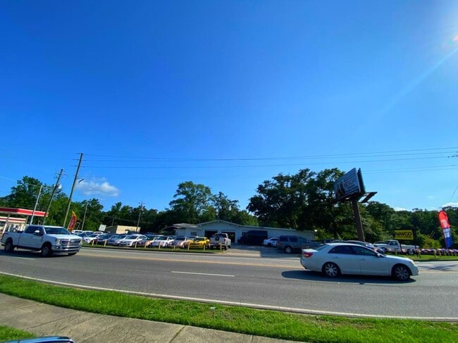


This Property Is For Sale
Property Detail
1400 Navco Rd
Mobile, AL
FROM NE COR OF LOT 4 OF MCRAES 1ST ADD MBK 2/47 RUN SLY ALG W ROW/L NAVCO RD 707.8 FT TO SW INT OF MCVAY DR & NAVCO RD & POB
32-02-37-0-004-097
MOBILE
Autorepair
Alabama
AE The base floodplain where base flood elevations are provided. AE Zones are now used on new format FIRMs instead of A1-A30 Zones.
4
2025
0.45 AC
2025
Midtown
002200
Mobile
3,570 SF
NEARBY LISTINGS FOR SALE OR LEASE
DEMOGRAPHICS near 1400 Navco Rd
1 mile
3 mile
5 mile
2024 Total Population
7,287
51,547
129,345
2029 Population
7,252
51,337
128,937
Pop Growth 2024-2029
(0.48%)
(0.41%)
(0.32%)
Average Age
37
38
40
2024 Total Households
2,614
21,397
54,446
HH Growth 2024-2029
(0.65%)
(0.54%)
(0.40%)
Median Household Inc
$38,201
$41,298
$44,950
Avg Household Size
2.60
2.30
2.30
2024 Avg HH Vehicles
2.00
2.00
2.00
Median Home Value
$62,628
$124,945
$160,557
Median Year Built
1964
1964
1969
Nearby Places
Map Layers
Map Styles
 Street
 Aerial
Transit
 Traffic
 Biking
Places
Listings with unknown addresses are not visible on the map
- Restaurants
- Banks
- Shops
- Fitness
- Groceries
PUBLIC TRANSPORTATION
AIRPORT
Mobile International
Drive
Walk
Distance
Mobile International
8 min
3.0 mi
Mobile Regional
Drive
Walk
Distance
Mobile Regional
25 min
11.6 mi
Freight Ports
Port of Mobile
Drive
Walk
Distance
Port of Mobile
11 min
6.3 mi
Nearby Properties
Address
Land Use
TOTAL SIZE
Lot Size
Zoning
Address
Land Use
TOTAL SIZE
Lot Size
Zoning
285,390 SF
131.72 AC
Address
Land Use
TOTAL SIZE
Lot Size
Zoning
115,875 SF
144.02 AC
Address
Land Use
TOTAL SIZE
Lot Size
Zoning
296,060 SF
40.49 AC
Address
Land Use
TOTAL SIZE
Lot Size
Zoning
169,511 SF
44.42 AC
Address
Land Use
TOTAL SIZE
Lot Size
Zoning
43,943 SF
156.19 AC
Address
Land Use
TOTAL SIZE
Lot Size
Zoning
139,460 SF
27.51 AC
Address
Land Use
TOTAL SIZE
Lot Size
Zoning
106,800 SF
17.69 AC
Address
Land Use
TOTAL SIZE
Lot Size
Zoning
194,016 SF
10.74 AC
Address
Land Use
TOTAL SIZE
Lot Size
Zoning
30,972 SF
4.75 AC
Address
Land Use
TOTAL SIZE
Lot Size
Zoning
228,018 SF
4.80 AC
Address
Land Use
TOTAL SIZE
Lot Size
Zoning
568,560 SF
34.83 AC
Address
Land Use
TOTAL SIZE
Lot Size
Zoning
277,067 SF
93.54 AC
Address
Land Use
TOTAL SIZE
Lot Size
Zoning
34,016 SF
162.48 AC
Address
Land Use
TOTAL SIZE
Lot Size
Zoning
56,656 SF
13.61 AC
Address
Land Use
TOTAL SIZE
Lot Size
Zoning
208,683 SF
11.68 AC
Address
Land Use
TOTAL SIZE
Lot Size
Zoning
29,448 SF
7.64 AC
Address
Land Use
TOTAL SIZE
Lot Size
Zoning
150,800 SF
15.39 AC
Address
Land Use
TOTAL SIZE
Lot Size
Zoning
16,584 SF
15.25 AC
Address
Land Use
TOTAL SIZE
Lot Size
Zoning
45,648 SF
6.32 AC
Address
Land Use
TOTAL SIZE
Lot Size
Zoning
108,130 SF
67.62 AC
Address
Land Use
TOTAL SIZE
Lot Size
Zoning
99,551 SF
8.16 AC
Address
Land Use
TOTAL SIZE
Lot Size
Zoning
18,392 SF
15.69 AC
Address
Land Use
TOTAL SIZE
Lot Size
Zoning
1,995 SF
38.26 AC
Address
Land Use
TOTAL SIZE
Lot Size
Zoning
207,036 SF
13.39 AC
Address
Land Use
TOTAL SIZE
Lot Size
Zoning
44,980 SF
Address
Land Use
TOTAL SIZE
Lot Size
Zoning
144,515 SF
8.50 AC
Address
Land Use
TOTAL SIZE
Lot Size
Zoning
142.28 AC
Address
Land Use
TOTAL SIZE
Lot Size
Zoning
131,480 SF
21 AC
Address
Land Use
TOTAL SIZE
Lot Size
Zoning
20,832 SF
93.54 AC
Address
Land Use
TOTAL SIZE
Lot Size
Zoning
50,582 SF
4.39 AC
The World's #1 Commercial Real Estate Marketplace
Connect with us
© 2026 CoStar Group
The information above has been obtained from sources believed reliable. While we do not doubt its accuracy we have not verified it and make no guarantee, warranty or representation about it. It is your responsibility to independently confirm its accuracy and completeness. Any projections, opinions, assumptions, or estimates used are for example only and do not represent the current or future performance of the property. The value of this transaction to you depends on tax and other factors which should be evaluated by your tax, financial, and legal advisors. You and your advisors should conduct a careful, independent investigation of the property to determine to your satisfaction the suitability of the property for your needs.