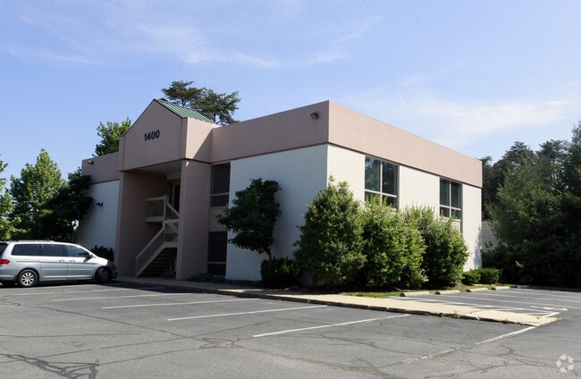
Property Record
1400 Shepard Dr, Sterling, VA 20164

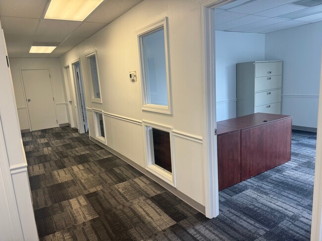

Current Lease Availabilities
Property Detail
1400 Shepard Dr
033-37-0147
STERLING INDUSTRIAL PARK SEC.1 LOT 5 200409170101131
Officebuilding
Loudoun
PDIP
Virginia
B and X Area of moderate flood hazard, usually the area between the limits of the 100-year and 500-year floods.
5
2025
1.44 AC
2025
Route 28 Corridor North
611601
Washington, DC
20,868 SF
Washington-Arlington-Alexandria, DC-VA-MD-WV
NEARBY LISTINGS FOR SALE OR LEASE
DEMOGRAPHICS near 1400 Shepard Dr
1 mile
3 mile
5 mile
2025 Total Population
9,142
86,382
261,379
2030 Population
9,374
88,870
269,679
Pop Growth 2025-2030
+ 2.54%
+ 2.88%
+ 3.18%
Average Age
37
37
39
2025 Total Households
2,811
28,807
94,952
HH Growth 2025-2030
+ 2.56%
+ 3.19%
+ 3.38%
Median Household Inc
$120,082
$127,823
$143,947
Avg Household Size
3.10
2.90
2.70
2025 Avg HH Vehicles
2.00
2.00
2.00
Median Home Value
$484,803
$619,010
$686,465
Median Year Built
1980
1988
1994
Nearby Places
Map Layers
Map Styles
 Street
 Aerial
Layers
 Traffic
 Biking
Places
Listings with unknown addresses are not visible on the map
- Restaurants
- Banks
- Shops
- Fitness
- Groceries
PUBLIC TRANSPORTATION
AIRPORT
Washington Dulles International
Drive
Walk
Distance
Washington Dulles International
13 min
5.0 mi
Ronald Reagan Washington Ntl
Drive
Walk
Distance
Ronald Reagan Washington Ntl
46 min
30.2 mi
Freight Ports
Port of Baltimore
Drive
Walk
Distance
Port of Baltimore
83 min
62.0 mi
Nearby Properties
Address
Land Use
TOTAL SIZE
Lot Size
Zoning
Address
Land Use
TOTAL SIZE
Lot Size
Zoning
518,449 SF
32.11 AC
IP
Address
Land Use
TOTAL SIZE
Lot Size
Zoning
462,210 SF
PDOP
Address
Land Use
TOTAL SIZE
Lot Size
Zoning
521,784 SF
PDOP
Address
Land Use
TOTAL SIZE
Lot Size
Zoning
650,346 SF
PDMUB
Address
Land Use
TOTAL SIZE
Lot Size
Zoning
800,702 SF
111.70 AC
PDIP
Address
Land Use
TOTAL SIZE
Lot Size
Zoning
1,434,706 SF
30.91 AC
PDRDP
Address
Land Use
TOTAL SIZE
Lot Size
Zoning
789,350 SF
31.73 AC
PDOP
Address
Land Use
TOTAL SIZE
Lot Size
Zoning
446,512 SF
25.41 AC
IP
Address
Land Use
TOTAL SIZE
Lot Size
Zoning
368,624 SF
8.85 AC
PDOP
Address
Land Use
TOTAL SIZE
Lot Size
Zoning
234,124 SF
23.84 AC
PDOP
Address
Land Use
TOTAL SIZE
Lot Size
Zoning
672,272 SF
44.53 AC
PDIP
Address
Land Use
TOTAL SIZE
Lot Size
Zoning
679,455 SF
31.97 AC
PDIP
Address
Land Use
TOTAL SIZE
Lot Size
Zoning
427,320 SF
16.33 AC
PDIP
Address
Land Use
TOTAL SIZE
Lot Size
Zoning
364,600 SF
PDOP
Address
Land Use
TOTAL SIZE
Lot Size
Zoning
302,180 SF
10.92 AC
PDOP
Address
Land Use
TOTAL SIZE
Lot Size
Zoning
310,717 SF
14.30 AC
PDOP
Address
Land Use
TOTAL SIZE
Lot Size
Zoning
288,403 SF
16.56 AC
PDOP
Address
Land Use
TOTAL SIZE
Lot Size
Zoning
286,865 SF
18.56 AC
IP
Address
Land Use
TOTAL SIZE
Lot Size
Zoning
493,504 SF
15.73 AC
PDOP
Address
Land Use
TOTAL SIZE
Lot Size
Zoning
308,630 SF
14.44 AC
PDIP
Address
Land Use
TOTAL SIZE
Lot Size
Zoning
147,260 SF
33.04 AC
PDIP
Address
Land Use
TOTAL SIZE
Lot Size
Zoning
565,680 SF
18.44 AC
PDIP
Address
Land Use
TOTAL SIZE
Lot Size
Zoning
228,606 SF
PDOP
Address
Land Use
TOTAL SIZE
Lot Size
Zoning
1,434,706 SF
96.74 AC
PDRDP
Address
Land Use
TOTAL SIZE
Lot Size
Zoning
455,793 SF
22.60 AC
IP
Address
Land Use
TOTAL SIZE
Lot Size
Zoning
180,355 SF
12.89 AC
PDIP
Address
Land Use
TOTAL SIZE
Lot Size
Zoning
362,108 SF
18.82 AC
PDOP
Address
Land Use
TOTAL SIZE
Lot Size
Zoning
764,166 SF
73.90 AC
PDIP
Address
Land Use
TOTAL SIZE
Lot Size
Zoning
226,456 SF
17.09 AC
PDIP
Address
Land Use
TOTAL SIZE
Lot Size
Zoning
154,125 SF
9.68 AC
PDIP
The World's #1 Commercial Real Estate Marketplace
Connect with us
© 2026 CoStar Group
The information above has been obtained from sources believed reliable. While we do not doubt its accuracy we have not verified it and make no guarantee, warranty or representation about it. It is your responsibility to independently confirm its accuracy and completeness. Any projections, opinions, assumptions, or estimates used are for example only and do not represent the current or future performance of the property. The value of this transaction to you depends on tax and other factors which should be evaluated by your tax, financial, and legal advisors. You and your advisors should conduct a careful, independent investigation of the property to determine to your satisfaction the suitability of the property for your needs.