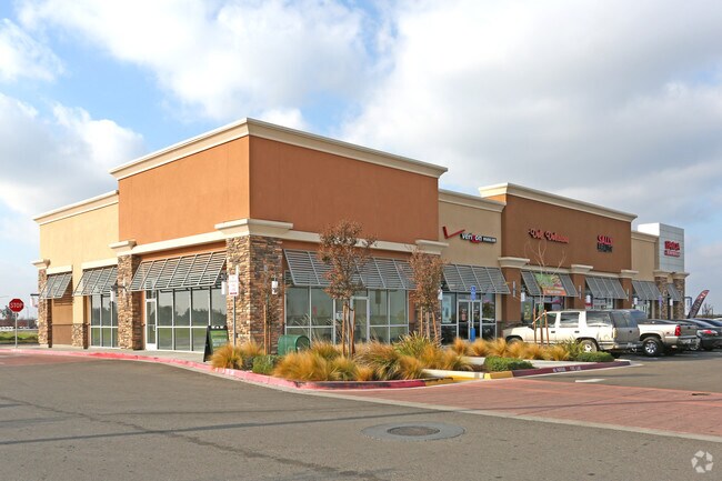
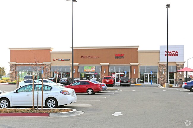
Property Record
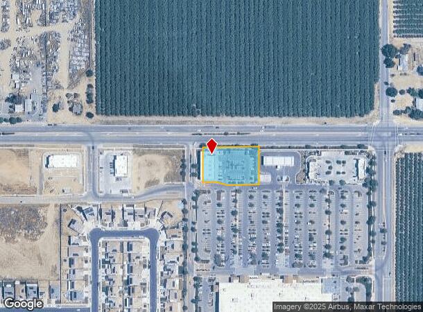
14049 W Whitesbridge Ave, Kerman, CA 93630
NEARBY LISTINGS FOR SALE OR LEASE
Property Detail
14049 W Whitesbridge Ave
023-220-68S
SUR RTS PARCEL 4 P/M 09-02 BK 71 PGS 96-98
Restaurantbuilding
Fresno
X
California
06019C2075H
0.99 AC
2025
W Outlying Fresno Cnty
2025
Fresno
004006
Fresno, CA
8,125 SF
DEMOGRAPHICS near 14049 W Whitesbridge Ave
1 Mile
3 Mile
5 Mile
2024 Total Population
7,094
18,080
20,464
2029 Population
7,247
18,456
20,727
Pop Growth 2024-2029
+ 2.16%
+ 2.08%
+ 1.29%
Average Age
35
34
34
2024 Total Households
2,047
5,038
5,725
HH Growth 2024-2029
+ 2.20%
+ 2.00%
+ 1.19%
Median Household Inc
$44,940
$61,171
$62,232
Avg Household Size
3.50
3.60
3.60
2024 Avg HH Vehicles
2.00
2.00
2.00
Median Home Value
$221,296
$278,847
$286,954
Median Year Built
1985
1992
1990
Nearby Places
Map Layers
Map Styles
 Street
 Aerial
- Restaurants
- Banks
- Shops
- Fitness
- Groceries
PUBLIC TRANSPORTATION
AIRPORT
Fresno Yosemite International
DRIVE
WALK
Distance
Fresno Yosemite International
28 min
19.8 mi
SALE & LEASE HISTORY
LISTING DATE
SALE/LEASE

Dec 09, 2016
For Lease
Nearby Properties
Address
Land Use
TOTAL SIZE
Lot Size
Zoning
Address
Land Use
TOTAL SIZE
Lot Size
Zoning
477,340 SF
21.45 AC
Address
Land Use
TOTAL SIZE
Lot Size
Zoning
151,227 SF
17.22 AC
C6
Address
Land Use
TOTAL SIZE
Lot Size
Zoning
65,017 SF
4.38 AC
R2
Address
Land Use
TOTAL SIZE
Lot Size
Zoning
82,656 SF
6.76 AC
R2
Address
Land Use
TOTAL SIZE
Lot Size
Zoning
63,187 SF
3.90 AC
R3
Address
Land Use
TOTAL SIZE
Lot Size
Zoning
63,187 SF
3.87 AC
R3
Address
Land Use
TOTAL SIZE
Lot Size
Zoning
92,979 SF
5.73 AC
R1
Address
Land Use
TOTAL SIZE
Lot Size
Zoning
90,082 SF
9.12 AC
C2
Address
Land Use
TOTAL SIZE
Lot Size
Zoning
70,786 SF
5.46 AC
SDR2
Address
Land Use
TOTAL SIZE
Lot Size
Zoning
16,000 SF
2.08 AC
Address
Land Use
TOTAL SIZE
Lot Size
Zoning
28.36 AC
M2
Address
Land Use
TOTAL SIZE
Lot Size
Zoning
69,820 SF
19.72 AC
Address
Land Use
TOTAL SIZE
Lot Size
Zoning
16,834 SF
0.96 AC
CG
Address
Land Use
TOTAL SIZE
Lot Size
Zoning
18,340 SF
1.21 AC
CG
Address
Land Use
TOTAL SIZE
Lot Size
Zoning
64,484 SF
13.62 AC
M1
Address
Land Use
TOTAL SIZE
Lot Size
Zoning
129,750 SF
12.52 AC
M2
Address
Land Use
TOTAL SIZE
Lot Size
Zoning
13,225 SF
1.67 AC
C5
Address
Land Use
TOTAL SIZE
Lot Size
Zoning
99.62 AC
Address
Land Use
TOTAL SIZE
Lot Size
Zoning
166,410 SF
9.80 AC
M2
Address
Land Use
TOTAL SIZE
Lot Size
Zoning
35,160 SF
3.45 AC
RM
Address
Land Use
TOTAL SIZE
Lot Size
Zoning
31,484 SF
3.03 AC
R2
Address
Land Use
TOTAL SIZE
Lot Size
Zoning
15,447 SF
1.95 AC
Address
Land Use
TOTAL SIZE
Lot Size
Zoning
1.02 AC
C5
Address
Land Use
TOTAL SIZE
Lot Size
Zoning
1,720 SF
20 AC
AE20
Address
Land Use
TOTAL SIZE
Lot Size
Zoning
5,161 SF
79.01 AC
AE20
Address
Land Use
TOTAL SIZE
Lot Size
Zoning
4,416 SF
80 AC
AE20
Address
Land Use
TOTAL SIZE
Lot Size
Zoning
10,186 SF
8.19 AC
R1
Address
Land Use
TOTAL SIZE
Lot Size
Zoning
14,375 SF
19.72 AC
AE20
The World's #1 Commercial Real Estate Marketplace
Connect with us
© 2025 CoStar Group
The information above has been obtained from sources believed reliable. While we do not doubt its accuracy we have not verified it and make no guarantee, warranty or representation about it. It is your responsibility to independently confirm its accuracy and completeness. Any projections, opinions, assumptions, or estimates used are for example only and do not represent the current or future performance of the property. The value of this transaction to you depends on tax and other factors which should be evaluated by your tax, financial, and legal advisors. You and your advisors should conduct a careful, independent investigation of the property to determine to your satisfaction the suitability of the property for your needs.