Property Record
14190 Orchard Pkwy, Westminster, CO 80023


Current Lease Availabilities
Property Detail
14190 Orchard Pkwy
Denver-Aurora-Centennial, CO
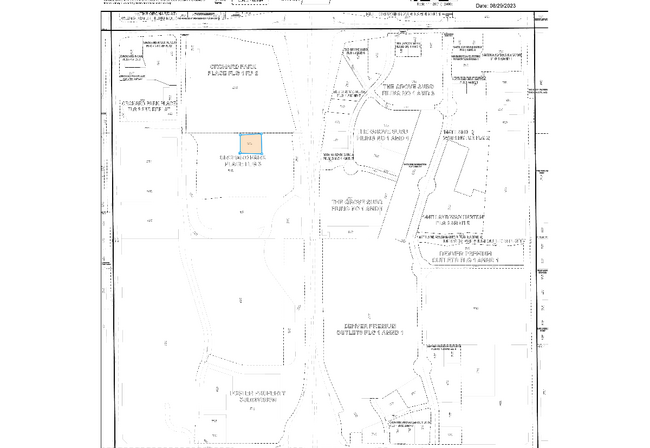
ORCHARD PARK PLACE SUBD FLG 3 LOT 1 DESC AS COM AT THE CEN4 COR OF SD SEC 33 TH N 34D 56M 48S W A DIST OF 1297/64 FT TO THE POB TH N 90D 00M 00S W A DIST OF 273/46 FT TH N 00D 00M 00S E A DIST OF 248/61 FT TH N 90D 00M 00S E A DIST OF 273/46 FT TH S
1573-22-2-01-010
ADAMS
Officebuilding
Colorado
2024
1
2025
1.56 AC
060100
North Denver
74,610 SF
Denver
NEARBY LISTINGS FOR SALE OR LEASE
DEMOGRAPHICS near 14190 Orchard Pkwy
1 mile
3 mile
5 mile
2025 Total Population
5,094
68,236
212,022
2030 Population
5,384
70,744
220,299
Pop Growth 2025-2030
+ 5.69%
+ 3.68%
+ 3.90%
Average Age
37
38
39
2025 Total Households
2,188
24,973
77,459
HH Growth 2025-2030
+ 6.54%
+ 4.00%
+ 4.16%
Median Household Inc
$116,396
$122,590
$118,501
Avg Household Size
2.30
2.70
2.70
2025 Avg HH Vehicles
2.00
2.00
2.00
Median Home Value
$781,120
$688,763
$655,631
Median Year Built
2010
2000
1997
Nearby Places
Map Layers
Map Styles
 Street
 Aerial
Transit
 Traffic
 Biking
Places
Listings with unknown addresses are not visible on the map
- Restaurants
- Banks
- Shops
- Fitness
- Groceries
PUBLIC TRANSPORTATION
COMMUTER RAIL
Eastlake - 124Th Station Track 2 (Union Station to Eastlake & 124th Station - Regional Transportation District)
Drive
Walk
Distance
Eastlake - 124Th Station Track 2 (Union Station to Eastlake & 124th Station - Regional Transportation District)
10 min
4.2 mi
Northglenn - 112Th Station Track 2 (Union Station to Eastlake & 124th Station - Regional Transportation District)
Drive
Walk
Distance
Northglenn - 112Th Station Track 2 (Union Station to Eastlake & 124th Station - Regional Transportation District)
12 min
6.2 mi
AIRPORT
Denver International
Drive
Walk
Distance
Denver International
32 min
26.6 mi
Freight Ports
Tulsa Port Of Catoosa
Drive
Walk
Distance
Tulsa Port Of Catoosa
739 min
720.7 mi
Nearby Properties
Address
Land Use
TOTAL SIZE
Lot Size
Zoning
Address
Land Use
TOTAL SIZE
Lot Size
Zoning
385,623 SF
32.77 AC
Address
Land Use
TOTAL SIZE
Lot Size
Zoning
355,866 SF
16.17 AC
Address
Land Use
TOTAL SIZE
Lot Size
Zoning
538,595 SF
87.92 AC
Address
Land Use
TOTAL SIZE
Lot Size
Zoning
712,276 SF
72.16 AC
Address
Land Use
TOTAL SIZE
Lot Size
Zoning
1,031,000 SF
31.98 AC
Address
Land Use
TOTAL SIZE
Lot Size
Zoning
869,000 SF
61.97 AC
Address
Land Use
TOTAL SIZE
Lot Size
Zoning
190,387 SF
106.32 AC
PUD
Address
Land Use
TOTAL SIZE
Lot Size
Zoning
424,498 SF
42.85 AC
Address
Land Use
TOTAL SIZE
Lot Size
Zoning
271,772 SF
21.57 AC
Address
Land Use
TOTAL SIZE
Lot Size
Zoning
202,491 SF
52.56 AC
PUD
Address
Land Use
TOTAL SIZE
Lot Size
Zoning
78,238 SF
181.60 AC
OLPF
Address
Land Use
TOTAL SIZE
Lot Size
Zoning
506,255 SF
19.10 AC
Address
Land Use
TOTAL SIZE
Lot Size
Zoning
244,459 SF
50.30 AC
Address
Land Use
TOTAL SIZE
Lot Size
Zoning
251,374 SF
20.95 AC
B-1
Address
Land Use
TOTAL SIZE
Lot Size
Zoning
1 SF
13.55 AC
Address
Land Use
TOTAL SIZE
Lot Size
Zoning
428,341 SF
22.35 AC
Address
Land Use
TOTAL SIZE
Lot Size
Zoning
547,908 SF
12.24 AC
Address
Land Use
TOTAL SIZE
Lot Size
Zoning
149,769 SF
20.71 AC
Address
Land Use
TOTAL SIZE
Lot Size
Zoning
150,494 SF
19.69 AC
PUDP
Address
Land Use
TOTAL SIZE
Lot Size
Zoning
325,764 SF
18.76 AC
Address
Land Use
TOTAL SIZE
Lot Size
Zoning
172,200 SF
10.94 AC
Address
Land Use
TOTAL SIZE
Lot Size
Zoning
18,900 SF
60.88 AC
PUD
Address
Land Use
TOTAL SIZE
Lot Size
Zoning
162,240 SF
14.41 AC
Address
Land Use
TOTAL SIZE
Lot Size
Zoning
176,000 SF
12.03 AC
Address
Land Use
TOTAL SIZE
Lot Size
Zoning
297,172 SF
24.11 AC
Address
Land Use
TOTAL SIZE
Lot Size
Zoning
120,471 SF
8.39 AC
Address
Land Use
TOTAL SIZE
Lot Size
Zoning
347,976 SF
11.91 AC
Address
Land Use
TOTAL SIZE
Lot Size
Zoning
290,841 SF
12.97 AC
Address
Land Use
TOTAL SIZE
Lot Size
Zoning
297,895 SF
6.77 AC
The World's #1 Commercial Real Estate Marketplace
Connect with us
© 2026 CoStar Group
The information above has been obtained from sources believed reliable. While we do not doubt its accuracy we have not verified it and make no guarantee, warranty or representation about it. It is your responsibility to independently confirm its accuracy and completeness. Any projections, opinions, assumptions, or estimates used are for example only and do not represent the current or future performance of the property. The value of this transaction to you depends on tax and other factors which should be evaluated by your tax, financial, and legal advisors. You and your advisors should conduct a careful, independent investigation of the property to determine to your satisfaction the suitability of the property for your needs.