Property Record
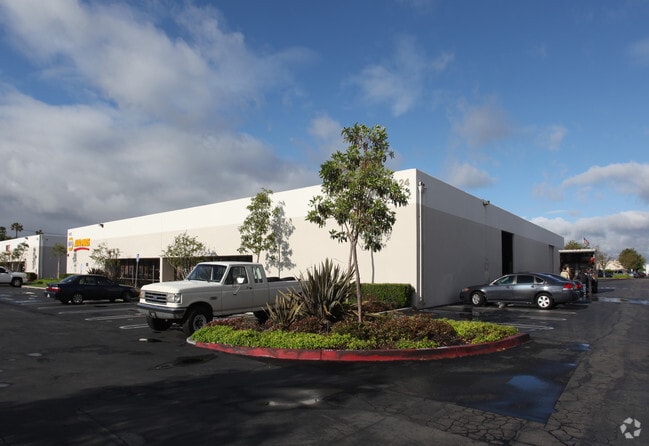
1422 N Batavia St, Orange, CA 92867


Property Detail
1422 N Batavia St
Orange County (California)
P BK 353 PG 5 PAR 4
Anaheim-Santa Ana-Irvine, CA
ORANGE
375-232-28
California
Industrialgeneral
4
2024
1.14 AC
2025
Orange
076204
NEARBY LISTINGS FOR SALE OR LEASE
DEMOGRAPHICS near 1422 N Batavia St
1 mile
3 mile
5 mile
2025 Total Population
7,586
202,759
591,665
2030 Population
7,573
203,095
591,445
Pop Growth 2025-2030
(0.17%)
+ 0.17%
(0.04%)
Average Age
37
38
38
2025 Total Households
2,214
63,875
174,345
HH Growth 2025-2030
(0.36%)
+ 0.11%
(0.12%)
Median Household Inc
$97,458
$99,261
$96,232
Avg Household Size
3.20
3.00
3.20
2025 Avg HH Vehicles
2.00
2.00
2.00
Median Home Value
$689,932
$795,961
$808,985
Median Year Built
1968
1970
1970
Nearby Places
Map Layers
Map Styles
 Street
 Aerial
Layers
 Traffic
 Biking
Places
Listings with unknown addresses are not visible on the map
- Restaurants
- Banks
- Shops
- Fitness
- Groceries
PUBLIC TRANSPORTATION
COMMUTER RAIL
Drive
Walk
Distance
4 min
1.3 mi
Drive
Walk
Distance
4 min
1.4 mi
AIRPORT
John Wayne/Orange County
Drive
Walk
Distance
John Wayne/Orange County
17 min
12.7 mi
Long Beach (Daugherty Field)
Drive
Walk
Distance
Long Beach (Daugherty Field)
28 min
22.1 mi
Ontario International
Drive
Walk
Distance
Ontario International
41 min
31.5 mi
SALE & LEASE HISTORY
LISTING DATE
SALE/LEASE

Mar 06, 2025
For Lease
Nearby Properties
Address
Land Use
TOTAL SIZE
Lot Size
Zoning
Address
Land Use
TOTAL SIZE
Lot Size
Zoning
31.01 AC
Address
Land Use
TOTAL SIZE
Lot Size
Zoning
2.60 AC
Address
Land Use
TOTAL SIZE
Lot Size
Zoning
41.12 AC
Address
Land Use
TOTAL SIZE
Lot Size
Zoning
5.07 AC
Address
Land Use
TOTAL SIZE
Lot Size
Zoning
4.89 AC
Address
Land Use
TOTAL SIZE
Lot Size
Zoning
4.13 AC
Address
Land Use
TOTAL SIZE
Lot Size
Zoning
12.20 AC
Address
Land Use
TOTAL SIZE
Lot Size
Zoning
6.60 AC
Address
Land Use
TOTAL SIZE
Lot Size
Zoning
Address
Land Use
TOTAL SIZE
Lot Size
Zoning
Address
Land Use
TOTAL SIZE
Lot Size
Zoning
4.71 AC
Address
Land Use
TOTAL SIZE
Lot Size
Zoning
11.61 AC
Address
Land Use
TOTAL SIZE
Lot Size
Zoning
52.51 AC
Address
Land Use
TOTAL SIZE
Lot Size
Zoning
Address
Land Use
TOTAL SIZE
Lot Size
Zoning
Address
Land Use
TOTAL SIZE
Lot Size
Zoning
3.47 AC
Address
Land Use
TOTAL SIZE
Lot Size
Zoning
Address
Land Use
TOTAL SIZE
Lot Size
Zoning
Address
Land Use
TOTAL SIZE
Lot Size
Zoning
40.76 AC
Address
Land Use
TOTAL SIZE
Lot Size
Zoning
Address
Land Use
TOTAL SIZE
Lot Size
Zoning
Address
Land Use
TOTAL SIZE
Lot Size
Zoning
Address
Land Use
TOTAL SIZE
Lot Size
Zoning
Address
Land Use
TOTAL SIZE
Lot Size
Zoning
126,979 SF
6.42 AC
Address
Land Use
TOTAL SIZE
Lot Size
Zoning
Address
Land Use
TOTAL SIZE
Lot Size
Zoning
4.94 AC
Address
Land Use
TOTAL SIZE
Lot Size
Zoning
Address
Land Use
TOTAL SIZE
Lot Size
Zoning
Address
Land Use
TOTAL SIZE
Lot Size
Zoning
50.72 AC
Address
Land Use
TOTAL SIZE
Lot Size
Zoning
5.63 AC
The World's #1 Commercial Real Estate Marketplace
Connect with us
© 2026 CoStar Group
The information above has been obtained from sources believed reliable. While we do not doubt its accuracy we have not verified it and make no guarantee, warranty or representation about it. It is your responsibility to independently confirm its accuracy and completeness. Any projections, opinions, assumptions, or estimates used are for example only and do not represent the current or future performance of the property. The value of this transaction to you depends on tax and other factors which should be evaluated by your tax, financial, and legal advisors. You and your advisors should conduct a careful, independent investigation of the property to determine to your satisfaction the suitability of the property for your needs.