Property Record
14225 W 67Th Ave, Arvada, CO 80004
NEARBY LISTINGS FOR SALE OR LEASE
Property Detail
14225 W 67Th Ave
Denver-Aurora-Centennial, CO
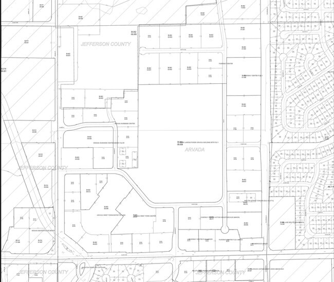
Parkway Center
39-063-02-001
SECTION 06 TOWNSHIP 03 RANGE 69 QTR SW SUBDIVISIONCD 584600 SUBDIVISIONNAME PARKWAY CENTER BLOCK 005 LOT 0003 SIZE: 65776 TRACT VALUE: 1.510
Industrialgeneral
Jefferson
X
Colorado
08059C0183G
3
2023
1.46 AC
2024
Northwest Denver
010303
Denver
DEMOGRAPHICS near 14225 W 67Th Ave
1 Mile
3 Mile
5 Mile
2024 Total Population
10,188
64,332
156,599
2029 Population
10,002
63,456
154,837
Pop Growth 2024-2029
(1.83%)
(1.36%)
(1.13%)
Average Age
43
43
42
2024 Total Households
3,946
24,726
62,813
HH Growth 2024-2029
(2.00%)
(1.42%)
(1.22%)
Median Household Inc
$116,431
$120,703
$104,125
Avg Household Size
2.50
2.50
2.40
2024 Avg HH Vehicles
2.00
2.00
2.00
Median Home Value
$629,570
$670,043
$606,692
Median Year Built
1988
1988
1978
Nearby Places
Map Layers
Map Styles
 Street
 Aerial
- Restaurants
- Banks
- Shops
- Fitness
- Groceries
PUBLIC TRANSPORTATION
COMMUTER RAIL
DRIVE
WALK
Distance
8 min
3.5 mi
DRIVE
WALK
Distance
8 min
4.3 mi
AIRPORT
Denver International
DRIVE
WALK
Distance
Denver International
46 min
33.7 mi
Nearby Properties
Address
Land Use
TOTAL SIZE
Lot Size
Zoning
Address
Land Use
TOTAL SIZE
Lot Size
Zoning
269,013 SF
31.89 AC
Address
Land Use
TOTAL SIZE
Lot Size
Zoning
253,643 SF
50.87 AC
A2
Address
Land Use
TOTAL SIZE
Lot Size
Zoning
227,132 SF
11.95 AC
Address
Land Use
TOTAL SIZE
Lot Size
Zoning
215,878 SF
11.82 AC
A2
Address
Land Use
TOTAL SIZE
Lot Size
Zoning
131,135 SF
2.83 AC
Address
Land Use
TOTAL SIZE
Lot Size
Zoning
262,699 SF
13.10 AC
A2
Address
Land Use
TOTAL SIZE
Lot Size
Zoning
363,989 SF
30.10 AC
Address
Land Use
TOTAL SIZE
Lot Size
Zoning
101,761 SF
4.34 AC
Address
Land Use
TOTAL SIZE
Lot Size
Zoning
520,896 SF
24.42 AC
I1
Address
Land Use
TOTAL SIZE
Lot Size
Zoning
223,338 SF
9.42 AC
I1
Address
Land Use
TOTAL SIZE
Lot Size
Zoning
64,883 SF
4.74 AC
Address
Land Use
TOTAL SIZE
Lot Size
Zoning
82,055 SF
19.39 AC
Address
Land Use
TOTAL SIZE
Lot Size
Zoning
68,300 SF
6 AC
Address
Land Use
TOTAL SIZE
Lot Size
Zoning
67,520 SF
6.46 AC
Address
Land Use
TOTAL SIZE
Lot Size
Zoning
51,987 SF
15.23 AC
PD
Address
Land Use
TOTAL SIZE
Lot Size
Zoning
83,684 SF
8.15 AC
Address
Land Use
TOTAL SIZE
Lot Size
Zoning
50,853 SF
3.94 AC
Address
Land Use
TOTAL SIZE
Lot Size
Zoning
201,582 SF
5.78 AC
Address
Land Use
TOTAL SIZE
Lot Size
Zoning
123,448 SF
7.80 AC
Address
Land Use
TOTAL SIZE
Lot Size
Zoning
67,879 SF
9.91 AC
A2
Address
Land Use
TOTAL SIZE
Lot Size
Zoning
68,500 SF
5.84 AC
Address
Land Use
TOTAL SIZE
Lot Size
Zoning
113,455 SF
7.98 AC
Address
Land Use
TOTAL SIZE
Lot Size
Zoning
175,599 SF
17.23 AC
Address
Land Use
TOTAL SIZE
Lot Size
Zoning
110,235 SF
2.32 AC
Address
Land Use
TOTAL SIZE
Lot Size
Zoning
62,604 SF
75.98 AC
Address
Land Use
TOTAL SIZE
Lot Size
Zoning
188,494 SF
15.14 AC
Address
Land Use
TOTAL SIZE
Lot Size
Zoning
68,060 SF
12 AC
A2
Address
Land Use
TOTAL SIZE
Lot Size
Zoning
160,377 SF
8.85 AC
Address
Land Use
TOTAL SIZE
Lot Size
Zoning
102,000 SF
1.85 AC
Address
Land Use
TOTAL SIZE
Lot Size
Zoning
83,450 SF
7.22 AC
The World's #1 Commercial Real Estate Marketplace
Connect with us
© 2026 CoStar Group
The information above has been obtained from sources believed reliable. While we do not doubt its accuracy we have not verified it and make no guarantee, warranty or representation about it. It is your responsibility to independently confirm its accuracy and completeness. Any projections, opinions, assumptions, or estimates used are for example only and do not represent the current or future performance of the property. The value of this transaction to you depends on tax and other factors which should be evaluated by your tax, financial, and legal advisors. You and your advisors should conduct a careful, independent investigation of the property to determine to your satisfaction the suitability of the property for your needs.